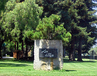
Area code 650 is a California telephone area code in the San Francisco Bay Area that was split from area code 415 on August 2, 1997. It includes most of San Mateo County, part of San Francisco, and the northwestern portion of Santa Clara County including Palo Alto, Mountain View, and Los Altos.
Cubberley Community Center known locally as "Cubberley", is a community center in Palo Alto, California that has been in operation since 1990. It is housed on the campus of the former Ellwood P. Cubberley High School. Space is available for rent by the hour, either one-time or on a regular basis for community related meetings, seminars, social events, dances, theatre performances, music rehearsals and athletic events.

Brooklyn is a former city in Alameda County, California, now annexed to Oakland, California.
William "Billy" Jones (1884–1968), a seasoned veteran of the steam era who established the Wildcat Railroad in Los Gatos, California, was born the son of a teamster in the town of Ben Lomond, California, USA.

Vasona Lake County Park is a park located in Los Gatos, California and part of the Santa Clara County Parks system.

Mountain View–Winchester is a light rail route operated by Santa Clara Valley Transportation Authority (VTA). The Mountain View–Winchester route is one of three existing VTA light rail routes. The other two light rail routes are the Alum Rock–Santa Teresa line and Ohlone/Chynoweth–Almaden line. On system maps, the line is represented as the Green Line; however, unlike many other transit systems, VTA personnel do not refer to the line by its color, much less refer to it as Line 902 on official documents.

Arastradero Preserve, officially known as Enid W. Pearson–Arastradero Preserve, is a nature preserve that protects most of the Arastradero Creek watershed. The preserve is owned and operated by the City of Palo Alto, California. The main parking lot hosts an interpretive center and is located at 1530 Arastradero Road.

Winchester Transit Center is a light rail station and park-and-ride lot operated by Santa Clara Valley Transportation Authority (VTA) in Campbell, California. Winchester is the southern terminus of the Mountain View–Winchester light rail line.
Los Trancos Woods is an unincorporated community in San Mateo County, California near the border of Santa Clara County. The US Geological Survey, National Geographic Names Database, show it as a feature type populated place. The area does not have its own unique ZIP code; it is in ZIP code 94028 and area code 650. The community adjoins the City of Palo Alto's Foothills Park. It is on the US Geological Survey's 7.5-minute "Mindego Hill" quadrangle. Coordinates in the National Geographic Names Database are shown as 37°20′58″N122°11′58″W. County documents suggest the community may eventually be annexed by Portola Valley.

The Peninsular Railway was an interurban electrified railway in the U.S. State of California in the United States of America. It served the area between San Jose, Los Gatos, and Palo Alto, comprising much of what is today known as "Silicon Valley". For much of its existence it was a subsidiary of the Southern Pacific Railroad.

North Crane is a small unincorporated community in Wea Township, Tippecanoe County, in the U.S. state of Indiana.
Osier is a populated place in Conejos County, Colorado, USA. It is an old railroad settlement and train stop approximately halfway along the Cumbres and Toltec Scenic Railroad where trains from both ends of the line meet and stop for lunch, making it possible for passengers to either continue in the same direction or return to their point of origin afterwards.

Perrinville is a neighborhood in Snohomish County, Washington, United States. Its ZIP Code is 98026.
Clems, California is a ghost town in Santa Cruz County with an elevation of 790 feet. It is located a latitude 37055N, longitude 1215947W; decimal degrees: latitude 37.09806, longitude -121.99639.

Myricks is an association community or populated place located in Berkley, Bristol County, Massachusetts at latitude 41.831 and longitude -71.027. The elevation is 62 feet. Myricks appears on the Assonet U.S. Geological Survey Map.

Soto is a ghost town in Butte County, California, United States. It was located 14 miles (23 km) northwest of Chico on the Southern Pacific Railroad, at an elevation of 184 feet. It still appeared on maps as of 1904.
There are 21 routes assigned to the "G" zone of the California Route Marker Program, which designates county routes in California. The "G" zone includes county highways in Monterey, San Benito, San Luis Obispo, Santa Clara, and Santa Cruz counties.
The Los Altos History Museum (LAHM) is a museum in Los Altos, California. It showcases the rich history of Los Altos and surrounding areas, including the transformation of the agricultural paradise once known as the "Valley of Heart's Delight" into the high-tech Silicon Valley. It is situated in one of the few remaining apricot orchards in the San Francisco Bay area.
Foothills Open Space Preserve is a 212 acre open space preserve on Page Mill Road in Palo Alto, California. The land for the preserve was gifted to the Midpeninsula Regional Open Space District in 1974. The preserve's only trail is .4 miles and leads to a hilltop with views of the San Francisco Bay Area.