Related Research Articles

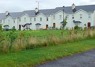
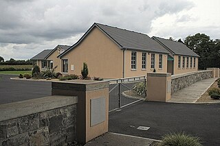
Coosan is a townland and suburb just north of Athlone, County Westmeath in Ireland. The suburb is surrounded on three sides by Lough Ree and on one side by Athlone.
Simonstown may refer to the following places:

Moycashel, previously the barony of Rossaughe, and before that, Delamares country, is a barony in south County Westmeath, in Ireland. It was formed by 1542. It is bordered by three other baronies: Clonlonan to the west, Rathconrath to the north, Moyashel and Magheradernon to the north-east and Fartullagh to the west. The largest population centre is Kilbeggan.
Rathconrath, previously the barony of Rathcomyrta, before that Daltons country, is a barony in the west of County Westmeath, in Ireland. It was formed by 1542. It is bordered by County Longford to the north–west and five other Westmeath baronies: Moygoish to the north, Moyashel and Magheradernon to the east, Moycashel and Clonlonan to the south and Kilkenny West to the west. Note that the village of Rathconrath is not synonymous with the barony of the same name.

Kilkenny West, previously Maherquirke or Dillons country, is a barony in west County Westmeath, Ireland. It was formed by 1542. It is bordered by County Longford to the west; it is also bordered by three other Westmeath baronies: Rathconrath, Brawny and Clonlonan. The largest centre of population in the barony is the village of Glassan.
Brawny is a barony in south–west County Westmeath, Ireland. It was formed by 1672. It is bordered by County Roscommon to the west. It also borders two other Westmeath baronies: Kilkenny West and Clonlonan. The largest centre of population in the barony is the town of Athlone.

Clonlonan is a barony in south–west County Westmeath, Ireland. It was formed by 1672. It is bordered by County Offaly to the south and a small part of County Roscommon at Long Island on the River Shannon to the west. It also borders four other Westmeath baronies: Kilkenny West and Rathconrath, Moycashel and Brawny. The largest centre of population in the barony is the town of Moate.
Fartullagh, previously Tyrrells country, is a barony in south–east County Westmeath, in Ireland. It was formed by 1542. It is bordered by County Offaly to the south and three other baronies: Moycashel, Moyashel and Magheradernon and Farbill.
Ballinalack is a village and a townland in County Westmeath, Ireland. It is located about 14 kilometres (9 mi) north–west of Mullingar.
Killucan is a civil parish in County Westmeath, Ireland. It is located about 13.68 kilometres (9 mi) east of Mullingar.
Kilbride is a civil parish in County Westmeath, Ireland. It is located about 9.26 kilometres (6 mi) south of Mullingar.
Mayne, is a civil parish in County Westmeath, Ireland. It is located about 18.03 kilometres (11 mi) north of Mullingar.
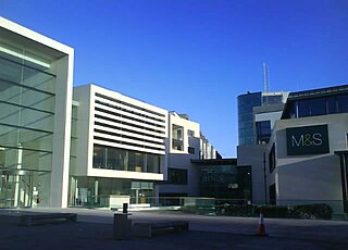
Golden Island Shopping Centre is a shopping centre located on the outskirts of Athlone, County Westmeath, Ireland.
Gaulstown, also spelt Gallstown is a townland in County Westmeath, Ireland. The townland is located in between the towns of Rochfortbridge and Milltownpass, close to the R446 regional road.. Neighbouring townlands include Bellfield, Corcloon, Drumman, Milltown and Windmill to the east, Gibbonstown and Gortumly to the west and Mahonstown to the north.
Dalystown is a village in Carrick, County Westmeath, Ireland. It is located in the south of the county on the N52 road, to the north of Tyrrellspass and Rochfortbridge.
Beggstown is a small townland in County Westmeath, Ireland. The townland is located in the civil parish of Kilbride. The R400 regional road runs through the middle of the area. The townland is to the south of Mullingar, and the north of Rochfortbridge.
Athlone is the name given to two bordering townlands in County Westmeath, Ireland. The townlands are in the civil parish of St. Mary's.

Lissywollen is a townland in Athlone, County Westmeath, Ireland. The townland is in the civil parish of St. Mary's.
Garrycastle is a townland in Athlone, County Westmeath, Ireland. It is in the civil parish of St. Mary's.
Garrynafela is a townland in Athlone, County Westmeath, Ireland. The townland is in the civil parish of St. Mary's.
References
- ↑ "Simonstown Townland, Co. Westmeath". www.townlands.ie. Retrieved 1 May 2020.
- ↑ "Simonstown". Logainm.ie. Retrieved 1 May 2020.
| | This Irish location article is a stub. You can help Wikipedia by expanding it. |