Umprempur is a town in Dhanusadham Municipality in Dhanusa District in the Janakpur Zone of south-eastern Nepal. The former village was merged on 18 May 2014 along with Govindapur, Umprempur, Yagyabhumi, Dhanusadham village development committees (VDCs) to form the new municipality. At the time of the 1991 Nepal census it had a population of 9,345 persons living in 1774 individual households.
Nigauli is a town and market place in Gaushala Municipality in Mahottari District in the Janakpur Zone of south-eastern Nepal. The municipality was established on 18 May 2024 by merging existing Nigauli, Ramnagar, Gaushala VDCs. At the time of the 1991 Nepal census it had a population of 5474 people living in 841 individual households.
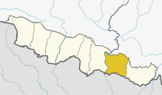
Bhagawanpur is a Village Development Committee in Siraha District in the Sagarmatha Zone of south-eastern Nepal. At the time of the 1991 Nepal census it had a population of 2845 people residing in 455 individual households.

Phulbariya is a town in Mirchaiya Municipality in Siraha District in the Sagarmatha Zone of south-eastern Nepal. The formerly village development committee was merged to form new municipality since 18 May 2014 along with existing Rampur Birta, Malhaniyakhori, Radhopur, Ramnagar Mirchaiya, Phulbariya, Sitapur PraDa and Maheshpur Gamharia Village Development Committees. At the time of the 1991 Nepal census it had a population of 6710 people living in 1273 individual households.
Govindapur Malahanama is a village development committee in Siraha District in the Sagarmatha Zone of south-eastern Nepal. At the time of the 1991 Nepal census it had a population of 6758.
Hanuman Nagar is a village development committee in Siraha District in the Sagarmatha Zone of south-eastern Nepal. At the time of the 1991 Nepal census it had a population of 4892 people living in 918 individual households.
Harakathi is a village development committee in Siraha District in the Sagarmatha Zone of south-eastern Nepal. At the time of the 1991 Nepal census it had a population of 2202 people living in 358 individual households.
Lakshmipur is a village development committee in Siraha District in the Sagarmatha Zone of south-eastern Nepal. At the time of the 1991 Nepal census it had a population of 2651 people living in 474 individual households.
Maheshpur Gamharia is a town in Mirchaiya Municipality in Siraha District in the Sagarmatha Zone of south-eastern Nepal. The formerly village development committee was merged to form new municipality since 18 May 2014 along with existing Rampur Birta, Malhaniyakhori, Radhopur, Ramnagar Mirchaiya, Fulbariya, Sitapur PraDa and Maheshpur Gamharia Village Development Committees. At the time of the 1991 Nepal census it had a population of 3174 people living in 589 individual households.
Malhaniyakhori is a town in Mirchaiya Municipality in Siraha District in the Sagarmatha Zone of south-eastern Nepal. The formerly village development committee was merged to form a new municipality on 18 May 2014 along with the existing Rampur Birta, Malhaniyakhori, Radhopur, Ramnagar Mirchaiya, Fulbariya, Sitapur PraDa and Maheshpur Gamharia Village Development Committees.
Pipra Pra. Dha. is a village development committee in Siraha District in the Sagarmatha Zone of south-eastern Nepal. At the time of the 1991 Nepal census it had a population of 3641.
Pipra Pra. Pi is a village development committee in Siraha District in the Sagarmatha Zone of south-eastern Nepal. At the time of the 1991 Nepal census it had a population of 5692.
Radhopur is a town in Mirchaiya Municipality in Siraha District in the Sagarmatha Zone of south-eastern Nepal. The formerly village development committee was merged to form new municipality since 18 May 2014 along with existing Rampur Birta, Malhaniyakhori, Radhopur, Ramnagar Mirchaiya, Fulbariya, Sitapur PraDa and Maheshpur Gamharia Village Development Committees. At the time of the 1991 Nepal census it had a population of 3608.
Rampur Birta is a town in Mirchaiya Municipality in Siraha District in the Sagarmatha Zone of south-eastern Nepal. The formerly village development committee was merged to form new municipality since 18 May 2014 along with existing Rampur Birta, Malhaniyakhori, Radhopur, Ramnagar Mirchaiya, Fulbariya, Sitapur PraDa and Maheshpur Gamharia Village Development Committees. At the time of the 1991 Nepal census it had a population of 4236.
Sitapur Pra. Dha. is a village development committee in Siraha District in the Sagarmatha Zone of south-eastern Nepal. At the time of the 1991 Nepal census it had a population of 3702 people living in 693 individual households.
Bhangha is a market center and town in Sambhunath Municipality in Saptari District in the Sagarmatha Zone of south-eastern Nepal. The formerly VDC was merged along with Khoksar Parbaha, Sambhunath, Mohanpur, Bhangha, Basbalpur and Rampur Jamuwa village development committee new municipality was formed on 18 May 2014. At the time of the 1991 Nepal census it had a population of 4281 people living in 750 individual households.
Rampur Jamuwa is a market center and town in Sambhunath Municipality in Saptari District in the Sagarmatha Zone of south-eastern Nepal. The formerly VDC was merged along with Khoksar Parbaha, Sambhunath, Mohanpur, Bhangha and Basbalpur village development committee new municipality was formed on 18 May 2014. At the time of the 1991 Nepal census it had a population of 3158 people living in 559 individual households.

Sundar Haraicha is a municipality in Morang District of Province No. 1 in Nepal that was established on 10 March 2017 by merging the former municipalities Sundar Dulari and Koshi Haraicha. At the time of the 2011 Nepal census, the localities out of which Chaudandigadhi would be formed had a joint population of 80,518 people living in 18,610 individual households.