Sithdipur

Last updated
Sithdipur

सिद्धिपुर
Nepal Province No 1 adm location map.svg
Red pog.svg
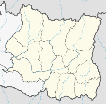
Sithdipur
Location in Nepal
Nepal adm location map.svg
Red pog.svg
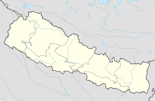
Sithdipur
Sithdipur (Nepal)
Coordinates: 26°53′N86°52′E / 26.883°N 86.867°E / 26.883; 86.867
CountryFlag of Nepal.svg    Nepal
Zone Sagarmatha Zone
District Udayapur District
Population
 (1991)
  Total2,606
Time zone UTC+5:45 (Nepal Time)

Siddhipur is a village development committee in Udayapur District in the Sagarmatha Zone of south-eastern Nepal. At the time of the 1991 Nepal census it had a population of 2606 people living in 459 individual households. [1]

Related Research Articles

Khotang District District in Province No. 1, Nepal

Khotang District is one of 14 districts of Province No. 1 of eastern Nepal. The district, with Diktel as its district headquarters, covers an area of 1,591 km2 (614 sq mi) and has a population (2011) of 206,312. The district has been bordered by Bhojpur District in the east, Udayapur district in the south, Okhaldhunga district in the west and Solukhumbu district in the North.

Ghumthang is a village in Sindhupalchok District in the Bagmati Zone of central Nepal. At the time of the 1991 Nepal census it had a population of 3975 and had 760 houses in the village. The rugged village hit by landslide sep 13 2020, 5 dead, 31 missing following heavy rain.

Udayapur is a Village Development Committee in Banke District in Lumbini Pradesh of south-western Nepal. At the time of the 1991 Nepal census it had a population of 2,301 and had 397 houses in the village. Two government owned primary schools are situated here along with one among 10 Health Posts in district and a Police station. Now, it is a part of Nepalgunj sub-metropolitan city.

Uiya is a village development committee in Gorkha District in the Gandaki Zone of northern-central Nepal. At the time of the 1991 Nepal census it had a population of 1,728 and had 382 houses.

Mukhiyapatti Musharniya is a village development committee in Dhanusa District in Province No. 2 of south-eastern Nepal. At the time of the 1991 Nepal census it had a population of 4,621 people living in 436 individual households.

Khartamchha is a village and Village Development Committee in Khotang District in the Sagarmatha Zone of eastern Nepal. At the time of the 1991 Nepal census it had a population of 2,387 persons living in 497 individual households.

Basaha is a town in Beltar Basaha Municipality in Udayapur District in the Sagarmatha Zone of south-eastern Nepal. The formerly village development committee was merged to form a new municipality on 18 May 2014. At the time of the 1991 Nepal census it had a population of 7887 people living in 1464 individual households.

Janti is a village development committee in Udayapur District in the Sagarmatha Zone of south-eastern Nepal. At the time of the 1991 Nepal census it had a population of 2142 people living in 385 individual households.

Katari Place in Nepal

Katari is a Municipality in Udayapur District in the Province No. 1 of south-eastern Nepal.It lies by the Tawa river having the bridge of length 123.5m. This was established by merging two existing village development committees i.e. Triveni and Katari on 18 May 2014. At the time of the 1991 Nepal census it had a population of 7230 people living in 1410 individual households.

Laphagaun Former Village Development Committee in Nepal

Laphagaun was a village development committee in Udayapur District in the Sagarmatha Zone of Eastern Development Region of Nepal. It became part of Rautamai Rural Municipality after reconstruction of administration in Nepal.

Panchawati Place in Province No. 1, Nepal

Panchawati is a village in, and headquarter of, Udayapurgadhi rural municipality in Udayapur District in Province No. 1 of south-eastern Nepal. At the time of the 1991 Nepal census it had a population of 6,580 people living in 1223 individual households.

Valaya Danda is a village development committee in Udayapur District in the Sagarmatha Zone of south-eastern Nepal. At the time of the 1991 Nepal census it had a population of 5770 people living in 1021 individual households.

Saune Ward in Province No. 1, Nepal

Saune is a populated place located in Triyuga municipality of Udayapur District in Province No. 1 of Nepal. At the time of 2011 Nepal census it had a population of 2,678 people living in 518 individual households.

Tamlichha is a village development committee in Udayapur District in the Sagarmatha Zone of south-eastern Nepal.

Thanagaun is a village development committee in Udayapur District in the Sagarmatha Zone of south-eastern Nepal. At the time of the 1991 Nepal census it had a population of 2408 people living in 428 individual households.

Triveni is a town in Katari Municipality, Udayapur District, in the Sagarmatha Zone of south-eastern Nepal. The formerly Triveni village development committee was merged to form a new municipality from 18 May 2014. At the time of the 1991 Nepal census, Triveni had a population of 6015 people, living in 1105 individual households.

Sawa is a village development committee in the Himalayas of Taplejung District in the Mechi Zone of north-eastern Nepal. At the time of the 2011 Nepal census it had a population of 2,410 people living in 501 individual households. There were 1,095 males and 1,315 females at the time of census.

Udayapur Dhurmi is a village development committee in Parsa District in the Narayani Zone of southern Nepal. At the time of the 2011 Nepal census it had a population of 7,163 people living in 1,085 individual households.

Ajingara is a village development committee in Kapilvastu District in the Lumbini Zone of southern Nepal. At the time of the 1991 Nepal census it had a population of 3646 people living in 603 individual households.

Belaka Municipality in Province No. 1, Nepal

Belaka is a municipality located in Udayapur District of Province No. 1 of Nepal. It is one of four urban municipalities located in Udayapur District. It covers the eastmost areas of the district.

References

  1. "Nepal Census 2001". Nepal's Village Development Committees. Digital Himalaya . Retrieved 13 November 2008.

Coordinates: 26°53′N86°52′E / 26.883°N 86.867°E / 26.883; 86.867