
The Au Sable River in Michigan, United States runs approximately 138 miles (222 km) through the northern Lower Peninsula, through the towns of Grayling and Mio, and enters Lake Huron at the town of Oscoda. It is considered one of the best brown trout fisheries east of the Rockies and has been designated a blue ribbon trout stream by the Michigan Department of Natural Resources. A map from 1795 located in the United States Gazetteer calls it the Beauais River. In French, the river is called the Rivière au sable, literally "Sand River".
Tawas City is a city in and county seat of Iosco County in the U.S. state of Michigan. The population was 1,834 at the 2020 census. The city is mostly surrounded by Tawas Township, but the two area administered automously.

Gaylord is a city in the U.S. state of Michigan. It is the county seat of Otsego County, and is the only city within the county. Gaylord had a population of 4,286 at the 2020 census, an increase from 3,645 at the 2010 census.
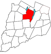
Otsego is a town in the north-central part of Otsego County, New York, United States. The population was 3,900 at the 2010 census. The town is named after Lake Otsego, which forms part of the town's eastern border.
Springfield is a town in Otsego County, New York, United States. The population was 1,358 at the 2010 census.
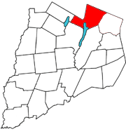
Worcester is a town in Otsego County, New York, United States. The population was 2,220 at the 2010 census. Worcester is on the southeastern border of the county and is northeast of Oneonta. The Worcester Central School District presently has 369 students enrolled in grades K-12.

The Kalamazoo River is a river in the U.S. state of Michigan. The river is 130 miles (210 km) long from the junction of its North and South branches to its mouth at Lake Michigan, with a total length extending to 178 miles (286 km) when one includes the South Branch. The river's watershed drains an area of approximately 2,020 square miles (5,200 km2) and drains portions of ten counties in southwest Michigan: Allegan, Barry, Eaton, Van Buren, Kalamazoo, Calhoun, Jackson, Hillsdale, Kent and Ottawa. The river has a median flow of 1,863 cubic feet per second (52.8 m3/s) at New Richmond, upstream from its mouth at Saugatuck and Douglas.

Otsego Lake is a 4,046-acre (16.37 km2) lake located in Otsego County in the U.S. state of New York. It is the source of the Susquehanna River and largest lake in Otsego County. The Village of Cooperstown is located at the lake's southern end. Glimmerglass State Park is located on the lake's northeastern shore, and includes Hyde Hall, a large mansion constructed in 1817, that overlooks the lake. The Glimmerglass Opera, opened in June 1987, is located on the western shore.

Canadarago Lake is a 1,917-acre (7.76 km2) lake located in Otsego County, New York and is the source of Oaks Creek. The Village of Richfield Springs is located at the lake's northern end. It is the second largest lake in Otsego County, lying to the west of and parallel to the larger Otsego Lake. The lake's name is also spelled "Candajarago Lake" or "Caniadaraga Lake".

The Deerslayer, or The First War-Path (1841) was James Fenimore Cooper's last novel in his Leatherstocking Tales. Its 1740–1745 time period makes it the first installment chronologically and in the lifetime of the hero of the Leatherstocking tales, Natty Bumppo. The novel's setting on Otsego Lake in central, upstate New York, is the same as that of The Pioneers, the first of the Leatherstocking Tales to be published (1823). The Deerslayer is considered to be the prequel to the rest of the series. Fenimore Cooper begins his work by relating the astonishing advance of civilization in New York State, which is the setting of four of his five Leatherstocking Tales.

The Deerslayer is a 1957 American Western film in CinemaScope and Color by De Luxe, directed by Kurt Neumann and written by Carroll Young, Neumann and an uncredited Dalton Trumbo. The film stars Lex Barker, Rita Moreno, Forrest Tucker, Cathy O'Donnell, Jay C. Flippen and Carlos Rivas. It is based on the 1841 novel The Deerslayer by James Fenimore Cooper. The film was released on September 10, 1957 by 20th Century-Fox.
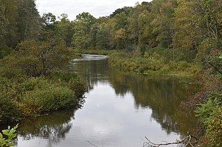
Oaks Creek is a river that drains Canadarago Lake, which is situated in the north central region of Otsego County, New York. The creek begins by the Hamlet of Schuyler Lake and flows southeast approximately 9.32 miles (15.00 km), dropping only 105 feet (32 m) in elevation, before converging with the Susquehanna River south of the Village of Cooperstown, by the Hamlet of Index. From the source to Oaksville the creek flows along Panther Mountain. Fly Creek is a main tributary, that converges with Oaks Creek south of the Hamlet of Fly Creek.

Rum Hill is a mountain located in Central New York Region of New York northwest of the Hamlet of Pierstown. Red House Hill is located southeast, Metcalf Hill is located south, Allen Lake and Mohegan Hill are located north-northwest and Otsego Lake is located east of Rum Hill.
Red House Hill is a mountain in the Central New York Region of New York. It is located south-southwest of the Hamlet of Springfield Center, New York, west of Hutter Point and Six Mile Point of Otsego Lake, and southeast of Rum Hill. Mohican Brook flows eastward along the southern edge of the hill.
Mohican Brook is a creek in central Otsego County, New York. It flows into Otsego Lake north of Cooperstown, New York at Five Mile Point.
Three Mile Point also known as Wild Rose Point is a geographic cape extending into Otsego Lake in the Town of Otsego in Otsego County in the U.S. State of New York. It is located north of the Village of Cooperstown and is accessible via State Route 80. In the summer months it is also a public swimming beach and offers changing rooms, a picnic area, and a pavilion. In the winter months it serves as a place for ice fishers to park.

Point Judith also known as Kingfisher Point is a geographic cape extending into Otsego Lake in the Town of Otsego north of Cooperstown, New York. Kingfisher Tower is located on the lake off Point Judith.
Gravelly Point is a geographic cape extending into Otsego Lake in Middlefield, New York. It is located on the east side of the lake, roughly 5 miles (8.0 km) north of the Village of Cooperstown. The point is not accessible from land but only the lake.
Peggs Point is a geographic cape extending into Otsego Lake in the Town of Middlefield in Otsego County in the U.S. State of New York. It is located on the east shore of the lake north of the Village of Cooperstown. The point forms the southern edge of Hyde Bay which is located north.
Blackbird Bay is a bay located on Otsego Lake. It is located in the Village of Cooperstown in the U.S. state of New York. The historic Otesaga Hotel is located on the shore as well as the Leatherstocking Golf Course.

