Related Research Articles

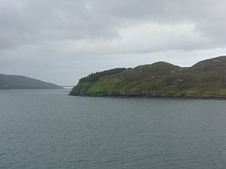
Scotasay is small island in the Outer Hebrides of Scotland. It lies 1 kilometre off the east coast of Harris and gives some shelter to the ferry port of Tarbert. There are two houses on the island, a wind turbine and a fresh water tank.

Niarbyl is a rocky promontory on the southwest coast of the Isle of Man between Port Erin and Peel. It is best known for its spectacular sea views which include the Calf of Man and, on clear days, the mountains of Ireland.
Ballytober Fault is a geological fault in County Antrim, Northern Ireland.
Carnlough Fault is a geological fault in County Antrim, Northern Ireland.
Camlough Fault is a geological fault in County Armagh, Northern Ireland.
Kinnegoe Fault is a geological fault in County Armagh, Northern Ireland.
Newry Fault is a geological fault in County Armagh, Northern Ireland.
Orlock Bridge Fault is a major geological fault which extends through County Armagh, Northern Ireland and across the North Channel into Galloway in southern Scotland.
Tow Valley Fault is a geological fault in County Antrim, Northern Ireland.
Clogher Valley Fault is a geological fault in County Fermanagh, Northern Ireland. The focus of deformation during the Variscan Orogenic Cycle in Northern Ireland was located on, and between, two major faults. In the north is the northern-bounding fault of the Midland Valley Terrane, the Castle Archdale Fault-Omagh Thrust Fault zone, while in the south is the Clogher Valley Fault. Carboniferous rocks located between these faults were affected by strike-slip, associated with intermittent dextral transpression and transtension. Between the Clogher Valley Fault and the Southern Upland Fault, the southern bounding fault of the Midland Valley Terrane, the Carboniferous rocks are relatively undeformed.
The Killadeas–Seskinore Fault is a geological fault in County Fermanagh, Northern Ireland.
Tempo–Sixmilecross Fault is a geological fault in County Fermanagh, Northern Ireland.
Belcoo Fault is a geological fault in County Fermanagh, Northern Ireland.
Elagh Fault is a geological fault in County Tyrone, Northern Ireland.
Laghy Fault is a geological fault in County Tyrone, Northern Ireland.

The Omagh Thrust Fault is a geological fault in County Tyrone. It is of one of the most important structural discontinuities in Northern Ireland and an extension of the Highland Boundary Fault which runs through Scotland.
Pettigoe Fault is a geological fault in County Tyrone, Northern Ireland.
The Denholme Clough Fault is a small fault located in Denholme, England. The fault is approximately 500 metres (1,600 ft) long. The fault has produced no appreciable earthquake history, but it is still subject to stresses that may cause it to slip. The maximum earthquake arising from a slip of this fault has been estimated to be below magnitude 3. The Denholme Clough Fault is part of the Pennine anticline and is partially visible from the surface.
The Aire Valley Fault is an inactive strike slip fault in Yorkshire, England. It is considered a northwestern continuation of the Morley-Campsall Fault Belt and extends northwards from the Huddersfield and Wakefield area into the South Craven fault. It is connected to the Denholme Clough Fault.
References
- Map sheet 44 (and accompanying memoir) of the series of 1:50,000 scale geological maps of Northern Ireland published by Geological Survey of Northern Ireland.
- Lyle, P. 2003 Classic geology in Europe 5 The north of Ireland Terra Publishing, Harpenden
54°45′00″N5°58′54″W / 54.75013°N 5.98177°W