
A ski route (German : Skiroute) or ski trail is an officially signed piste or ski run that is cleared for skiing but is not usually managed or prepared by snowcats or other equipment. [1]
A ski route (German : Skiroute) or ski trail is an officially signed piste or ski run that is cleared for skiing but is not usually managed or prepared by snowcats or other equipment. [1]
Usually known as a Skiroute in Austria, Germany or Switzerland, ski routes are properly signed downhill routes for skiers. However, they are not normally groomed by ski piste equipment. As a result, they are not recommended for beginners. In addition to being unprepared, ski routes generally follow a challenging course, often with sheets of ice, rocks, bushes, snowdrifts or other obstacles, and they are often steep. In other places, these slopes are narrow. [1]
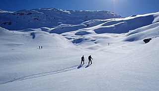
An advantage of ski routes is that they allow off-piste skiing in deep powder snow without significant risk from avalanches or natural obstacles. Ski routes may also include mogul routes.

In the Alps, ski routes are usually signed with orange-red diamonds, often surrounded by a black border and with the route number and word Skiroute marked on it. [1]
In Poland, it is customary to mark the ski route with three horizontal stripes on trees, walls, rocks, and signposts (set up in open areas). The two outer stripes are orange, while the middle one is filled with black, red, green or blue paint. The basic sign measures 9x15 cm.
The colour of the route is related to its skiing difficulty, unlike the markings of hiking trails. The difficulty levels are determined by taking into account the slope of the route in the longitudinal profile. Factors such as the terrain, forest cover, buildings and other objects located in the immediate vicinity are also important. The final degree of difficulty of the route is determined by GOPR or TOPR. The markings are as follows: [2]
| Difficulty level | Routes | Colour marking | Slope in the longitudinal profile | |
|---|---|---|---|---|
| medium | maximum | |||
| A | very easy | | up to 15% (9°) | 21% (12°) |
| B | easy | | 17-21% (10-12°) | 30% (17°) |
| C | difficult | | 21-29% (12-16°) | 40% (22°) |
| D | very difficult | | over 29% (16°) | 53% (28°) |
Marked ski trails may be accompanied by appropriate tourist information: boards with a description of the trail, its length, as well as warning signs for skiers (triangular with a yellow background).
Cross-country skiing is a form of skiing whereby skiers traverse snow-covered terrain without use of ski lifts or other assistance. Cross-country skiing is widely practiced as a sport and recreational activity; however, some still use it as a means of travel. Variants of cross-country skiing are adapted to a range of terrain which spans unimproved, sometimes mountainous terrain to groomed courses that are specifically designed for the sport.

Slalom is an alpine skiing and alpine snowboarding discipline, involving skiing between poles or gates. These are spaced more closely than those in giant slalom, super giant slalom and downhill, necessitating quicker and shorter turns. Internationally, the sport is contested at the FIS Alpine World Ski Championships, and at the Olympic Winter Games.

Alpine skiing, or downhill skiing, is the pastime of sliding down snow-covered slopes on skis with fixed-heel bindings, unlike other types of skiing, which use skis with free-heel bindings. Whether for recreation or for sport, it is typically practiced at ski resorts, which provide such services as ski lifts, artificial snow making, snow grooming, restaurants, and ski patrol.

A trail, also known as a path or track, is an unpaved lane or a small paved road not intended for usage by motorized vehicles, usually passing through a natural area. In the United Kingdom and Ireland, a path or footpath is the preferred term for a pedestrian or hiking trail. The term is also applied in North America to accompanying routes along rivers, and sometimes to highways. In the US, the term was historically used for a route into or through wild territory used by explorers and migrants. In the United States, "trace" is a synonym for trail, as in Natchez Trace.

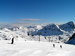
A ski resort is a resort developed for skiing, snowboarding, and other winter sports. In Europe, most ski resorts are towns or villages in or adjacent to a ski area – a mountainous area with pistes and a ski lift system. In North America, it is more common for ski areas to exist well away from towns, so ski resorts usually are destination resorts, often purpose-built and self-contained, where skiing is the main activity.
Obertauern is a tourist destination which is located in the Radstädter Tauern in the Salzburger Land of Austria. The winter sports resort is separated in two communities: Tweng and Untertauern.
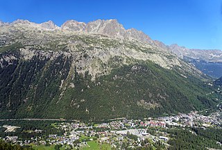
Argentière is a picturesque skiing, alpine walking and mountaineering village in the French Alps, part of the commune of Chamonix-Mont-Blanc, at an altitude of 1,252 m (4,108 ft).
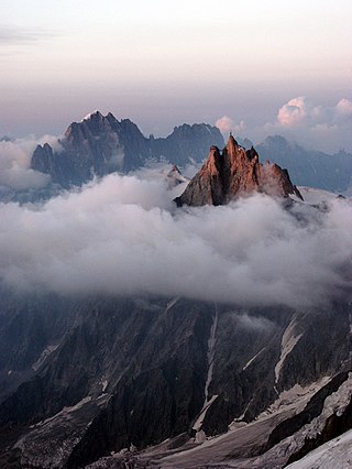
The Aiguille du Midi is a 3,842-metre-tall (12,605 ft) mountain in the Mont Blanc massif within the French Alps. It is a popular tourist destination and can be directly accessed by cable car from Chamonix that takes visitors close to Mont Blanc.

Trail blazing or way marking is the practice of marking paths in outdoor recreational areas with signs or markings that follow each other at certain, though not necessarily exactly defined, distances and mark the direction of the trail.

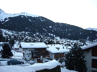
Lech am Arlberg is a mountain village and an exclusive ski resort in the Bludenz district in the westernmost Austrian state of Vorarlberg, on the banks of the river Lech.

Whiteface Mountain is the fifth-highest mountain in the U.S. state of New York, and one of the High Peaks of the Adirondack Mountains. Set apart from most of the other High Peaks, the summit offers a 360-degree view of the Adirondacks and clear-day glimpses of Vermont and even Canada, where the skyscrapers of Montreal, 80 miles (130 km) away, can be seen on a very clear day. Located about halfway between the town of Wilmington and Lake Placid, the mountain's east slope is home to a major ski area which boasts the greatest vertical drop east of the Rockies, and which hosted the alpine skiing competitions of the 1980 Winter Olympics. Unique among the High Peaks, Whiteface features a developed summit and seasonal accessibility by motor vehicle. Whiteface Memorial Highway reaches a parking area at an elevation of 4,600 feet (1,400 m), with the remaining 267 feet (81 m) being obtained by tunnel and elevator.
Verbier is a village located in south-western Switzerland in the canton of Valais. It is a holiday resort and ski area in the Swiss Alps and is recognised as one of the premier off-piste resorts in the world. Some areas are covered with snow all year. Skiers have settled in the Verbier area in order to take advantage of the steep slopes, varied conditions, and resort culture.

A piste is a marked ski run or path down a mountain for snow skiing, snowboarding, or other mountain sports.

Snow grooming is the process of manipulating snow for recreational uses with a tractor, snowmobile, piste caterpillar, truck or snowcat towing specialized equipment. The process is used to maintain ski hills, cross-country ski trails and snowmobile trails by grooming the snow on them. A variation of the technique is used to construct snow runways in Antarctica.
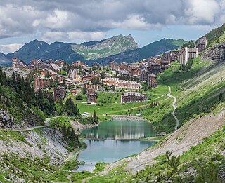
Avoriaz is a French mountain resort in the heart of the Portes du Soleil. It is located in the territory of the commune of Morzine. It is easily accessible from either Thonon at Lake Geneva or Cluses station on the A40 motorway between Geneva and Chamonix. Either way one follows the D902, Route des Grandes Alpes, to Morzine and then the D338 running from Morzine to Avoriaz. Snow chains are often necessary. Avoriaz is built on a shelf high above the town of Morzine, which is among the pioneering towns of skiing with its first lifts dating back to the early 1930s. Today Avoriaz is one of the major French ski destinations catering for all standards of skiing and ranks among the top snowboarding destinations of the world. Apart from snow-based pursuits, Avoriaz is also a centre for trekking, golf, VTT and other outdoor activities during the summer. Cars are forbidden in Avoriaz. The resort is designed to be fully skiable. Other transport around the resort includes horse-drawn sleighs and snowcats during winter.

Speikboden is a massif in the Central Eastern Alps located between the three valleys Weißenbach, Mühlwald and Ahrntal. Running in a south-easterly direction, it forms the eastern part of an outlier of the western Zillertal Alps. Its highest point, likewise named Speikboden, is 2,517 m. Further well-known peaks in this massif include Seewassernock (2,516 m), Große Nock (2,400 m), Kleine Nock (2,227 m) and Gornerberg (2,475 m).
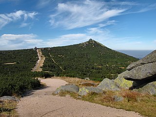
Szrenica is a mountain peak situated in the western part of Giant Mountains in Poland, very close to the Polish-Czech border, within the Karkonosze National Park. Its name originates from the Polish word szron (frost). There is a weather station situated close to the summit. The peak is deforested, both the southern and the northern parts are used intensively for skiing. The elevation gain compared to the main range is approximately 60 m.
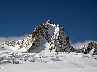
The Tour Ronde is a mountain in the Mont Blanc massif of the Alps, situated on the border between France and Italy. It is a prominent mountain, some 3.5 km north-east of Mont Blanc, but is effectively part of a continuation of the south eastern spur of Mont Maudit which forms a frontier ridge between the two countries. It is easily accessible to mountaineers and provides not only a very good viewpoint from its summit of the Brenva face and the major peaks on the southern side of Mont Blanc, but it also offers a popular introduction to alpine climbing of all grades, including a north face ascent.

The Czech Hiking Markers Standard is an international system of hiking markers for tourist trails, used in more countries than any competing standard. The signs and markers can be used in both wilderness and cities. They are internationally well understandable as they grow from the same tradition in other Central European countries. Similar signs are in use in Austria, Germany, Poland and Switzerland.
This glossary of skiing and snowboarding terms is a list of definitions of terms and jargon used in skiing, snowboarding, and related winter sports.