Ashland is a town in Hanover County, Virginia, United States, located 16 miles (26 km) north of Richmond along Interstate 95 and U.S. Route 1. As of the 2020 census it had a population of 7,565, up from 7,225 at the 2010 census.

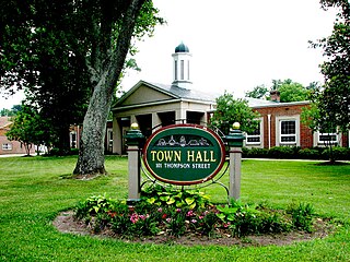
Farmville is a town in Prince Edward and Cumberland counties in the Commonwealth of Virginia. The population was 7,473 at the 2020 census. It is the county seat of Prince Edward County.

The Battle of Sailor's Creek was fought on April 6, 1865, near Farmville, Virginia, as part of the Appomattox Campaign, near the end of the American Civil War. It was the last major engagement between the Confederate Army of Northern Virginia, commanded by General Robert E. Lee, and the Army of the Potomac, under the overall direction of Union General-in-Chief Lieutenant General Ulysses S. Grant.

Moseley is an unincorporated area in Powhatan and Chesterfield counties in the U.S. state of Virginia. It is located to the west of the metropolitan Richmond area.

Ballsville is an unincorporated community in Powhatan County, Virginia. The community is located approximately forty miles due west of Richmond. It is on Virginia State Route 13 between Powhatan, Virginia and Cumberland, Virginia.

The East End of Richmond, Virginia is the quadrant of the City of Richmond, Virginia, and more loosely the Richmond metropolitan area, east of the downtown.

Farmville Historic District is a national historic district located at Farmville, Prince Edward County, Virginia. It encompasses 246 contributing buildings and 1 contributing object in the central business district and surrounding residential areas of Farmville. It includes a variety of commercial, residential, institutional, and industrial buildings dating from the mid-19th to early-20th centuries. Notable buildings include the Paulett-Gill house, Farmville Presbyterian Church, Johns Memorial Episcopal Church (1881), Farmville Methodist Church (1907), Hotel Weyanoke (1925), the warehouses of the Dunnington Tobacco Company and Central Virginia Processing, Inc., the former Craddock-Terry Shoe Company, the former Cunningham and Company tobacco prizery, Norfolk and Western Railroad passenger station, Doyne Building, the Watkins M. Abbitt Federal Building (1917), Prince Edward County Courthouse, and the former Farmville High School (1913). Located in the district is the separately listed First Baptist Church.
Belmont is an unincorporated community in Spotsylvania County, in the U.S. state of Virginia. It is marked with a highway sign at the intersection of Belmont Road and Orange Springs Road by the Virginia Department of Transportation, however is marked as being the intersection with Belmont Road and Jones Powell Road by the United States Geological Survey (USGS). The immediate area has Fletcher's Store and the Belmont Christmas Tree farm. Further south, there are other buildings identifying with Belmont, such as Belmont Baptist Church, the Belmont Ruritan Community Building where the Belmont Ruritan Club meets each evening at 7 p.m. and serves as the district's polling place for registered voters, and the Belmont Fire & Rescue station staffed by Spotsylvania County Volunteer Company 9.
Flat Rock is an unincorporated community in Powhatan County, in the U.S. state of Virginia. Flatrock was a stop on the Farmville and Powhatan Railroad from 1884 to 1905 and then on the Tidewater and Western Railroad from 1905 to 1917.
Macon is an unincorporated community in Powhatan County, in the U.S. state of Virginia. Macon was a stop on the Farmville and Powhatan Railroad from 1884 to 1905 and then on the Tidewater and Western Railroad from 1905 to 1917. It is on the new Virginia State Route 13 between Powhatan, Virginia, and Cumberland, Virginia, from 1918 to today.
Tobaccoville is an unincorporated rural hamlet in Powhatan County, Virginia. Tobaccoville was a stop on the Farmville and Powhatan Railroad from 1884 to 1905 and then on the Tidewater and Western Railroad from 1905 to 1917. A magazine notice for renting the "Indian Camp" farm advertised that the farm was near the Tobaccoville station of the Tidewater and Western Railroad. This would help the tenant farmer get dairy products to market. Since 1918, Tobaccoville is on Virginia State Route 13 at the T-intersection with Clement Town Road, between Powhatan, Virginia and Cumberland, Virginia. It consists of a convenience store with gasoline pumps and a volunteer fire department station, along with several houses and farmland.
McRae is an unincorporated community in Cumberland County, in the U.S. state of Virginia. McRae was a stop on the Farmville and Powhatan Railroad from 1884 to 1905 and then on the Tidewater and Western Railroad from 1905 to 1917. It is on the new Virginia State Route 45 between Cumberland, Virginia and Farmville, Virginia today.
Raines Tavern is an unincorporated community in Cumberland County on Virginia State Route 45 just north of Farmville, Virginia, in the U.S. state of Virginia. It was a stop on the Farmville and Powhatan Railroad from 1884 to 1905, and on the Tidewater and Western Railroad from 1905 to 1917.
Sunny Side is an unincorporated community in Buckingham and Cumberland counties, in the U.S. state of Virginia. Sunny Side was a stop on the Farmville and Powhatan Railroad from 1884 to 1905 and then on the Tidewater and Western Railroad from 1905 to 1917. It is on the new Virginia State Route 13 between Powhatan, Virginia and Cumberland, Virginia from 1918 to today.

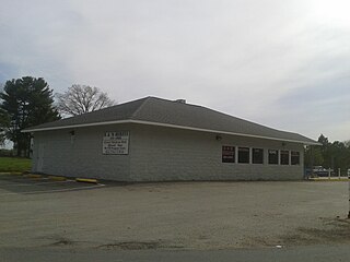
Beach Station a national historic district located near Chesterfield, in Chesterfield County, Virginia. The district includes six contributing buildings and one contributing site in the Village of Beach. They were all constructed about 1890 and are two single-family dwellings, a post office, a railway depot, an outbuilding, two railroad shanties, and the ruins of the former general store. Beach Station was accessible from the Farmville and Powhatan Railroad later named the Tidewater and Western Railroad. Leasing arrangements had been made with the Brighthope Railway company which was sold to become the Farmville and Powhatan. The district represents an unusual collection of late-nineteenth-century buildings in their historic surroundings. It was listed on the National Register of Historic Places in 2008.

In 1886, Randolph Harrison, of the Virginia department of Agriculture, cited Cumberland Mining Company, stating that the United States had purchased stock in the Brighthope Railway. He continued by citing their assertion that extending the railway into Cumberland would increase the value of farms there because they could sell consumer agricultural products such as fruit, dairy and vegetables to all markets of Virginia. The Brighthope Railway was founded in 1877 by the creditors of the Clover Hill Railroad who bought that railroad when the Clover Hill Railroad went bankrupt. The Brighthope Railway continued in the role of the Clover Hill Railroad, hauling coal from the Clover Hill Pits at Winterpock, Virginia. In addition to coal, the Bright Hope Railway transported timber and agricultural products and had passenger service. The Bright Hope Railway was narrowed from standard gauge to narrow gauge and rerouted in 1881. In 1886, much of the southern rails were changed to standard gauge. The Brighthope Railway was not changed back.
In 1886, Randolph Harrison, of the Virginia department of Agriculture, cited Cumberland Mining Company, stating that businessmen would soon open a hotel at Lithia Springs, Farmville, VA for people seeking the healing waters. The Brighthope railway would be extended to bring them there. But instead, the Farmville and Powhatan Railroad Company built the narrow gauge rails through Cumberland County and the Farmville and Powhatan Railroad Company bought the Brighthope Railway, so the Farmville and Powhatan Railroad made the connection. In 1890, Beach Station was built with a railroad depot, some railroad shanties, a general store and an owner's house, the George Perdue House as a stop on the line.

The Swift Creek Rail Bridge was a granite and iron truss bridge over Swift Creek in Virginia. The Tidewater and Western Railroad included a bridge over Swift Creek that had been built by an earlier railroad company, the Clover Hill Railroad. The bridge was used during the whole time the four railroad companies operated rails over the bridge. The metal on the bridge was sold as part of foreclosure of the final company in 1917.

The Farmville and Powhatan Railroad went bankrupt in 1905 and became the Tidewater and Western Railroad. The line survived until 1917 when it was pulled up and sent to France for the World War I effort. The Tidewater and Western Railroad carried freight and passengers along a route from Farmville, Virginia to Bermuda Hundred. The Tidewater and Western Railroad continued to have Western Union Telegraphs run along the rails. These connected to telegraphs on the Atlantic Coast Line along the East Coast of the US and to Europe.
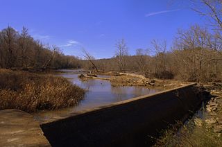
The Upper Appomattox Canal Navigation system allowed farmers who took their wheat and corn to mills on the Appomattox River, as far way as Farmville, Virginia, to ship the flour all the way to Petersburg from 1745 to 1891. The system included a navigation, modifications on the Appomattox River, a Canal around the falls Petersburg, and a turning basin in Petersburg to turn their narrow long boats around, unload the farm products from upstream and load up with manufactured goods from Petersburg. In Petersburg, workers could put goods on ships bound for the Chesapeake Bay and load goods from far away for Farmville and plantations upstream. Canal boats would return up river with manufactured goods. People who could afford it, rode in boats on the canal as the fastest and most comfortable ride. The river was used for transportation and shipping goods for over 100 years.
