
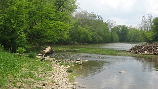
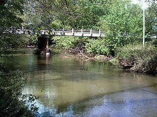
Skull Fork is a stream in the U.S. state of Ohio. [1]
According to legend, local Indians had kidnapped and murdered some individuals whose skulls were found near this creek. [2]
Skull Fork is a stream in the U.S. state of Ohio. [1]
According to legend, local Indians had kidnapped and murdered some individuals whose skulls were found near this creek. [2]

Little Beaver Creek is a wild and scenic area in Ohio. The Little Beaver Creek watershed is located primarily in Columbiana County in eastern Ohio, and in portions of Carroll County, Mahoning County, and western Pennsylvania, draining approximately 605 mi² (1,567 km²), of which 503 mi² (1,303 km²) are in Ohio. The watershed in total size covers an area of approximately 510 square miles, with about 80% of this being situated in Ohio. The great majority of land within the watershed is privately owned. Within the watershed are roughly 808 miles of linear streams.
The Little River is a 22.6-mile-long (36.4 km) stream in Allen and Huntington counties in northeastern Indiana. A tributary of the Wabash River, it is sometimes called the "Little Wabash", which may cause it to be confused with the Little Wabash River of Illinois. The river drains an area of 287.9 square miles (746 km2).

Wills Creek is a tributary of the Muskingum River, 92.2 mi (148.4 km) long, in eastern Ohio in the United States. Via the Muskingum and Ohio Rivers, it is part of the watershed of the Mississippi River. It drains an area of 853 mi2 (2,209 km2).

The Sandy and Beaver Canal was a canal and lock transportation system which ran seventy-three miles from the Ohio and Erie Canal at Bolivar, Ohio, to the Ohio River at Glasgow, Pennsylvania.
Wolf Creek is a tributary of the Muskingum River in the U.S. state of Ohio. It consists of two forks: the muddy fork, which begins toward Barlow, and the Clear Fork, which begins toward Chesterhill. The Clear Fork has interesting whitewater with a ledge called Chipmunk Falls and several interesting rapids which could be classified as up to class IV in difficulty. Wolf Creek also is the site of the Wolf Creek Recreation Center which once was the site of a 152-acre (0.62 km2) lake but it was destroyed by a flash flood in 1950. Now this area located near McConnelsville is mostly used for hunting, fishing and hiking. The Clear Fork and Muddy Fork of Wolf Creek merge and enter the Muskingum River near Waterford.

Piney Fork is an unincorporated community in central Smithfield Township, Jefferson County, Ohio, United States.1063420 The stream of Piney Fork flows southeast past the community; it meets Short Creek in far western Warren Township, and Short Creek in turn meets the Ohio River at Rayland.
Barlow is an unincorporated community in western Barlow Township, Washington County, Ohio, United States. Although it is unincorporated, it has a ZIP code 45712. It lies at the intersection of State Routes 339 and 550 near the South Fork of Wolf Creek, which meets the Muskingum River at Waterford to the north.

Birmingham is an unincorporated community in southeastern Monroe Township, Guernsey County, Ohio, United States. It lies at the intersection of Beal, Birmingham, and Peoli Roads, 3+3⁄4 miles (6.0 km) south of Peoli, 7 miles east-northeast of Kimbolton, and 13 miles (21 km) northeast of central Cambridge, the county seat of Guernsey County. Nearby streams flow southward into Salt Fork Lake, which is included in Salt Fork State Park.
Shenkani is a village in the Alagyaz Municipality of the Aragatsotn Province of Armenia. The town is mostly populated by Yazidis.
Atwood Lake is a reservoir located in Tuscarawas and Carroll counties in east central Ohio. The lake is formed by Atwood Dam 40°31′36″N81°17′5″W across Indian Fork, a tributary of Conotton Creek. The lake is named for the community of Atwood 40°31′36″N81°17′5″W which was purchased, demolished and inundated. Evidence of an old rail station and roadbed can also be seen near Dellroy when the lake level is drawn down for winter. In addition to the Indian Fork the lake also has coves to the north up Elliott Run, Willow Run and two unnamed streams along Bark Road and Ohio State Route 542. The dam was completed in September 1936 at a cost of $1,403,900 by the Muskingum Watershed Conservancy District. The operation of the lake and dam, along with the property immediately surrounding the dam site, was transferred to the U.S. Army Corps of Engineers, Huntington District, after the approval of the Flood Control Act of 1939 by Congress. The MWCD continues to be responsible for the management of much of the reservoir areas behind the dam, serving as a partner to the U.S. Army Corps of Engineers for flood reduction. In addition to operating a number of recreation facilities, the MWCD cooperates with the Ohio Division of Wildlife for fishing and hunting management.
Conotton Creek is a tributary of the Tuscarawas River, 38.7 miles (62.3 km) long, in eastern Ohio in the United States. Via the Tuscarawas, Muskingum and Ohio Rivers, it is part of the watershed of the Mississippi River, draining an area of 286 square miles (741 km2) in Carroll, Harrison and Tuscarawas County, Ohio. The source is at 1240 feet and the mouth is at 874 feet. Dover Dam, downstream on the Tuscarawas river, is normally dry, but can impound a reservoir on Conotton and tributaries to a pool elevation of 916 feet for downstream flood control by the Corps of Engineers. From its source in eastern Harrison County, Ohio the creek flows west northwest through Jewitt, Scio, Conotton, Bowerston, Leesville, Sherrodsville, New Cumberland and Somerdale before reaching its mouth in central Tuscarawas County, Ohio. The Wheeling and Lake Erie Railway is situated in the valley. Ohio State Route 151 runs in the valley from near the source to Bowerston. Ohio State Route 212 run along the valley from Bowerston to the mouth. The Conotton Creek Trail runs from Bowerston to Jewett.

Leesville Lake is a reservoir located near Ohio State Route 212 and Leesville, Ohio. The lake is formed by Leesville Dam 40°28′6″N81°11′41″W across McGuire Creek, a tributary of Conotton Creek. The lake is named for the village of Leesville.

Petersburg, sometimes spelled "Petersburgh", is an unincorporated community in Union Township, Carroll County, Ohio, United States. The community is part of the Canton–Massillon Metropolitan Statistical Area. The community is served by the Carrollton post office, ZIP code 44615. It is located on the North Fork McGuire Creek and State Route 332.

Pattersonville is an unincorporated community in Augusta Township, Carroll County, Ohio, United States. The community is part of the Canton–Massillon Metropolitan Statistical Area. The community is serviced by the Minerva, Ohio post office, ZIP code 44657 . It is located on the Still Fork creek and the Ohi-Rail Corporation (OHIC) railroad.
Center Point is an unincorporated community in Worcester Township, Montgomery County, Pennsylvania, United States, at the junction of Routes 73 and 363. It is drained by the Zacharias Creek westward into the Skippack Creek, a tributary of the Perkiomen Creek. The community is served by the Methacton School District and by the Collegeville, Lansdale, and Norristown post offices, with the zip codes of 19426, 19446, and 19403, respectively.

Perryton is an unincorporated community in Licking County, in the U.S. state of Ohio.
Archers Fork is an unincorporated community in Washington County, in the U.S. state of Ohio.
Dunlap Creek is a stream located entirely within Tuscarawas County, Ohio. It is a tributary of the Tuscarawas River.
Guernsey is an unincorporated community in Wheeling Township, Guernsey County, in the U.S. state of Ohio.
Rocky Fork is an unincorporated community in Licking County, in the U.S. state of Ohio.
40°12′4″N81°16′24″W / 40.20111°N 81.27333°W
| | This article related to a river in Ohio is a stub. You can help Wikipedia by expanding it. |