Related Research Articles

The Feather River is the principal tributary of the Sacramento River, in the Sacramento Valley of Northern California. The river's main stem is about 73 miles (117 km) long. Its length to its most distant headwater tributary is just over 210 miles (340 km). The main stem Feather River begins in Lake Oroville, where its four long tributary forks join—the South Fork, Middle Fork, North Fork, and West Branch Feather Rivers. These and other tributaries drain part of the northern Sierra Nevada, and the extreme southern Cascades, as well as a small portion of the Sacramento Valley. The total drainage basin is about 6,200 square miles (16,000 km2), with approximately 3,604 square miles (9,330 km2) above Lake Oroville.

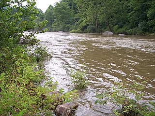
The Coal River is a tributary of the Kanawha River in southern West Virginia. It is formed near the community of Alum Creek by the confluence of the Big and Little Coal Rivers, and flows generally northward through western Kanawha County, past the community of Upper Falls and into the Kanawha River at St. Albans.

The Williams River is a tributary of the Gauley River, 33 miles (53 km) long, in east-central West Virginia, USA. Via the Gauley, Kanawha and Ohio Rivers, it is part of the watershed of the Mississippi River, draining an area of 132 square miles (342 km2) in a sparsely populated region of the southern Allegheny Mountains and the unglaciated portion of the Allegheny Plateau.
The Cherry River is a tributary of the Gauley River in southeastern West Virginia in the United States. Via the Gauley, Kanawha and Ohio rivers, it is part of the watershed of the Mississippi River. The Cherry River drains mostly rural and forested areas and flows for much of its length through the Monongahela National Forest. Throughout its entire length the Cherry goes over a series of whitewater rapids in a mountainous setting.
Lunice Creek is a 7.3-mile-long (11.7 km) tributary of the South Branch Potomac River, belonging to the Potomac River and Chesapeake Bay watersheds. The creek is located in Grant County, West Virginia. Lunice Creek is created by its North and South Forks and empties into the South Branch at Petersburg.

Glady Fork is a 31.9-mile-long (51.3 km) river in the Allegheny Mountains of eastern West Virginia, USA. It is considered one of the five principal headwaters tributaries of the Cheat River — known as the Forks of Cheat.
Arches Fork is a stream in the U.S. state of West Virginia.
Canoe Run is a stream in the U.S. state of West Virginia. It is a tributary of West Fork River.
Cassity Fork is a stream in the U.S. state of West Virginia.
Clifty is an unincorporated community in Fayette County, in the U.S. state of West Virginia.
Cougar Fork is a stream in the U.S. state of West Virginia.
Cutlips Fork is a stream in the U.S. state of West Virginia.

Elliott is an extinct town in Fayette County, in the U.S. state of West Virginia.
Hughes Fork is a stream in the U.S. state of West Virginia. It is a tributary of Skin Creek.
Knob Fork is a stream in the U.S. state of West Virginia.
Little Otter Creek is a stream in the U.S. state of West Virginia.
Sleith is an extinct town in Braxton County, in the U.S. state of West Virginia.
Spruce Fork is a stream in the U.S. state of West Virginia.
Westfall Fork is a stream in the U.S. state of West Virginia.
Wheeler Fork is a stream in the U.S. state of West Virginia.
References
- ↑ U.S. Geological Survey Geographic Names Information System: Upper Sleith Fork
- ↑ U.S. Geological Survey Geographic Names Information System: Lower Sleith Fork
- ↑ Kenny, Hamill (1945). West Virginia Place Names: Their Origin and Meaning, Including the Nomenclature of the Streams and Mountains. Piedmont, WV: The Place Name Press. p. 587.
38°43′15″N80°55′59″W / 38.72083°N 80.93306°W