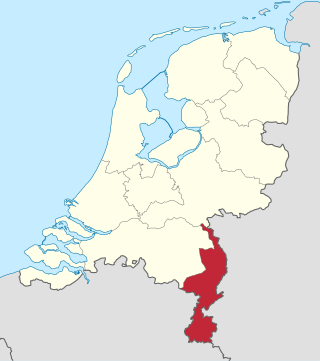
Limburg, also known as Dutch Limburg, is the southernmost of the twelve provinces of the Netherlands. It is bordered by Gelderland to the north and by North Brabant to its west. Its long eastern boundary forms the international border with the state of North Rhine-Westphalia in Germany. To the west is the international border with the similarly named Belgian province of Limburg, part of which is delineated by the river Meuse. To the south, Limburg is bordered by the Belgian province of Liège. The Vaalserberg is on the extreme southeastern point, marking the tripoint of the Netherlands, Germany and Belgium.

Gulpen-Wittem is a municipality in the southeastern Netherlands with 14,206 inhabitants as of 2021.
Broek may refer to the following places in the Netherlands:

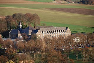
Mechelen is a town in the Dutch province of Limburg. It is a part of the municipality of Gulpen-Wittem, and lies about 13 km south of Heerlen.

Epen is a village in the southern part of the Dutch province of Limburg. It is a part of the municipality of Gulpen-Wittem, and lies about 15 km southwest of Kerkrade. Epen is known for its timber framed houses and is part of the sightseeing tour the Mergellandroute.
Wittem is a small village in the Dutch province of Limburg. It is located in the municipality of Gulpen-Wittem.

Berghem is a hamlet in the Netherlands, in the province of Limburg. It is located about 1 km south of the town of Gulpen, in the municipality of Gulpen-Wittem.
Helle is a hamlet in the Dutch province of Limburg. It is located in the municipality of Gulpen-Wittem, about 1 km south of the village of Mechelen.
Gulpen is a village in the Dutch province of Limburg. It is approximately midway between the Dutch city of Maastricht and the German city of Aachen.

Wijlre is a village in the Dutch province of Limburg. It is located in the municipality of Gulpen-Wittem.
South Limburg is both a COROP (statistical) region as well as a landstreek (area) of the Netherlands located in the province of Limburg. The Dutch term landstreek, literally translated "land area/region", means that the area is not an administrative region but an area that displays cohesion with regard to culture and landscape. With regards to South Limburg this deals with its hilly landscape, especially in the Heuvelland region, sunken lanes, an abundance of castles, and the regional language Limburgish spoken by a significant part of the population alongside Dutch. The region also contains the highest point above sea level in mainland Netherlands, the Vaalserberg being 322.5 metres (1,058 ft) above sea level.

Eys is a village in the municipality of Gulpen-Wittem, Limburg, the Netherlands. The town is located 3 km. from Gulpen and 17 km. from provincial capital Maastricht. Furthermore, it is characterised by its location in the hilly landscape of South Limburg. The village was first mentioned in 1193 in a document of the Sint-Pauluskapittel of Liège, Belgium, and was named after the river Eyserbeek.
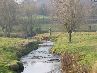
The Gulp is a 21 kilometres (13 mi) long river in eastern Belgium and southeastern Netherlands. It flows through the Belgian provinces of Liège and Limburg, and the Dutch province of Limburg. It is a strongly meandering, fast flowing, left-bank tributary of the Geul river. Because of it strong meanders, it is difficult to determine its exact length.

Wahlwiller is a village in the Dutch province of Limburg. It is located in the municipality of Gulpen-Wittem. The village is located south of the Selzerbeek.

Eyserheide is a hamlet in the southeastern Netherlands. It is located close to the village of Eys in the municipality of Gulpen-Wittem, Limburg, around 15 km east of Maastricht. The name refers to a former heathland in the area. The village has a population of 90 people.

Beutenaken is a hamlet in the southeastern Netherlands. It is part of the village of Slenaken in the municipality of Gulpen-Wittem, Limburg, about 20 km east of Maastricht. Older names for the village are Bottinachs, Butenacho and Butenachen.

Imstenrade is a hamlet in the southeastern Netherlands. It is part of the municipality of Heerlen in the province of Limburg, about 20 km east of Maastricht. The village lies between Benzenrade and Simpelveld, next to the A76 motorway and the N281 provincial road. In 2014 the village had a population of 336 and was home to an immigration detention centre with space for 700 immigrants.

Bosschenhuizen is a hamlet in the southeastern Netherlands. It is part of the municipality of Simpelveld in the province of Limburg, about 20 km east of Maastricht. The village lies southeast of Trintelen and west of Simpelveld. In 2016, the village had an estimated population of 80.

Huls is a hamlet in the southeastern Netherlands. It is part of the municipality of Simpelveld in the province of Limburg, about 20 km east of Maastricht. The village lies on a hill, north of Simpelveld, and south of Ubachsberg. In 2008 the village had a population of 350 on an area of 0.44 km2. On the hillside south of Huls lies Hulsveld, a hamlet sharing the same name with a population of 1630. Since the hamlets share a single built-up area, and are both located on the hill called Huls, the village Huls is sometimes mistaken to include Hulsveld.
Nijswiller is a village in the southern part of the Dutch province of Limburg. It is a part of the municipality of Gulpen-Wittem, and is located about 19 kilometres (12 mi) east of Maastricht.


