
In mathematics, the slope or gradient of a line is a number that describes both the direction and the steepness of the line. Slope is often denoted by the letter m; there is no clear answer to the question why the letter m is used for slope, but its earliest use in English appears in O'Brien (1844) who wrote the equation of a straight line as "y = mx + b" and it can also be found in Todhunter (1888) who wrote it as "y = mx + c".

The North Slope Borough is the northernmost borough in the US state of Alaska and thus, the northernmost county or equivalent of the United States as a whole. As of the 2020 census, the population was 11,031. The borough seat and largest city is Utqiaġvik, which is also the northernmost settlement in the United States.

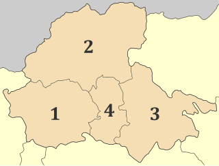
Slope County is a county in the U.S. state of North Dakota. As of the 2020 census, the population was 706, making it the least populous county in North Dakota and the 20th-least populous county in the United States. The county seat is Amidon.
Pella is one of the regional units of Greece, in the geographic region of Macedonia. It is part of the Region of Central Macedonia. It is named after the ancient city of Pella, the capital of ancient Macedonia and the birthplace of Alexander the Great. The capital of Pella is Edessa with a population of 19,036 inhabitants according to the census of 2011, while the largest town is Giannitsa. Other towns include Aridaia, Skydra, Arnissa and Krya Vrysi.

The grade of a physical feature, landform or constructed line refers to the tangent of the angle of that surface to the horizontal. It is a special case of the slope, where zero indicates horizontality. A larger number indicates higher or steeper degree of "tilt". Often slope is calculated as a ratio of "rise" to "run", or as a fraction in which run is the horizontal distance and rise is the vertical distance.
In economics, the marginal cost is the change in the total cost that arises when the quantity produced is incremented, the cost of producing additional quantity. In some contexts, it refers to an increment of one unit of output, and in others it refers to the rate of change of total cost as output is increased by an infinitesimal amount. As Figure 1 shows, the marginal cost is measured in dollars per unit, whereas total cost is in dollars, and the marginal cost is the slope of the total cost, the rate at which it increases with output. Marginal cost is different from average cost, which is the total cost divided by the number of units produced.
In economics, average cost or unit cost is equal to total cost (TC) divided by the number of units of a good produced :

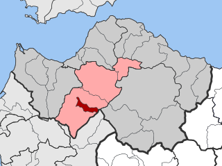
Levidi is a small town and a former municipality in Arcadia, Peloponnese, Greece. Since the 2011 local government reform it is part of the municipality Tripoli, of which it is a municipal unit. The municipal unit has an area of 312.641 km2. The town is situated on the northeastern slope of the Mainalo mountains, at about 850 m elevation. Levidi is 9 km northwest of Kapsas, 10 km east of Vytina, 12 km southwest of Kandila and 20 km northwest of Tripoli. It is at the junction of the Greek National Road 74 (Tripoli–Pyrgos) and the Greek National Road 66.
Kalentzi is a village and a former community in Achaea, West Greece, Greece. Since the 2011 local government reform it is part of the municipality Erymanthos, of which it is a municipal unit. The municipal unit has an area of 23.907 km2. The population of the village was 71 in 2011, and of the municipal unit 380. It is renowned in Greece as the ancestral home of the Papandreou political dynasty. Kalentzi is situated on the northern slope of Mount Erymanthos, about 35 km south of Patras.

Accropode blocks are wave-dissipating concrete blocks designed to resist the action of waves on breakwaters and coastal structures.

Rusk Mountain is a peak located in the towns of Jewett and Lexington in Greene County, New York, United States. At 3,680 feet (1,120 m) in elevation, it is the 20th-highest peak in the Catskill Mountains and considered a member of the Catskill High Peaks. While there is no maintained trail, a bushwhack to the summit is considered relatively easy, and required for membership in the Catskill Mountain 3500 Club.
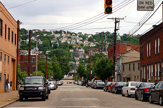
South Side Slopes is a neighborhood in Pittsburgh, Pennsylvania's South Side area. The neighborhood comprises the hills from the South Side Flats neighborhood along the Monongahela River from the Liberty Bridge (west) to beyond Josephine Street (east).

Arctic Slope Regional Corporation, or ASRC, is one of 13 Alaska Native Regional Corporations created under the Alaska Native Claims Settlement Act of 1971 (ANCSA) in settlement of aboriginal land claims. ASRC was incorporated in Alaska on June 22, 1972. Headquartered in Utqiaġvik, Alaska, with administrative offices in Anchorage, ASRC was as of 2017, a for-profit corporation with nearly 11,000 Alaska Native shareholders primarily of Inupiat Eskimo descent.

A cliff-former is a geological unit of bedrock that is more resistant to erosion than overlying or underlying strata and consequently produces outcrops with high slope angles. It is more or less equivalent to ridge-former, and may be contrasted with slope-former. In humid environments, sandstones are typically cliff-formers. In arid environments, limestones are often cliff-formers also. Recent lavas may be cliff-formers as well.
Prudhoe Bay Oil Field is a large oil field on Alaska's North Slope. It is the largest oil field in North America, covering 213,543 acres (86,418 ha) and originally contained approximately 25 billion barrels (4.0×10⁹ m3) of oil. The amount of recoverable oil in the field is more than double that of the next largest field in the United States by acreage (the East Texas Oil Field), while the largest by reserves is the Permian Basin (North America). The field was operated by BP; partners were ExxonMobil and ConocoPhillips until August 2019; when BP sold all its Alaska assets to Hilcorp.

Halcott Mountain is one of the Catskill Mountains of the U.S. state of New York. It is mostly located in Greene County, with some of its lower slopes in Delaware and Ulster counties. Its exact summit elevation has not been officially determined, but the highest contour line on the mountain is 3,520 feet (1,070 m). It is one of the peaks on the divide between the Delaware and Hudson watersheds.
The Integrated Marine and Coastal Regionalisation of Australia (IMCRA), formerly the Interim Marine and Coastal Regionalisation for Australia, is a biogeographic regionalisation of the oceanic waters of Australia's exclusive economic zone (EEZ). As of 2008, the most recent version is IMCRA Version 4.0.
The Mill Field is a 3.4-hectare (8.4-acre) Site of Borough Importance for Nature Conservation, Grade II, in Mill Hill in the London Borough of Barnet. It is a public open space which slopes steeply down from the road called The Ridgeway. It may be the site of the windmill which gave the area its name. This was documented as early as 1321 and had disappeared by 1754.

Isis Temple is a prominence in the Grand Canyon, Arizona, Southwestern United States. It is located below the North Rim and adjacent to the Granite Gorge along the Colorado River. The Trinity Creek and canyon flow due south at its west border; its north, and northeast border/flank is formed by Phantom Creek and canyon, a west tributary of Bright Angel Creek; the creeks intersect about 3 mi (4.8 km) southeast, and 1.0 mi (1.6 km) north of Granite Gorge. The Isis Temple prominence, is only about 202 ft (62 m) lower than Grand Canyon Village, the main public center on Grand Canyon’s South Rim.

The Lower Permian Esplanade Sandstone is a cliff-forming, resistant sandstone, dark red, geologic unit found in the Grand Canyon. The rock unit forms a resistant shelf in the west Grand Canyon, south side of the Colorado River, at the east of the Toroweap Fault, down-dropped to west, southeast of Toroweap Overlook, and west of Havasupai. The red, sandstone shelf, The Esplanade is about 20-mi long. At Toroweap Overlook region, Toroweap Valley with Vulcan's Throne, Uinkaret volcanic field, the resistant Esplanade Sandstone is described in access routes exploring the Toroweap Lake area.
