Sly River

Last updated

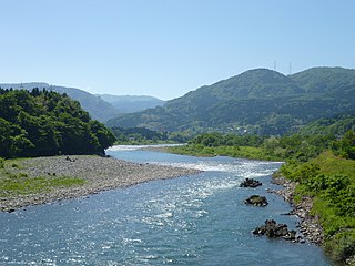
The Sly River is a river in northern Algeria, North Africa. The Sly River is a tributary of the Chelif River and joins the Chelif just east of the town of Sidi ben Thiour.

River Natural flowing watercourse

A river is a natural flowing watercourse, usually freshwater, flowing towards an ocean, sea, lake or another river. In some cases a river flows into the ground and becomes dry at the end of its course without reaching another body of water. Small rivers can be referred to using names such as stream, creek, brook, rivulet, and rill. There are no official definitions for the generic term river as applied to geographic features, although in some countries or communities a stream is defined by its size. Many names for small rivers are specific to geographic location; examples are "run" in some parts of the United States, "burn" in Scotland and northeast England, and "beck" in northern England. Sometimes a river is defined as being larger than a creek, but not always: the language is vague.

Algeria country in North Africa

Algeria, officially the People's Democratic Republic of Algeria, is a country in the Maghreb region of North Africa. The capital and most populous city is Algiers, located in the far north of the country on the Mediterranean coast. With an area of 2,381,741 square kilometres (919,595 sq mi), Algeria is the tenth-largest country in the world, and the largest in Africa. Algeria is bordered to the northeast by Tunisia, to the east by Libya, to the west by Morocco, to the southwest by the Western Saharan territory, Mauritania, and Mali, to the southeast by Niger, and to the north by the Mediterranean Sea. The country is a semi-presidential republic consisting of 48 provinces and 1,541 communes (counties).

North Africa Northernmost region of Africa

North Africa is a region encompassing the northern portion of the African continent. There is no singularly accepted scope for the region, and it is sometimes defined as stretching from the Atlantic shores of Morocco in the west, to Egypt's Suez Canal and the Red Sea in the east. Others have limited it to top North-Western countries like Algeria, Morocco, and Tunisia, a region that was known by the French during colonial times as “Afrique du Nord” and is known by all Arabs as the Maghreb. The most commonly accepted definition includes Algeria, Sudan, Morocco, Tunisia, Libya and Egypt, the 6 countries that shape the top North of the African continent. Meanwhile, “North Africa”, particularly when used in the term North Africa and the Middle East, often refers only to the countries of the Maghreb and Libya. Egypt, being also part of the Middle East, is often considered separately, due to being both North African and Middle Eastern at the same time. North Africa includes a number of Spanish and Portuguese possessions, Plazas de soberanía, Ceuta and Melilla and the Canary Islands and Madeira. The countries of North Africa share a common ethnic, cultural and linguistic identity that is unique to this region. Northwest Africa has been inhabited by Berbers since the beginning of recorded history, while the eastern part of North Africa has been home to the Egyptians. Between the A.D. 600s and 1000s, Arabs from the Middle East swept across the region in a wave of Muslim conquest. These peoples, physically quite similar, formed a single population in many areas, as Berbers and Egyptians merged into Arabic and Muslim culture. This process of Arabization and Islamization has defined the cultural landscape of North Africa ever since.

Related Research Articles

Jinzū River river in Japan

The Jinzū River is a river that flows from Gifu Prefecture to Toyama Prefecture in Japan. It is called Miya River in Gifu. It is 120 km (75 mi) in length and has a watershed of 2,720 km2 (1,050 sq mi).

Ténès Place

Ténès is a town in Algeria located around 200 kilometers west of the capital Algiers. As of 2000, it has a population of 35,000 people.

Chelif River river in Algeria

Chelif River is a 700-kilometre (430 mi) long river in Algeria and also the longest one in the country. It rises from the Saharan Atlas near the city of Aflou, flows through the Tell Atlas and empties into the Mediterranean Sea north of the city of Mostaganem. Water level in the river often fluctuates. The river is being used for irrigation.

Tell Atlas mountain range

The Tell Atlas is a mountain chain over 1,500 km (932 mi) in length, belonging to the Atlas mountain ranges in North Africa, stretching from Morocco, through Algeria to Tunisia.

<i>Sly Cooper</i> video game series

Sly Cooper is a series of platform stealth video games for the PlayStation 2, PlayStation 3 and PlayStation Vita. The series was developed by Sucker Punch Productions for the first three games, and then it was passed on to Sanzaru Games while Sucker Punch continued work on the Infamous series. The first three games were remastered into high-definition for the PlayStation 3 by Sanzaru Games, titled The Sly Collection.

Nettlecombe, Isle of Wight village on the Isle of Wight, England

Nettlecombe is a farming hamlet on the Isle of Wight. It is the site of a deserted medieval village and there is evidence of earthworks close to the present hamlet. There are several fishing lakes in Nettlecombe.

El Amra Place in Aïn Defla, Algeria

El Amra is a town in northern Algeria.

Srednje Village in Styria, Slovenia

Srednje is a settlement in the hills above the left bank of the Drava River west of Maribor in northeastern Slovenia. It belongs to the City Municipality of Maribor.

Sly Park, California Unincorporated community in California, United States

Sly Park is an unincorporated community in El Dorado County, California. It is located in Sly Valley 13 miles (21 km) east of Placerville, at an elevation of 3560 feet.

Oued Fodda Commune and town in Chlef Province, Algeria

Oued Fodda is a town and commune in Chlef Province, Algeria. According to the 1998 census it has a population of 36,187.

Oued Sly Commune and town in Chlef Province, Algeria

Oued Sly is a town and commune in Chlef Province, Algeria. According to the 1998 census it has a population of 41,245.

Ksar Boukhari Commune and town in Médéa Province, Algeria

Ksar Boukhari is a town and commune in Médéa Province, Algeria. According to the 1998 census it had a population of 53,637. The town is bordered by woods and the Atlas mountains, and is built on the Chelif river.

Ouarsenis mountains in Algeria

The Ouarsenis or Ouanchariss is a mountain range and inhabited region in northwestern Algeria.

Sheliff Basin Berber is a variety of the Berber languages that is spoken in Algeria. It is traditionally taken to be a dialect of Shenwa, one of the Western Algerian Zenati languages. Blench (2006) argues instead that the variety is part of the Riffian dialect cluster.

Mechtat el Mehedia is a village in Djidioua commune, Relizane Province, Algeria. the village is located on the Plaine du Cheliff on the left (west) bank of the Oued Ang el Djemel, an intermittent tributary of the Chelif River.

Vagal or Vagalitanus was a Vandal and Roman era civitas (town) in Mauretania Caesariensis, Roman North Africa. The town has been tentatively identified with Sidi ben Thiour on the Mekerra River near its confluence with the Sly River.(36.073819n, 1.094881e) Nearby towns included Castellum Tingitanum and Catabum Castra (Djidioua). The mines at Malakoff were to the north-east of the town.

Sig River

The Sig River, also known as Mekerra, is a river of Algeria.

Berners Hotel hotel in London

The Berners Hotel, now known as the London Edition hotel, is located in Berners Street in the City of Westminster, London. It was built in 1908–10 to a design by John Slater, surveyor to the Berners Estate, and is a grade II listed building.

References

    Coordinates: 36°05′51″N1°08′10″E / 36.09744°N 1.13606°E / 36.09744; 1.13606

    Geographic coordinate system Coordinate system

    A geographic coordinate system is a coordinate system that enables every location on Earth to be specified by a set of numbers, letters or symbols. The coordinates are often chosen such that one of the numbers represents a vertical position and two or three of the numbers represent a horizontal position; alternatively, a geographic position may be expressed in a combined three-dimensional Cartesian vector. A common choice of coordinates is latitude, longitude and elevation. To specify a location on a plane requires a map projection.