Smithfield, properly known as West Smithfield, is a district located in Central London, part of Farringdon Without, the most westerly ward of the City of London, England.

The Falls Road is the main road through West Belfast, Northern Ireland, running from Divis Street in Belfast City Centre to Andersonstown in the suburbs. The name has been synonymous for at least a century and a half with the Catholic community in the city. The road is usually referred to as the Falls Road, rather than as Falls Road. It is known in Irish as the Bóthar na bhFál and as the Faas Raa in Ulster-Scots.
Belfast City Centre is the central business district of Belfast, Northern Ireland.

Belfast Castle is a mansion located in Cave Hill Country Park in Belfast, Northern Ireland, in a prominent position 400 feet (120 m) above sea level. Its location provides unobstructed views over the City of Belfast and Belfast Lough. There have been several structures called "Belfast Castle" over the centuries, located on different sites. The current "castle" is a Victorian structure, built between 1867 and 1870 on the slopes of Cave Hill, and is Grade A listed. The main entrance into the Belfast Castle Demesne is now where Innisfayle Park meets Downview Park West, just off the Antrim Road. The original main entrance into the current demesne was formerly on the Antrim Road itself, where Strathmore Park now meets the Antrim Road.

Smithfield is a neighbourhood and former village in Toronto, Ontario, Canada. Some new residents of Toronto and new immigrants to Canada are attracted to this neighbourhood, mainly because there is a large amount of affordable public housing. It is named after the former village of Smithfield located at the intersection of Albion Road and Martin Grove Road. The neighbourhood is located north of the west branch of the Humber River and west of Kipling Avenue.

The Donegall Road is a residential area and road traffic thoroughfare that runs from Shaftesbury Square on what was once called the "Golden Mile" to the Falls Road in west Belfast. The road is bisected by the Westlink – M1 motorway. The largest section of the road, east of the Broadway junction with the Westlink, has a community which self-identifies as predominantly Protestant while the community on the other side of the Westlink – M1 motorway self-identifies as predominantly Catholic.

The Cathedral Quarter in Belfast, Northern Ireland, is a developing area of the city, roughly situated between Royal Avenue near where the Belfast Central Library building is, and the Dunbar Link in the city centre. From one of its corners, the junction of Royal Avenue, Donegall Street and York Street, the Cathedral Quarter lies south and east. Part of the area, centred on Talbot Street behind the cathedral, was formerly called the Half Bap. The "Little Italy" area was on the opposite side of Great Patrick Street centred on Little Patrick Street and Nelson Street.
The subdivisions of Belfast are a series of divisions of Belfast, Northern Ireland that are used for a variety of cultural, electoral, planning and residential purposes.

The buildings and structures of Belfast, Northern Ireland comprise many styles of architecture ranging from Edwardian through to state-of-the-art modern buildings like the Waterfront Hall. The city's beautiful Edwardian buildings are notable for their display of a large number of sculptures. Many of Belfast's Victorian landmarks, including the main Lanyon Building at Queens University in 1849, were designed by Sir Charles Lanyon.

Ormeau Road is a road in south Belfast, the capital of Northern Ireland. Ormeau Park is adjacent to it. It forms part of the A24.
The Tribeca Belfast development, formerly known as North East Quarter and previously Royal Exchange, is a planned £500 million development based in the north east of Belfast City Centre. It is a major mixed-use regeneration scheme, with a total area of 1.5 million sq ft (0.14 million m2) as of 2018. The development has generated controversy since its inception in 2003. Over the years, opposition has been levelled against its lack of care towards existing important built heritage, lack of integration with local small businesses and arts organisations and even its brand name, and much of its existence so far has been in the context of an arson attack on one of the existing buildings in 2004, while under the ownership of the developers.
The Library Quarter, sometimes referred to as Scotch Quarter and Press Quarter, is the area of Belfast City Centre, Northern Ireland, located around Belfast Central Library on Royal Avenue. The Library Quarter is bounded by Royal Avenue, Donegall Street, Carrick Hill and North Street. Other important buildings in the area include those previously occupied by the two main regional newspapers, the Belfast Telegraph and the Irish News. They both moved their operations to other premises. This quarter is now considered part of the larger Smithfield and Union Quarter, Belfast.

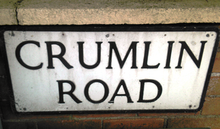
The Crumlin Road is a main road in north-west Belfast, Northern Ireland. The road runs from north of Belfast City Centre for about four miles to the outskirts of the city. It also forms part of the longer A52 road which leads out of Belfast to the town of Crumlin. The lower section of the road houses a number of historic buildings, including the city's former law courts and prison, whilst the road encompasses several large housing areas, including Ardoyne, Ballysillan and Ligoniel(from Irish Lag an Aoil, meaning 'hollow of the lime').

The Shore Road is a major arterial route and area of housing and commerce that runs through north Belfast and Newtownabbey in Northern Ireland. It forms part of the A2 road, a traffic route which links Belfast to the County Antrim coast.

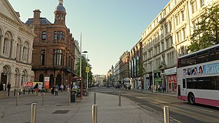
Royal Avenue is a street in the heart of Belfast city centre, Northern Ireland. It runs for about 500 metres from the junction with Castle Place and Donegall Place to the junction with Donegall Street. It lies between the Cathedral Quarter and the Smithfield and Union Quarter of the city. It has been the city's principal shopping thoroughfare since its establishment in 1881. Today Royal Avenue is one of Belfast's main commercial centres and is home to the £40 million shopping complex Westfield CastleCourt.

The Donegall Street bombing took place in Belfast, Northern Ireland on 20 March 1972 when, just before noon, the Provisional IRA detonated a car bomb in Lower Donegall Street in the city centre when the street was crowded with shoppers, office workers, and many schoolchildren.
The Antrim Road is a major arterial route and area of housing and commerce that runs from inner city north Belfast to Dunadry, passing through Newtownabbey and Templepatrick. It forms part of the A6 road, a traffic route which links Belfast to Derry. It passes through the New Lodge, Newington and Glengormley areas of Northern Ireland amongst others.

Great Victoria Street in Belfast, Northern Ireland, is a major thoroughfare located in the city centre and is one of the important streets used by pedestrians alighting from Belfast Great Victoria Street railway station and walking into shopping streets such as Royal Avenue.

St. Patrick's Church, Belfast is a Catholic church located in Donegall Street area of Belfast, Northern Ireland. The first church was opened on the site in 1815 while the current building dates from 1877.


