| Smoleva | |
|---|---|
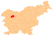
 Smoleva Location in Slovenia | |
| Coordinates: 46°12′39.99″N14°9′57.19″E / 46.2111083°N 14.1658861°E Coordinates: 46°12′39.99″N14°9′57.19″E / 46.2111083°N 14.1658861°E | |
| Country | |
| Traditional Region | Upper Carniola |
| Statistical region | Upper Carniola |
| Municipality | Železniki |
| Elevation | 591.8 m (1,941.6 ft) |
| Population (2002) | |
| • Total | 59 |
| [1] | |
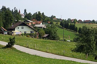
Smoleva (pronounced [smɔˈleːʋa] ) is a village in the Municipality of Železniki in the Upper Carniola region of Slovenia. It lies in the valley of Lower Smoleva Creek (Slovene : Prednja Smoleva) between Špik Hill (882 meters or 2,894 feet) to the northeast and Mount Vancovec (1,085 meters or 3,560 feet) to the southwest.

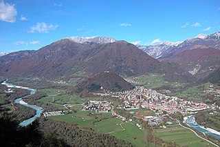
The Municipality of Železniki is a municipality in the Upper Carniola region of Slovenia. The seat of the municipality is the town of Železniki. The municipality was established in its current form on 3 October 1994, when the former larger Municipality of Škofja Loka was subdivided into the municipalities of Gorenja Vas–Poljane, Škofja Loka, Železniki, and Žiri.
Upper Carniola is a traditional region of Slovenia, the northern mountainous part of the larger Carniola region. The centre of the region is Kranj, while other urban centers include Jesenice, Tržič, Škofja Loka, Kamnik, and Domžale. It has around 300,000 inhabitants or 14% of the population of Slovenia.

Slovenia, officially the Republic of Slovenia, is a sovereign state located in southern Central Europe at a crossroads of important European cultural and trade routes. It is bordered by Italy to the west, Austria to the north, Hungary to the northeast, Croatia to the southeast, and the Adriatic Sea to the southwest. It covers 20,273 square kilometers (7,827 sq mi) and has a population of 2.07 million. One of the successor states of the former Yugoslavia, Slovenia is a parliamentary republic and a member of the United Nations, of the European Union, and of NATO. The capital and largest city is Ljubljana.