Buncombe is a village in Johnson County, Illinois, United States. The population was 203 at the 2010 census.

The Marlan and Rosemary Bourns College of Engineering, or commonly known as Bourns Engineering or BCOE, is an Accreditation Board for Engineering and Technology-accredited College of Engineering located in Riverside, California on the campus of the University of California, Riverside. The Bourns College of Engineering was established in 1989, and named in honor of Marlan Bourns, a B.S. physics graduate of the University of Michigan and Rosemary Bourns, founders of Bourns, Inc.

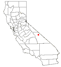
Eureka Valley is located in Inyo County, in eastern California in the southwestern United States. It is approximately 28 miles (45 km) long and up to 10 miles (16 km) wide, with elevations varying from 2870 feet up to 8456 feet. The southern section of the valley is now part of the Death Valley National Park - Death Valley itself lies just to the southeast. To the north is Deep Springs Valley, Fish Lake Valley, and the White Mountain Range. To the east the Last Chance Range rises over 5500 feet above the valley floor. To the west are the Saline Mountains, and to the southwest lies Saline Valley.

Northwye is a former community in Phelps County, Missouri, United States. It lies at the north junction of U.S. Routes 63 and 66, just north of Rolla. The name refers to the Y-intersection of the two roads north of town. Several homes are still in the area.
Zalduondo is a village and municipality located in the province of Araba (Álava), in the Basque Country, northern Spain. In 2012 the population was 185 persons and the extension of the village is 12,03 km².

Montelíbano is a town and municipality located in the Córdoba Department of Colombia. It is the seat of the Roman Catholic Diocese of Montelíbano.

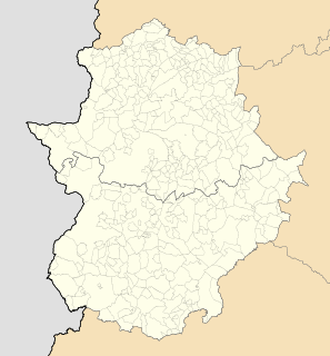
Esparragosa de Lares is a municipality in the province of Badajoz, Extremadura, Spain. It has a population of 1,066 and an area of 209 km².

Higuera de Vargas is a municipality in the province of Badajoz, Extremadura, Spain. It has a population of 2,011 and an area of 67.6 km².

Waco is an unincorporated community in central Canton Township, Stark County, Ohio, United States. It lies along State Route 43 just southeast of the Canton city line. Waco's altitude is 1,070 feet (326 m) The community is part of the Canton–Massillon Metropolitan Statistical Area.

Bolivia is an unincorporated community in Christian County, Illinois, United States. It lies at 39°44′32″N89°20′49″W.
Lallie Township is a civil township in Benson County, North Dakota, United States. As of the 2000 census, its population was 364.
Elton is a rural municipality in the Canadian province of Manitoba, located to the north of the city of Brandon. The community was incorporated in 1883, and its first officials took office the following year.

Ōkawadamukōen Station is a railway station on the Aizu Railway Aizu Line in Aizuwakamatsu, Fukushima Prefecture, Japan, operated by the Aizu Railway..
Concord is a census-designated place (CDP) in Campbell and Appomattox counties, Virginia, United States. The population as of the 2010 census was 1,458.
Rich Neck is an unincorporated community in Richmond County, in the U.S. state of Virginia.
The East Branch Croton River is a tributary of the Croton River in Dutchess, Putnam, and Westchester counties in the U.S. state of New York.
Millboro is an unincorporated community in Bath County, Virginia, in the United States.

WTHD 105.5 FM is a radio station broadcasting a Country music format. Licensed to LaGrange, Indiana, the station serves the areas of Sturgis, Michigan and Kendallville, Indiana, and is owned by Swick Broadcasting Company, Inc.
Asian Highway 76 (AH76) is a major road of northern Afghanistan. It connects Pole khomri at AH7 to Mazar-i-Sharif, passing through Samangan on the way, and then passes west and eventually ends at Herat, where it unites with AH1 and AH77 At Mazar-e-Sharif the road continues and joins the A01 and AH77 highways. Another road passes north from the A76 and connects it to Termiz in southern Uzbekistan. Note though that this "other road" is often regarded as a continuation of the A76, although it is actually part of the historical Pamir Highway, now known as the M41 highway (AH62). This road links Mazar-i-Sharif across the Amu Darya river, to Termiz. The Pamir Highway or the M41 is an extremely important highway of Uzbekistan, Tajikistan and Kyrgyzstan, which connects Termiz to Kara Balta to the west of Bishkek and links with the M39 highway twice at both cities.
Spencer Creek is a stream in Ralls and Pike counties of the U.S. state of Missouri. It is a tributary of the Salt River. The stream headwaters arise in the western edge of Pike County adjacent to the south side of Missouri Route 154 about 7 miles (11 km) west of Curryville. The stream flows generally west passing about 2 miles (3.2 km) north of Vandalia then turns northwest crossing under Route 154 east of Liberty Hall. The stream turns north then northeast and passes the village of Madisonville and continues roughly parallel to the boundary between Ralls and Pike counties. It enters briefly into Pike County just prior to passing under U.S. Route 61. It enters the Salt River about 4 miles (6.4 km) southeast of New London.


