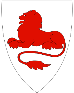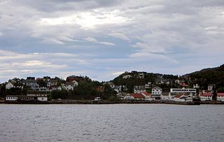
Herøy is a municipality in Nordland county, Norway. It is part of the Helgeland traditional region. The administrative centre of the municipality is the village of Silvalen. The municipality is located about 15 kilometres (9.3 mi) west of the town of Sandnessjøen.

Nesna is a municipality in Nordland county, Norway. It is part of the Helgeland traditional region. The administrative centre of the municipality is the village of Nesna. Other villages in Nesna include Handnesneset, Husby, Saura, and Vikholmen.

Rødøy is a municipality in Nordland county, Norway. It is part of the Helgeland traditional region. The administrative centre of the municipality is the village of Vågaholmen. Other villages include Gjerøy, Jektvika, Kilboghamn, Melfjordbotn, Oldervika, Sørfjorden, and Tjong. The municipality consists of many islands to the west of Norway's second biggest glacier, Svartisen.

Lødingen is a municipality in Nordland county in Norway. Lødingen is located on the southeastern corner of the island of Hinnøya, and is part of the traditional district of Ofoten. The administrative centre of the municipality is the village of Lødingen. The other main village is Vestbygda. Lødingen has the nickname "Biketown" because it hosts several annual bicycle races like Lofoten Insomnia and Vestbygd-rittet.

Moskenes is a municipality in Nordland county, Norway. The municipality comprises the southern part of the island of Moskenesøya in the traditional district of Lofoten. The administrative centre of the municipality is the village of Reine. Other villages include Sørvågen, Hamnøy, and Å.

Leknes (help·info) is a town in Nordland county, Norway. The town is also the administrative centre of the municipality of Vestvågøy. Leknes was designated a "town" in 2002. The 2.52-square-kilometre (620-acre) town has a population (2018) of 3,556 which gives the town a population density of 1,411 inhabitants per square kilometre (3,650/sq mi).

Nordvik is a former municipality in Nordland county, Norway. The 86-square-kilometre (33 sq mi) municipality existed from 1917 until its dissolution in 1962. The island municipality encompassed the central part of the island of Dønna as well as the smaller surrounding islands of Vandve, Slapøya, Havstein, and many others in what is now the southern part of Dønna Municipality. The municipality had 2 churches: Nordvik Church in the north and Hæstad Church in the south.

Gravdal is a village in Vestvågøy Municipality in Nordland county, Norway. It is located on the island of Vestvågøya in the central part of the Lofoten archipelago, north of the Arctic Circle. The village is situated along the shore of the Buksnesfjorden, about 3 kilometres (1.9 mi) southwest of the town of Leknes. The village also lies approximately 72 kilometres (45 mi) west of the town of Svolvær and 63 kilometres (39 mi) east of the village of Å in Moskenes. Historically, the village was the administrative centre of the old Buksnes municipality which existed from 1838 until 1963.

Straume is the administrative centre of Bø Municipality in Nordland county, Norway. The village is located on the island of Langøya in the Vesterålen archipelago. The village is located about 10 kilometres (6.2 mi) from the village of Bø and the village of Eidet, in the west central part of the municipality.

Reine is the administrative centre of Moskenes Municipality in Nordland county, Norway. The fishing village is located on the island of Moskenesøya in the Lofoten archipelago, above the Arctic Circle, about 300 kilometres (190 mi) southwest of the town of Tromsø. Reine Church is located here and it serves the northern part of the municipality.

Lovund is an island and village in the municipality of Lurøy in Nordland county, Norway. The island is located west of the Solvær islands and southeast of the Træna islands. Lovund is notable for the large puffin breeding colony located on the rocky north slope of the island.

Inndyr is the administrative centre of the municipality of Gildeskål in Nordland county, Norway. The village is located on the mainland part of the municipality, about 6 kilometres (3.7 mi) north of Norwegian County Road 17. The village lies along the Sørfjorden and it looks out to the west over the nearby islands of Fugløya, Fleina, and Femris.

Sørland is a fishing village and the administrative centre of Værøy Municipality in Nordland county, Norway. It is located on the southern side of the island of Værøya. The village is the main population center of the island, and it is the location of Værøy Church, Værøy Heliport, and Værøy Lighthouse. The village of Nordland lies about 5 kilometres (3.1 mi) to the north and the now-abandoned village of Mostad is located about 5 kilometres (3.1 mi) to the southwest. There are no other villages on the island.

Ballstad is a village in Vestvågøy Municipality in Nordland county, Norway. It is located on a small island off the southwestern tip of the island of Vestvågøya in the Lofoten archipelago. It is one of the largest fishing villages in Lofoten.

Alsvåg is a village in the municipality of Øksnes in Nordland county, Norway. It is located on the western bank of the Gavlfjorden on the island of Langøya and about 8 kilometres (5.0 mi) east of the municipal centre of Myre. Alsvåg Church is located in this village.

Sigerfjord is a village in Sortland Municipality in Nordland county, Norway. The village is located on the island of Hinnøya by the entrance to the Sigerfjorden. The village of Strand and the Sortland Bridge are located about 6 kilometres (3.7 mi) to the north. Sigerfjord Church is located in this village.

Myre is the administrative centre of Øksnes Municipality in Nordland county, Norway. It is located on the northwestern part of the island of Langøya in the Vesterålen archipelago. Myre is one of the largest fishing villages in the Vesterålen region. Myre Church is located in this village.

Tjøtta is a former municipality in Nordland county, Norway. The 326-square-kilometre (126 sq mi) municipality existed from 1862 until its dissolution in 1965. The municipality was centered around the island of Tjøtta plus the mainland to the east and south as well as over 3000 islands, islets, and skerries to the west. The administrative centre of Tjøtta was the village of Tjøtta, located on the island of Tjøtta, where the Tjøtta Church is located.

Dverberg is a former municipality in Nordland county, Norway. The municipality existed from 1838 until its dissolution in 1964. The municipality encompassed areas on the island of Andøya in what is now Andøy Municipality. Starting out at about 616 square kilometres (238 sq mi) in 1838, it was reduced in size in 1924. Upon its dissolution in 1964, the municipality was only 279 square kilometres (108 sq mi). The administrative centre was the village of Dverberg where Dverberg Church is located.


