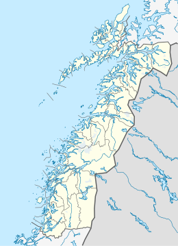
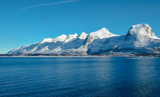
Herøy is a municipality in Nordland county, Norway. It is part of the Helgeland traditional region. The administrative centre of the municipality is the village of Silvalen. The municipality is located about 15 kilometres (9.3 mi) west of the town of Sandnessjøen.

Åsvær is a small group of islands lying on the Arctic Circle in the municipality of Dønna in Nordland county, Norway. The islands lie on the south side of the Nordåsværfjord, about 15 kilometres (9.3 mi) south of the island of Lovund and 12 kilometres (7.5 mi) northwest of the island of Dønna. The Åsvær Lighthouse was built here in 1876. The islands are noted for their herring fishery.

North Cape is a cape on the northern coast of the island of Magerøya in Northern Norway. The cape is in Nordkapp Municipality in Finnmark county, Norway. The European route E69 highway has its northern terminus at North Cape, which makes it the northernmost point in Europe that can be accessed by car and makes the E69 the northernmost public road in Europe. The plateau is a popular tourist attraction. The cape includes a 307-metre-high cliff (1,007 ft) with a large flat plateau on top, where visitors, weather permitting, can watch the midnight sun and views of the Barents Sea to the north. North Cape Hall, a visitor centre, was built in 1988 on the plateau. It includes a café, restaurant, post office, souvenir shop, a small museum, and video cinema.
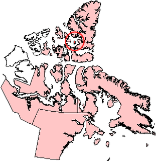
Graham Island is an uninhabited island in Qikiqtaaluk Region, Nunavut, Canada. A member of the Queen Elizabeth Islands and Canadian Arctic Archipelago, it is located in Norwegian Bay off the coast of Ellesmere Island. Located at 77°25'N 90°30'W it has an area of 1,378 km2 (532 sq mi), 55 kilometres (34 mi) long and 40 kilometres (25 mi) wide. It was named in 1910.
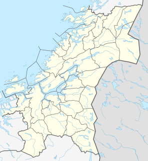
Rien is a lake in the municipality of Røros in Trøndelag county, Norway. The 14.87-square-kilometre (5.74 sq mi) lake is located near the headwaters of the river Glomma, only about 10 kilometres (6.2 mi) east of the border with Sweden. The water flows out through the river Glomma and heads a short distance south, into the large lake Aursunden. The village of Brekken lies about 6 kilometres (3.7 mi) south of the lake and the town of Røros lies about 40 kilometres (25 mi) to the southwest.
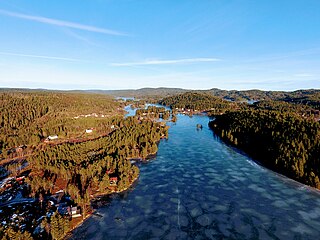
Vegår is a lake in the municipality of Vegårshei in Aust-Agder county, Norway. The 17.7-square-kilometre (6.8 sq mi) lake is located about 3 kilometres (1.9 mi) north of the municipal center of Myra and about 12 kilometres (7.5 mi) east of the village of Åmli in the neighboring municipality of Åmli.
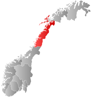
Nordvik is a former municipality in Nordland county, Norway. The 86-square-kilometre (33 sq mi) municipality existed from 1917 until its dissolution in 1962. The island municipality encompassed the central part of the island of Dønna as well as the smaller surrounding islands of Vandve, Slapøya, Havstein, and many others in what is now the southern part of Dønna Municipality. The municipality had 2 churches: Nordvik Church in the north and Hæstad Church in the south.
Storvatnet is a lake in the municipality of Indre Fosen in Trøndelag county, Norway. The 15.78 square kilometres (6.09 sq mi) lake is located about 10 kilometres (6.2 mi) east of the village of Årnset and about 5 kilometres (3.1 mi) north of the village of Vanvikan. It is the largest lake on the Fosen peninsula.
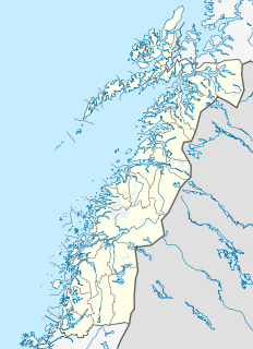
Solfjellsjøen or Solfjellsjyen is the administrative centre of the municipality of Dønna in Nordland county, Norway. The village is located on the west-central part of the island of Dønna. Nordvik Church is located about 2 kilometres (1.2 mi) north of the village. There is a ferry connection from Solfjellsjøen to the nearby island of Vandve to the west.

Bouvet Island is an uninhabited subantarctic high island and dependency of Norway located in the South Atlantic Ocean at 54°25′S3°22′E, thus locating it north of and outside the Antarctic Treaty System. It lies at the southern end of the Mid-Atlantic Ridge and is the most remote island in the world, approximately 1,700 kilometres (1,100 mi) north of the Princess Astrid Coast of Queen Maud Land, Antarctica, 1,160 kilometres (720 mi) east of the South Sandwich Islands and 2,600 kilometres (1,600 mi) south-southwest of the coast of South Africa.
Brusdalsvatnet is a large lake on the island of Oksenøya in Møre og Romsdal county, Norway. The lake sits on the border between Ålesund Municipality and Skodje Municipality. The lake is a reservoir that is the water supply for the nearby city of Ålesund. The 7.3-square-kilometre (2.8 sq mi) lake is about 9.5 by 1.3 kilometres.
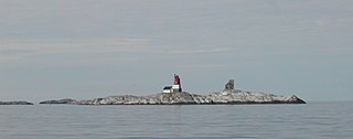
Åsvær Lighthouse is a coastal lighthouse in Dønna Municipality in Nordland county, Norway. It is located on the island of Åsvær, about 10 kilometres (6.2 mi) north of the village of Vandve, about 16 kilometres (9.9 mi) northwest of the island of Dønna, and about 11 kilometres (6.8 mi) south of the village of Lovund.

Løkta is an island in the municipality of Dønna in Nordland county, Norway. The 17.4-square-kilometre (6.7 sq mi) island is located between the islands of Dønna and Hugla, at the entrance to the Ranfjorden. The village of Sandåker is located on the southern part of the island, just west of the 238-metre (781 ft) tall Sandåkerfjellet. Løkta Church is located on the island. Historically, the western part of the island was a part of the old municipality of Dønnes and the eastern part belonged to the municipality of Nesna, but in 1962 all of the island became a part of Dønna Municipality. In 2017, there were 135 residents of the island.

Hestad is a village in the municipality of Dønna in Nordland county, Norway. The village is located on the southern part of the island of Dønna, about 6 kilometres (3.7 mi) northwest of the town of Sandnessjøen. Hæstad Church is located in the village. Norwegian County Road 828 runs through the village along the coast of the island.
Vandve Church is a chapel of the Church of Norway in Dønna Municipality in Nordland county, Norway. It is located in the island village of Vandve. It is an annex chapel in the Dønna parish which is part of the Nord-Helgeland prosti (deanery) in the Diocese of Sør-Hålogaland. The white, wooden chapel was built in a long church style in 1956 by the architect Arne Reppen. The chapel seats about 50 people. The church was originally named "Vandve chapel" until 1980 when it was renamed "Vandve church".
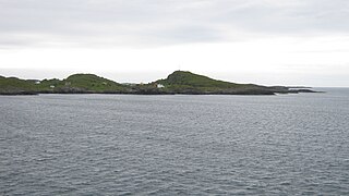
Helligvær is an island group in the Vestfjorden in Bodø Municipality in Nordland county, Norway. The islands are located about 25 kilometres (16 mi) northwest of the town of Bodø. The Bliksvær islands are about 12 kilometres (7.5 mi) to the south, Landegode island is 15 kilometres (9.3 mi) to the east, and the islands of Røstlandet and Værøya are about 60 kilometres (37 mi) to the west.
Skipsfjorden is an arm of the Stifjorden in Dønna Municipality in Nordland county, Norway. The 5.5-kilometre (3.4 mi) long fjord lies between the island of Dønna on the west and the island of Løkta in the east.
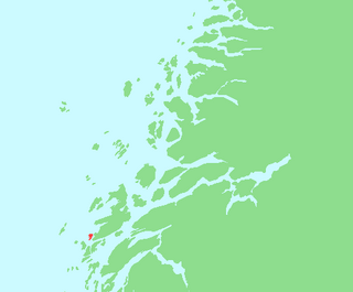
Staulen is an island in the municipality of Herøy in Nordland county, Norway. The 2.6-square-kilometre (1.0 sq mi) island just southwest of the large island of Dønna. The settlements on the island include the villages of Nordstaulen, Sørstaulen, and Sandvikja.

Dønna is the largest island in Dønna Municipality in Nordland county, Norway. The 138-square-kilometre (53 sq mi) island lies off the west coast of the mainland of Helgeland, Norway. The islands of Løkta and Tomma lie northeast of the island, the islands of Vandve and Åsvær lie to the west, and the islands of Herøy and Alsta lie to the south.