US Army Engineers laying Sommerfield tracking in the sand during a landing exercise at Camp Edwards, Massachusetts, United States, 1942.A jeep comes ashore onto Sommerfield tracking during a landing exercise at Camp Edwards, Massachusetts, United States, 1942.Rolls of Sommerfield tracking can be seen in the foreground during a landing exercise at Slapton Sands, Devon, England, April 1944.
Sommerfeld tracking, named after German expatriate engineer, Kurt Joachim Sommerfeld,[1][2] then living in Cambridge, England, was a lightweight wire mesh type of prefabricated airfield surface. First put into use by the British in 1941, it consisted of wire netting stiffened laterally by steel rods. This gave it load-carrying capacity while staying flexible enough to be rolled up.[3] Kurt Sommerfeld developed the track in the workshops of D.Mackay engineering based in East Road Cambridge. He worked on the design with Donald Mackay.
Nicknamed "tin lino",[2] Sommerfeld tracking consisted of rolls 3.25m (10ft 8in) wide by 23m (75ft 6in) long. Mild steel rods threaded through at 9 inch intervals gave it strength. The rolls could be joined at the edges by threading flat steel bar through loops in the ends of the rods.[3]
Sommerfeld tracking was used extensively by the Royal Air Force in the Second World War to make runways at their airfields, as it could be deployed quickly. In addition, some 44,500,000 yards of Sommerfeld tracking was supplied to US forces by Britain in Reverse Lend-Lease.[4]
Sommerfeld tracking was used widely on RAF and USAAF Advanced Landing Grounds, both in the UK and elsewhere.
Use
The ground was cleared and, if swampy, a layer of coir (also known as coco peat) or coconut matting laid down. The Sommerfeld tracking was unrolled over the ground, pulled tight by a tractor, bulldozer, or similar vehicle, then fastened to the ground with angle-iron pickets.[1] A typical runway made of Sommerfeld tracking was 3,000 feet (910m) by 156 feet (48m).
It would appear that this method did have some limitations and there are various reports of airfields being out of use during heavy rainfall due to mud, and the fact that the tracking would lift off the ground. There are also anecdotal reports of it causing damage to aircraft, such as wheels being torn off.[citation needed]
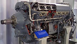
The Rolls-Royce Griffon is a British 37-litre capacity, 60-degree V-12, liquid-cooled aero engine designed and built by Rolls-Royce Limited. In keeping with company convention, the Griffon was named after a bird of prey, in this case the griffon vulture.
Hendon Aerodrome was an aerodrome in London, England, that was an important centre for aviation from 1908 to 1968.
Pago Pago International Airport, also known as Tafuna Airport, is a public airport located 7 miles (11.3 km) southwest of the central business district of Pago Pago, in the village and plains of Tafuna on the island of Tutuila in American Samoa, an unincorporated territory of the United States.
Marston Mat, more properly called pierced (or perforated) steel planking (PSP), is standardized, perforated steel matting material developed by the United States at the Waterways Experiment Station shortly before World War II, primarily for the rapid construction of temporary runways and landing strips (also misspelled as Marsden matting). The nickname came from Marston, North Carolina, adjacent to Camp Mackall airfield where the material was first used.
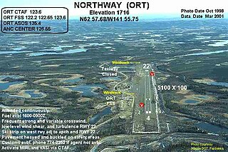
Northway Airport is a state-owned public-use airport serving Northway, a community located in the Southeast Fairbanks Census Area of the U.S. state of Alaska. It is included in the National Plan of Integrated Airport Systems for 2011–2015, which categorized it as a general aviation facility.
Tatenhill Airfield is a licensed airfield operated by Tatenhill Aviation Ltd. Its CAA Ordinary Licence allows flights for the public transport of passengers and for flying instruction as authorised by the licensee, Tatenhill Aviation. The three runways are paved, but one is no longer operational, and a second is used only occasionally. Running east–west, the main runway is the longest.
Royal Air Force Wendling or RAF Wendling is a former Royal Air Force station located 4 miles (6.4 km) north west of East Dereham, Norfolk, England.
Siskiyou County Airport is a public airport located three miles (4.8 km) northeast of Montague, serving Siskiyou County, California, United States. It has one runway and is mostly used for general aviation.
Venice Municipal Airport is a city managed public-use airport located two miles (3.2 km) south of the central business district of Venice, a city in Sarasota County, Florida, United States.
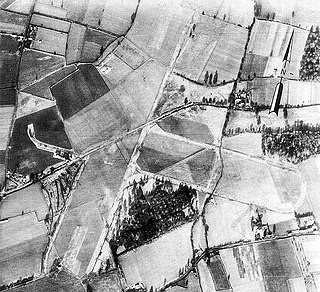
Advanced landing grounds (ALGs) were temporary advance airfields constructed by the Allies during World War II during the liberation of Europe. They were built in the UK prior to the invasion and thereafter in northwest Europe from 6 June 1944 to V-E Day, 7 May 1945.
Royal Air Force Winkton, or more simply RAF Winkton, is a former Royal Air Force Advanced Landing Ground previously in Hampshire but now, due to County boundary changes, in Dorset, England. The airfield is located approximately 3 miles (4.8 km) north of Christchurch; and is named after the nearby hamlet of Winkton.
Royal Air Force Balderton or more simply RAF Balderton was a former Royal Air Force station located 2.0 miles (3.2 km) south of Newark-on-Trent, sandwiched between the now extinct Great Northern Railway (GNR) Bottesford-Newark line and the A1 road in Nottinghamshire, England.
Decatur County Industrial Air Park is a county-owned public-use airport located six nautical miles (11 km) northwest of the central business district of Bainbridge, a city in Decatur County, Georgia, United States.
Beauregard Regional Airport is a public use airport in Beauregard Parish, Louisiana, United States. It is owned by Beauregard Parish and is located three nautical miles (6 km) southwest of the central business district of DeRidder, Louisiana. The airport serves the general aviation community, with no scheduled commercial airline service.
Royal Air Force Babdown Farm or more simply RAF Babdown Farm is a former Royal Air Force relief landing ground located 2.9 miles (4.7 km) west of Tetbury, Gloucestershire, and 7.1 miles (11.4 km) south of Stroud, Gloucestershire, England. It was open between 1940 and 1948 as a relief landing ground used by training units before being used by maintenance units for storage. Part of the site has since been converted into an industrial estate, while the rest is used for agriculture.
Miami Municipal Airport is two miles northwest of Miami, in Ottawa County, Oklahoma. The National Plan of Integrated Airport Systems for 2011–2015 called it a general aviation facility.
RAF Holme-on-Spalding Moor, or more simply RAF Holme is a former Royal Air Force station located in the East Riding of Yorkshire, England.
RAF Findo Gask was a Royal Air Force satellite station located 7 mi (11 km) west of Perth, Scotland used during the Second World War.
Naval Outlying Landing Field Barin is a United States Navy airfield located in Foley, a city in Baldwin County, Alabama, United States.
Royal Air Force Coolham, or more simply RAF Coolham, also known as Coolham Advanced Landing Ground (ALG), is a former Second World War Royal Air Force Advanced Landing Ground located in Coolham, West Sussex, England, United Kingdom.
This page is based on this Wikipedia article Text is available under the CC BY-SA 4.0 license; additional terms may apply. Images, videos and audio are available under their respective licenses.