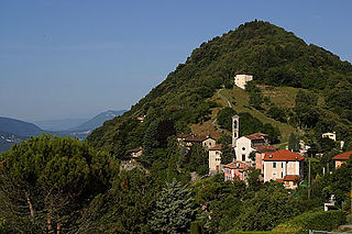
Soragno | |
---|---|
Village | |
Country | Switzerland |
Canton | Ticino |
District | Lugano |
City | Lugano |
Quarter | Davesco-Soragno |
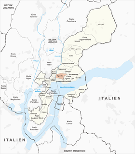
Soragno is a village in the district of Lugano in the canton of Ticino, Switzerland.
The canton of Ticino, formally the Republic and Canton of Ticino is the southernmost canton of Switzerland. Ticino borders the canton of Uri to the north, the canton of Valais to the west, the canton of Graubünden to the northeast, Italy's regions of Piedmont and Lombardy to the south and it surrounds the small Italian enclave of Campione d'Italia.
Switzerland, officially the Swiss Confederation, is a country situated in western, central and southern Europe. It consists of 26 cantons, and the city of Bern is the seat of the federal authorities. The sovereign state is a federal republic bordered by Italy to the south, France to the west, Germany to the north, and Austria and Liechtenstein to the east. Switzerland is a landlocked country geographically divided between the Alps, the Swiss Plateau and the Jura, spanning a total area of 41,285 km2 (15,940 sq mi). While the Alps occupy the greater part of the territory, the Swiss population of approximately 8.5 million people is concentrated mostly on the plateau, where the largest cities are to be found: among them are the two global cities and economic centres Zürich and Geneva.
It was first recorded in 1335 as Soragnio. [1]
The village, together with Davesco, constituted the former municipality Davesco-Soragno. In 2004, Davesco-Soragno municipality was incorporated into the larger, neighboring municipality Lugano and now forms a quarter of that city.
Davesco is a village in the district of Lugano in the canton of Ticino, Switzerland.
Davesco-Soragno is a quarter of the city of Lugano, Switzerland. Davesco-Soragno was formerly a municipality of its own, having been incorporated into Lugano in 2004.
Lugano is a city in southern Switzerland in the Italian-speaking canton of Ticino bordering Italy. It has a population of 63,494, and an urban agglomeration of over 145,000. The 9th largest Swiss city, it is the largest in Ticino and largest with an Italian speaking majority outside of Italy. The city lies on Lake Lugano, surrounded by the mountains of the Lugano Prealps. The eastern part of the city shares a border with Italy.
Gandria is both a quarter of the city of Lugano in the Swiss canton of Ticino, and a village on the northern shore of Lake Lugano, which forms the core of that quarter. Until 2004, the quarter of Gandria was an independent municipality, joining with Lugano in that year.
There are 115 municipalities in the canton of Ticino, Switzerland,. Municipalities (comuni) are grouped in circles (circoli) which are part of districts (distretti).
Cadro is quarter of the city of Lugano and a former municipality in the district of Lugano in the canton of Ticino in Switzerland. On 14 April 2013 the former municipalities of Bogno, Cadro, Carona, Certara, Cimadera, Valcolla and Sonvico merged into the city of Lugano.
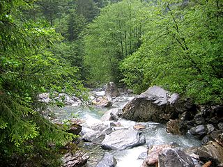
Engelberger Aa is a river in Switzerland. It rises west of Surenenpass in the Canton of Uri, flows through the valley of Engelberg (Obwalden) and Nidwalden. At Buochs, it empties into Lake Lucerne and is thus a tributary of the Reuss, which drains that lake.
Viganello is a quarter of the city of Lugano, Switzerland. Viganello was formerly a municipality of its own, having been incorporated into Lugano in 2004. It was first recorded in 1300 as de Viganello.
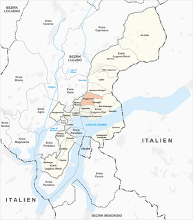
Pregassona is a quarter of the city of Lugano, Switzerland. Pregassona was formerly a municipality of its own, having been incorporated into Lugano in 2004.
Campestro is a village and former municipality in the district of Lugano in the canton of Ticino, Switzerland.
Roveredo is a village and former municipality in the canton of Ticino, Switzerland.
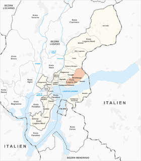
Brè-Aldesago is a quarter of the city of Lugano, in the Swiss canton of Ticino. It occupies the slopes and summit of Monte Brè, and contains the mountain villages of Brè, to the east of the summit, and Aldesago, to the west. It has an area of 420 hectares and, in 2011, it had a population of 1,055.
Brè is a village on the eastern slopes of the mountain of Monte Brè, in the Swiss canton of Ticino. Politically the village forms part of the Brè-Aldesago quarter of the city of Lugano, although until 1972 Brè-Aldesago was an independent municipality, known simply as Brè until 1953.
Castagnola is a village on the northern shore of Lake Lugano, below the mountain of Monte Brè, in the Swiss canton of Ticino. Politically the village forms part of the Castagnola-Cassarate quarter of the city of Lugano, although until 1972 Castagnola-Cassarate was an independent municipality under the name Castagnola.
Cassarate is a village on the northern shore of Lake Lugano, to the east of the outfall of the Cassarate River, in the Swiss canton of Ticino. Politically the village forms part of the Castagnola-Cassarate quarter of the city of Lugano, although until 1972 Castagnola-Cassarate was an independent municipality under the name Castagnola.
Breganzona is a quarter of the city of Lugano, Switzerland. Breganzona was formerly a municipality of its own, having been incorporated into Lugano in 2004. It was first recorded in 984 as Brianzona. The municipality had 232 inhabitants in 1850, which increased to 369 in 1900, 883 in 1950, 4,654 in 1990 and 4,782 in 2000.
Cureggia is a quarter of the city of Lugano, Switzerland. Cureggia was formerly a municipality of its own, having been incorporated into Lugano in 2004. It was first recorded in 1329 as Curezia.
Aldesago is a village on the western slopes of the mountain of Monte Brè, in the Swiss canton of Ticino. Politically the village forms part of the Brè-Aldesago quarter of the city of Lugano, although until 1972 Brè-Aldesago was an independent municipality.
Castagnola-Cassarate is a quarter of the city of Lugano, in the Swiss canton of Ticino. Until 1972, it was an independent municipality under the name Castagnola.
Ambrogio Preda was an Italian painter, mainly of landscapes of the alpine mountains and valleys.
Coordinates: 46°1′53″N8°58′44″E / 46.03139°N 8.97889°E
A geographic coordinate system is a coordinate system that enables every location on Earth to be specified by a set of numbers, letters or symbols. The coordinates are often chosen such that one of the numbers represents a vertical position and two or three of the numbers represent a horizontal position; alternatively, a geographic position may be expressed in a combined three-dimensional Cartesian vector. A common choice of coordinates is latitude, longitude and elevation. To specify a location on a plane requires a map projection.
This Ticino location article is a stub. You can help Wikipedia by expanding it. |