Related Research Articles

Rio Grande do Sul is a state in the southern region of Brazil. It is the fifth-most-populous state and the ninth largest by area. Located in the southernmost part of the country, Rio Grande do Sul is bordered clockwise by Santa Catarina to the north and northeast, the Atlantic Ocean to the east, the Uruguayan departments of Rocha, Treinta y Tres, Cerro Largo, Rivera and Artigas to the south and southwest, and the Argentine provinces of Corrientes and Misiones to the west and northwest. The capital and largest city is Porto Alegre. The state has the highest life expectancy in Brazil, and the crime rate is relatively low compared to the Brazilian national average. Despite the high standard of living, unemployment is still high in the state, as of 2017. The state has 5.4% of the Brazilian population and it is responsible for 6.6% of the Brazilian GDP.
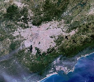
Greater São Paulo is a nonspecific term for one of the multiple definitions of the large metropolitan area located in the São Paulo state in Brazil.
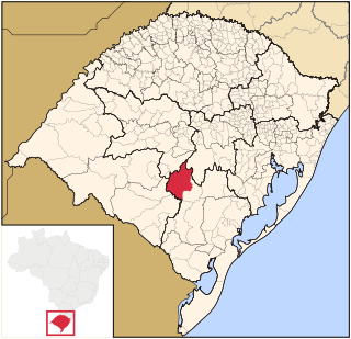
Caçapava do Sul is a Brazilian municipality in the state of Rio Grande do Sul, located on the banks of the Camaquã River. As of 2020, the city has an estimated population of 33,548. It was the 2nd capital of the Piratini Republic from 1839 to 1840.

The Centro Ocidental Rio-Grandense is one of the seven mesoregions of the state of Rio Grande do Sul in Brazil. It consists of 31 municipalities, grouped in three microregions:
Camargo is a municipality in the state of Rio Grande do Sul, Brazil.
Condor is a municipality in the state of Rio Grande do Sul, Brazil. As of 2020, the estimated population was 6,759.
Cristal do Sul is a municipality in the state of Rio Grande do Sul, Brazil. As of 2020, the estimated population is 2,844.
Ibiraiaras is a municipality in the state of Rio Grande do Sul, Brazil. As of 2020, the estimated population was 7,265.

Ibirubá is a municipality in the state of Rio Grande do Sul, Brazil. As of 2020, the estimated population was 20,413.
Miraguaí is a municipality in the state of Rio Grande do Sul, Brazil. As of 2020, the estimated population was 4,911.

Planalto is a municipality in the state of Rio Grande do Sul, Brazil, located at 27°19′44″S53°03′31″W, at an elevation of 568 meters above sea level. It has a total area of 237.35 km². Its estimated population in 2020 was 10,019 inhabitants.
Salto do Jacuí is a municipality in the state of Rio Grande do Sul, Brazil. As of 2020, the estimated population was 12,481.
Santa Bárbara do Sul is a municipality in the state of Rio Grande do Sul, Brazil. As of 2020, the estimated population was 7,909.
Seberi is a municipality in the state of Rio Grande do Sul, Brazil. As of 2020, the estimated population was 10,713.
Taquaruçu do Sul is a municipality in the state of Rio Grande do Sul, Brazil. As of 2020, the estimated population was 3,077.
The Cacequi River is a river of Rio Grande do Sul state in southern Brazil.
The Rio da Várzea is a river of Rio Grande do Sul state in southern Brazil. It is a tributary of the Uruguay River.
The Jacuizinho River is a river of Rio Grande do Sul state in southern Brazil.

The Vacacaí-Mirim River is a river of Rio Grande do Sul state in southern Brazil.
References
Coordinates: 29°38′09″S53°21′46″W / 29.63583°S 53.36278°W