The Gulf of Saint Lawrence is the outlet of the North American Great Lakes via the Saint Lawrence River into the Atlantic Ocean. The gulf is a semi-enclosed sea, covering an area of about 226,000 square kilometres (87,000 sq mi) and containing about 34,500 cubic kilometres (8,300 cu mi) of water, which results in an average depth of 152 metres (499 ft).

The Arctic Archipelago, also known as the Canadian Arctic Archipelago, groups together all islands lying to the north of the Canadian continental mainland excluding Greenland.

The Mid-Atlantic Ridge (MAR) is a mid-ocean ridge, a divergent or constructive plate boundary located along the floor of the Atlantic Ocean, and part of the longest mountain range in the world. In the North Atlantic, it separates the North American from the Eurasian Plate and the African Plate, north and south of the Azores Triple Junction respectively. In the South Atlantic, it separates the African and South American plates. The ridge extends from a junction with the Gakkel Ridge northeast of Greenland southward to the Bouvet Triple Junction in the South Atlantic. Although the Mid-Atlantic Ridge is mostly an underwater feature, portions of it have enough elevation to extend above sea level, for example in Iceland. The ridge has an average spreading rate of about 2.5 centimetres (1 in) per year.

Whalsay is the sixth largest of the Shetland Islands in the north of Scotland.

The Northwestern Hawaiian Islands or Leeward Islands are the small islands and atolls in the Hawaiian island chain located northwest of the islands of Kauai and Niihau. Politically, they are all part of Honolulu County in the U.S. state of Hawaii, except Midway Atoll, which is a territory distinct from Hawaii and grouped as one of the United States Minor Outlying Islands. The United States Census Bureau defines this area, except Midway, as Census Tract 114.98 of Honolulu County. Its total land area is 3.1075 square miles (8.048 km2). All the islands except Nihoa are north of the Tropic of Cancer, making them the only islands in Hawaii that lie outside the tropics.

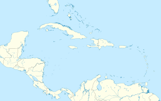
Grenadines is an administrative parish of Saint Vincent and the Grenadines, comprising the islands of the Grenadines other than those belonging to Grenada. The capital is Port Elizabeth.

Pedro Bank is a large bank of sand and coral, partially covered with seagrass, about 80 km south and southwest of Jamaica, rising steeply from a seabed of 800 metres depth. It slopes gently from Pedro Cays to the west and north with depths from 13 to 30 metres. The total area of the bank within the 100-metre (328-foot) isobath measures 8,040 square kilometres. The area of a depth to 40 metres is triangular, 70 kilometres long east-west, and 43 kilometres wide. 2,400 square kilometres are less than 20 metres deep. With its islets, cays and rocks, a total land area of 270,000 m2 (2,906,256 sq ft), it is the location of one of the two offshore island groups of Jamaica, the other one being the Morant Cays. The bank is centered at 17°06′N78°20′W.

Morant Cays is an offshore island group 51 km SSE off Morant Point, Jamaica. They are one of two offshore island groups belonging to Jamaica, the other ones being the Pedro Cays. They are located at 17°24′N75°59′W and consist of four small islets grouped closely together along the southeastern rim of Morant Bank a comparatively extensive crescent-shaped bank of coral, over 7 km long, rising from 1000 m. The area of Morant Bank is about 100 km². The aggregate land area of the four cays is only 16.0 hectares or 39.5 acres. Morant Cays are low-lying, mostly uninhabited, seasonally visited by fishermen, and fronted by highly exposed reefs over which the sea constantly breaks.

The Cul De Sac River is a river in Saint Lucia. It flows north and then west from the central highlands in the south of the island, reaching the Caribbean Sea to the south of the capital, Castries. It is one of the longest rivers in Saint Lucia.

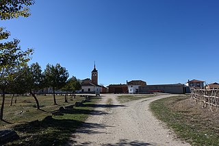
Marazuela is a municipality located in the province of Segovia, Castile and León, Spain. According to the 2004 census (INE), the municipality has a population of 61 inhabitants.

The Webhannet River is an 8.3-mile-long (13.4 km) river whose 8,963-acre (36.27 km2) watershed is contained entirely within the town of Wells, Maine.

Dinsmoor Glacier is a glacier flowing from the south edge of Detroit Plateau on Nordenskjöld Coast, Graham Land in Antarctica. It drains eastwards between Darzalas Peak and Mount Elliott to enter Mundraga Bay. Mapped from surveys by Falkland Islands Dependencies Survey (FIDS) (1960–61). Named by United Kingdom Antarctic Place-Names Committee (UK-APC) for Charles Dinsmoor of Warren, PA, who invented the endless tracking "vehicle" in 1886, a forerunner of the modern continuous track and tracked vehicles. It was first manufactured commercially by Holt Manufacturing Company of Stockton, California in 1906.
Jenny Buttress is a rock buttress 2.5 nautical miles (5 km) north of Melville Peak, overlooking Destruction Bay on the east side of King George Island, in the South Shetland Islands. It was named by the UK Antarctic Place-Names Committee in 1960 for the sailing vessel Jenny from the Isle of Wight which was found drifting in Drake Passage by the whaler Hope in September 1840. All her crew were dead and the log was entered up to January 17, 1823.
Mural Nunatak is a conspicuous nunatak on the east side of Hektoria Glacier, 5 nautical miles (9 km) northwest of Shiver Point, in Graham Land. Surveyed by Falkland Islands Dependencies Survey (FIDS) in 1947 and 1955. The name, given by United Kingdom Antarctic Place-Names Committee (UK-APC), is descriptive of the nunatak's wall-like appearance when seen from the southwest.
Esther Harbour is a small harbour at the west side of Venus Bay, lying immediately west of Pyrites Island and south of Gam Point, on the north coast of King George Island in the South Shetland Islands. The harbour was known to both American and British sealers as early as 1821. The sealing vessel Esther of Boston worked in this area in the 1820–21 season.

Skilly Peak is a conspicuous rock peak 4.3 miles (6.9 km) northeast of Shiver Point and 3.5 miles (5.6 km) northeast of Eduard Nunatak on the east coast of Graham Land, Antarctica. It surmounts Rogosh Glacier to the north and Artanes Bay to the southeast.
Spallanzani Point is a point forming the north side of the entrance to Hill Bay and the east tip of Albena Peninsula and Brabant Island, in the Palmer Archipelago. Probably first seen by the Belgian Antarctic Expedition, 1897–99, under Gerlache. Mapped in 1959 from photos taken by Hunting Aerosurveys Ltd. in 1956–57. Named by the United Kingdom Antarctic Place-Names Committee (UK-APC) for Lazzaro Spallanzani (1729–1799), Italian physiologist who first interpreted the process of digestion in 1780.


