South-East, Russian SFSR

Last updated

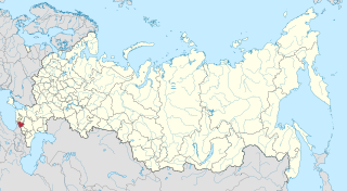
The South-East (Russian : Ю́го-Восто́к), also referred to as South-Eastern Krai (Ю́го-Восто́чный край) and South-Eastern Oblast (Ю́го-Восто́чная о́бласть) was a territory, and later an administrative division, of the Russian Soviet Federative Socialist Republic (RSFSR) which existed in 1920-1924.

Russian language East Slavic language

Russian is an East Slavic language, which is official in the Russian Federation, Belarus, Kazakhstan and Kyrgyzstan, as well as being widely used throughout Eastern Europe, the Baltic states, the Caucasus and Central Asia. It was the de facto language of the Soviet Union until its dissolution on 25 December 1991. Although, nowadays, over two decades after the breakup of the Soviet Union, Russian is used in official capacity or in public life in all the post-Soviet nation-states, as well as in Israel and Mongolia, the rise of state-specific varieties of this language tends to be strongly denied in Russia, in line with the Russian World ideology.

A krai or kray was a type of geographical administrative division in the Russian Empire and in the Russian SFSR, and it is one of the types of the federal subjects of modern Russia.

An oblast is a type of administrative division of Belarus, Bulgaria, Kazakhstan, Kyrgyzstan, Russia, Ukraine, and the former Soviet Union and Kingdom of Yugoslavia.

Contents

The 1924 map showing the entity as "South-Eastern Oblast" Iugo-Vostochnaia oblast' RSFSR (1924).png
The 1924 map showing the entity as "South-Eastern Oblast"

Originally, the name "South-East" was used informally to refer to the territories of Don, Kuban-Black Sea, and Terek Oblasts, as well as those of Stavropol Governorate and Dagestan ASSR, which were governed by the Revolutionary Soviet of the Laborers' Army of South-East Russia (hence the name "South-East") established on August 7, 1920. While the Soviet itself was abolished in 1921, the name "South-East" stuck. Occasionally, the territory was also referred to as "South-Eastern Krai" and "South-Eastern Oblast", even though no official krai/oblast status was assigned to it at the time.

Kuban Black Sea Oblast was an administrative division of the Russian Soviet Federative Socialist Republic which existed in 1920–1924.

Terek Oblast

The Terek Oblast was an oblast (province) of the Caucasus Viceroyalty of the Russian Empire. It roughly corresponded to most of present-day northeastern Caucasus. It was created out of the former territories of the Caucasian Peoples.

Stavropol Governorate governorate of Russian Empire between 1847-1924

The Stavropol Governorate was a governorate (province) of the Russian Empire. It roughly corresponded to most of present-day Stavropol Krai. It was created in 1847 out of the territories of Caucasian peoples and disbanded in Russian SFSR in 1924.

The system of the administrative and territorial division of the RSFSR was developing haphazardly in the beginning of the 1920s: it was inconsistent, expensive to maintain, and not very effective in practice. As a reaction to that, the 12th Congress of the Russian Communist Party (Bolsheviks) on April 23, 1924 decided to test a new system of the administrative division in two experimental areas: one industrially developed and one agricultural. The South-East became a testing ground for the new system in the agricultural area. On February 13, 1924, the All-Russian Central Executive Committee (VTsIK) officially defined the South-East as the area comprising the territories of Don and Kuban Oblasts, Terek and Stavropol Governorates, the city of Grozny, and Kabardino-Balkar, Karachay-Cherkess, Adyghe-Cherkess, and Chechen Autonomous Oblasts [1] and mandated its division into districts ( raions ) by the end of 1924. On June 2, 1924, the Presidium of the VTsIK established a list of the new okrugs and districts into which the "South-Eastern Krai (Oblast)" was to be divided. At the same time, Kuban-Black Sea Oblast was abolished and replaced with four new okrugs, which were further divided into districts by the Executive Committee of Kuban-Black Sea Oblast on July 19, 1924.

12th Congress of the Russian Communist Party (Bolsheviks)

The 12th Congress of the Russian Communist Party (Bolsheviks) was held during 17–25 April 1923 in Moscow. The congress elected the 12th Central Committee. It was attended by 408 delegates with deciding votes and 417 with consultative votes, representing 386,000 party members. This was the last congress of the Russian Communist Party (Bolsheviks) (RCP during Vladimir Lenin's leadership, though Lenin was unable to attend due to illness. Much of this Congress was taken up with Joseph Stalin's struggle against the Georgian Bolshevists. Stalin dominated the Congress with Grigoriy Ordzhonikidze and Mamia Orakhelashvili, moving against the Old Bolsheviks Budu Mdivani and Filipp Makharadze. Stalin accused the latter of the following:

All-Russian Central Executive Committee

The All-Russian Central Executive Committee, was the highest legislative, administrative, and revising body of the Russian Soviet Federative Socialist Republic from 1917 until 1937. Although the All-Russian Congress of Soviets had supreme authority, in periods between its sessions its powers were passed to VTsIK.

Grozny City in Chechnya, Russia

Grozny is the capital city of Chechnya, Russia. The city lies on the Sunzha River. According to the 2010 Census, it had a population of 271,573; up from 210,720 recorded in the 2002 Census, but still only about two-thirds of 399,688 recorded in the 1989 Census. It was previously known as Groznaya.

South-Eastern Krai was renamed North Caucasus Krai by the Resolution of the Presidium of the VTsIK of October 16, 1924 and by the Resolution of the Krai Executive Committee of November 16, 1924.

North Caucasus Krai

North Caucasus Krai was an administrative division (krai) within the Russian Soviet Federative Socialist Republic of the Soviet Union. It was established on 17 October 1924. Its administrative center was Rostov-on-Don until 10 January 1934, Pyatigorsk until January 1936, then Ordzhonikidze and, from 15 December 1936, Voroshilovsk.

Related Research Articles

Polyarny, Murmansk Oblast Town in Murmansk Oblast, Russia

Polyarny is a town and the administrative center of the closed administrative-territorial formation of Alexandrovsk in Murmansk Oblast, Russia, situated on the outermost western side of the Kola Bay. Population: 17,293 (2010 Census); 18,552 (2002 Census); 27,635 (1989 Census).

Karachay-Cherkessia First-level administrative division of Russia

The Karachay-Cherkess Republic or Karachay-Cherkessia is a federal subject of Russia. It is geographically located in the North Caucasus region of Southern Russia and is administratively part of the North Caucasian Federal District. Karachay-Cherkessia has a population of 477,859.

Stavropol Krai First-level administrative division of Russia

Stavropol Krai is a federal subject of Russia. It is geographically located in the North Caucasus region in Southern Russia, and is administratively part of the North Caucasian Federal District. Stavropol Krai has a population of 2,786,281 (2010).

Mountain Autonomous Soviet Socialist Republic autonomous soviet socialist republic of a union republic of the Soviet Union

The Mountain Autonomous Soviet Socialist Republic or Mountain ASSR was a short-lived autonomous republic within the Russian SFSR in the Northern Caucasus that existed from January 20, 1921, to July 7, 1924. The Mountainous Republic of the Northern Caucasus was created from parts of the Kuban and Terek Oblasts by the indigenous nationalities after the Russian Revolution; however, Soviet rule was installed on this territory after the Red Army conquered the Northern Caucasus in the course of the Russian Civil War, and the former republic was transformed into a Soviet one. The area of the republic was over 73,000 square kilometres (28,000 sq mi), and the population was about 800,000. It comprised six okrugs: Balkar, Chechen, Kabardian, Karachay, Nazran (Ingushetia), and Vladikavkaz Okrug (Ossetia) and had two cities: Grozny and Vladikavkaz. In addition, a special autonomy was provided to the Terek Cossacks: Sunzha Cossack Okrug, which included a large enclave in northern Ingushetia, and a smaller one bordering Grozny. Its boundaries approximated those of classical Zyx.

Autonomous oblasts of the Union of Soviet Socialist Republics were administrative units created for a number of smaller nations, which were given autonomy within the fifteen republics of the USSR.

Monchegorsk Town in Murmansk Oblast, Russia

Monchegorsk is a town in Murmansk Oblast, Russia, located on the Kola Peninsula, 145 kilometers (90 mi) south of Murmansk, the administrative center of the oblast. Population: 45,361 (2010 Census); 52,242 ; 68,652.

Murmansk Oblast is a federal subject of Russia, which is located in the northwestern part of the country, occupying mostly the Kola Peninsula. The oblast itself was established on May 28, 1938, but some kind of administrative organization of the territory existed here since at least the 13th century. As of the 2002 Census, Russians account for the majority of the oblast's population, with the indigenous Sami constituting only a 0.20% minority (1,769 people).

Lovozersky District District in Murmansk Oblast, Russia

Lovozersky District is an administrative district (raion), one of the six in Murmansk Oblast, Russia. Municipally, it is incorporated as Lovozersky Municipal District. It occupies most of the central and northeastern parts of the Kola Peninsula. The area of the district is 53,800 square kilometers (20,800 sq mi). Its administrative center is the rural locality of Lovozero. District's population: 11,820 (2010 Census); 14,311 (2002 Census); 18,263 (1989 Census). The population of Lovozero accounts for 24.3% of the district's total population.

Kolsky District District in Murmansk Oblast, Russia

Kolsky District is an administrative district (raion), one of the six in Murmansk Oblast, Russia. As a municipal division, it is incorporated as Kolsky Municipal District. It is located in the northwest of the oblast, partially lies on the Kola Peninsula, and borders with the Barents Sea in the north and Finland in the west. The area of the district is 27,600 square kilometers (10,700 sq mi). Its administrative center is the town of Kola. Population: 44,670 (2010 Census); 51,125 (2002 Census); 73,555 (1989 Census). The population of Kola accounts for 23.4% of the district's total population.

Tersky District, Murmansk Oblast District in Murmansk Oblast, Russia

Tersky District is an administrative district (raion), one of the six in Murmansk Oblast, Russia. Municipally, it is incorporated as Tersky Municipal District. It is located in the south of the Kola Peninsula and borders the White Sea in the south. The area of the district is 19,300 square kilometers (7,500 sq mi). Its administrative center is the urban locality of Umba. District's population: 6,288 (2010 Census); 7,434 (2002 Census); 9,752 (1989 Census). The population of Umba accounts for 88.0% of the district's total population.

Murmansk Governorate was an administrative division of the early Russian SFSR which existed in 1921–1927. The governorate was established on the territory of former Alexandrovsky Uyezd of Arkhangelsk Governorate by the All-Russian Central Executive Committee (VTsIK) Decree issued on June 13, 1921. The administrative center was in Murmansk.

Murmansk Okrug was an administrative division of the Russian SFSR, Soviet Union, which existed in 1927–1938.

Monchegorsky District was an administrative division of Murmansk Okrug of Leningrad Oblast, and later of Murmansk Oblast of the Russian SFSR, Soviet Union, which existed in 1938–1949.

Polyarny District was an administrative division of Murmansk Okrug of Leningrad Oblast of the Russian SFSR, Soviet Union, and later of Murmansk Oblast, which existed in 1927–1960.

Teribersky District, also known as Severomorsky District was an administrative division of Murmansk Okrug of Leningrad Oblast of the Russian SFSR, Soviet Union, and later of Murmansk Oblast, which existed in 1927–1963.

Saamsky District was an administrative division of Murmansk Okrug of Leningrad Oblast, and later of Murmansk Oblast, of the Russian SFSR, Soviet Union, which existed in 1927–1963.

Kandalakshsky District District in Murmansk Oblast, Russia

Kandalakshsky District is an administrative district, one of the six in Murmansk Oblast, Russia. As a municipal division, it is incorporated as Kandalakshsky Municipal District. It is located in the southwest of the oblast, and borders with Kovdorsky District to the north, Loukhsky District of the Republic of Karelia, and with Finland to the west. The area of the district is 14,400 square kilometers (5,600 sq mi). Its administrative center is the town of Kandalaksha. Population: 49,544 (2010 Census); 60,140 (2002 Census); 78,239 (1989 Census). The population of Kandalaksha accounts for 72.0% of the district's total population.

Khabarovsk Oblast

Khabarovsk Oblast was an administrative division of the Russian Soviet Federative Socialist Republic which existed between 1934 and 1939. Its seat was in the city of Khabarovsk. The oblast was located in the eastern part of the Russian Far East, and its territory is currently divided between Khabarovsk and Primorsky Krais. The oblast was created as part of the Far Eastern Krai and briefly became part of the newly created Khabarovsk Krai when the former was abolished in 1938, before being merged into the latter.

References

Notes

  1. The names of some of these administrative units, as used in the definition of the South-East, are inconsistent with their official names. The area of the South-East itself was inconsistently referred to as either "South-East", or "South-Eastern Oblast", or "South-Eastern Krai".

Sources