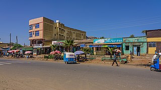
Based on figures from the Central Statistical Agency in 2005, Soyama has an estimated total population of 8,052 of whom 4,134 were males and 3,918 were females.[2] The 1994 national census reported this town had a total population of 4,445 of whom 2,289 were males and 2,156 were females.
Adami Tullu a town located about 168 kilometers south of Addis Ababa in the East Shewa Zone of the Oromia Region, Ethiopia., Adami Tullu has a latitude and longitude of 7°52′N38°42′E with an elevation of 1636 meters above sea level. It is one of five towns in Adami Tullu and Jido Kombolcha woreda.
Bentu Liben is a town in central Oromia Region, Ethiopia. Located in the Southwest Shewa Zone about 40 kilometers south-west of Addis Ababa, this town has a latitude and longitude of 8°37′N38°22′E with an elevation of 2234 meters above sea level.
Debarq also spelled Dabareq and Debark, is a town in northern Ethiopia, 90 kilometers north-east of Gondar on the highway between Gondar and Axum, and is in the Semien Gondar Zone of the Amhara Region. It has a latitude and longitude of 13°08′N37°54′E and an elevation of 2850 meters above sea level.
Addis Zemen is a town in northern-central Ethiopia. Located in the Debub Gondar Zone of the Amhara Region, on the road connecting Gondar and Bahir Dar, Addis Zemen has a latitude and longitude of 12°07′N37°47′E and an elevation of 1975 meters above sea level. It is the administrative center of Kemekem woreda.
Enfraz or Infraz, also called Guba'e, or Guzara is a historic town and district in northern Ethiopia. Located in the mountainous area overlooking the northeast shore of Lake Tana in the North Gondar Zone of the Amhara Region, it sits at a latitude and longitude of 12°15′30″N37°37′45″E.
Woreta is a town in northern Ethiopia. Located in the Debub Gondar Zone of the Amhara Region, east of Lake Tana and south of Addis Zemen, this town has a latitude and longitude of 11°55′N37°42′E with an elevation of 1828 meters above sea level. It is the administrative center of Fogera woreda.
Robe, also called as Bale Robe, is a town in south-central Oromia Region, Ethiopia. Located in the Bale Zone, this town has a latitude and longitude of 7°7′N40°0′E with an elevation of 2,492 metres (8,176 ft) above sea level.
Boditi is city in southern Ethiopia. Located in the Wolaita Zone of the Southern Nations, Nationalities, and Peoples Region, this town has a latitude and longitude of 6°58′N37°52′E with an average elevation of 2050 meters above sea level. It is the administrative center of Damot Gale woreda. The town is bounded by Shasha-Gale Kebele in the north, Ade-Koisha Kebele in the south, Chawkare Kebele in the east and Sibaye-Korke kebele in the west. It is located in East Rift valley at a distance of 370 km (230 mi) to the south of Addis Ababa and at about 140 km (87 mi) to the west of Hawassa.
Gerba Guracha is a town in central Ethiopia. Located in the North Shewa Zone of Oromia Region, Ethiopia, it is an inland port city in Selale. It has a latitude and longitude of 9°48′N38°24′E and an elevation between 2,515 and 2,547 meters above sea level. It is the administrative center of Kuyu woreda.
Guduru is a town in south-western Ethiopia. Located in the Horo Gudru Welega Zone of the Oromia Region, this town has a latitude and longitude of 09°32′N37°30′E and an elevation of 1969 meters above sea level. It is the administrative center of Guduru woreda.
Limmu Inariya is a town in southern Ethiopia. Located in the Jimma Zone of the Oromia Region. The town of Limmu Inariya is founded in 1952. One of the five wives of King Abba Jifar was from Limu, the wife's name was Limuti.
Badessa is a town and separate Aanaa in eastern Ethiopia. Located in the West Hararghe Zone of the Oromia Region, at the base of a spur of the Chercher Mountains 40 km south of the Addis Ababa - Djibouti Railway and 65 km east of Awash, this town has a latitude and longitude of 8°54′N40°47′E with an elevation of 1761 m above sea level.
Fofa is a town in southern Ethiopia, and is the administrative center of the Yem special woreda. Located in the Southern Nations, Nationalities, and Peoples Region, this town has a latitude and longitude of 07°51′N37°31′E with an elevation of 2506 meters above sea level.
Sagan is a town in southern Ethiopia. Located in the Southern Nations, Nationalities, and Peoples Region, this town has a latitude and longitude of 05°35′N37°46′E with an elevation of 1066 meters above sea level. It is named after the nearby Sagan River, a tributary of the Weito.
Durame is a town in southeastern Ethiopia. The administrative center of the Kembata Tembaro Zone of the Southern Nations, Nationalities and Peoples Region (SNNPR), this town has a latitude and longitude of 7°14′N37°53′E with an elevation of 2101 meters above sea level. It is surrounded by Damboya woreda. Materials on the Nordic Africa Institute website, describe Durame as the main town for the Kambaata-speaking people..
Seka Chekorsa is a town in southern Ethiopia. Located in the Jimma Zone of the Oromia Region, this town has a latitude and longitude of 07°35′N36°33′E. It is the administrative center of Seka Chekorsa woreda.
Gobessa is a town in southeastern Ethiopia. Located in the Arsi Zone of the Oromia Region, this town has a latitude and longitude of 07°37′N39°30′E with an elevation of 2353 meters above sea level. It is the administrative center of Shirka woreda.
Kula is a town in southeastern Ethiopia. Located in the Arsi Zone of the Oromia Region, it has a latitude and longitude of 07°58′N39°42′E with an elevation of 2842 meters above sea level. The town is the administrative center of Sude woreda; according to materials on the Nordic Africa Institute website, it had been the administrative center at least as early as the 1980s.
Ogolcho is a town in southeastern Ethiopia. Located in the Arsi Zone of the Oromia Region, it has a latitude and longitude of 08°03′N39°00′E with an elevation of 1687 meters above sea level. It is the administrative center of Ziway Dugda woreda.
Bulki is a town in south-western Ethiopia. It sits on a narrow ridge, high above the town of Sawla, in the Gamo Gofa Zone of the Southern Nations, Nationalities, and People's Region. It is the administrative center of Geze Gofa woreda.
This page is based on this Wikipedia article Text is available under the CC BY-SA 4.0 license; additional terms may apply. Images, videos and audio are available under their respective licenses.