
Charlotte Amalie, located on St. Thomas, is the capital and the largest town of the United States Virgin Islands. It is the anchor of the subdistrict of Charlotte Amalie that is composed of the town of Charlotte Amalie, the census-designated place (CDP) of Charlotte Amalie West, and the CDP of Charlotte Amalie East. It was founded in 1666 as Taphus. In 1691, the town was renamed to Charlotte Amalie after the Danish queen Charlotte Amalie of Hesse-Kassel (1650–1714). It has a deep-water harbor that was once a haven for pirates and is now one of the busiest ports of call for cruise ships in the Caribbean, with about 1.5 million-plus cruise ship passengers landing there annually. Protected by Hassel Island, the harbor has docking and fueling facilities, machine shops, and shipyards and was a U.S. submarine base until 1966. The town has been inhabited for centuries. When Christopher Columbus arrived in 1493, the area was inhabited by Caribs, Arawaks, Ciboney and Taíno native peoples. It is on the southern shore at the head of Saint Thomas Harbor. In 2020 the subdistrict of Charlotte Amalie had a population of 14,477 which makes it the most densely populated area in the Virgin Islands Archipelago with the town of Charlotte Amalie as the anchor of "the City". Hundreds of ferries and yachts pass by the town each week.

Coates is a town in the U.S. state of Minnesota located west of the Upper Mississippi River on the exurban fringe in central Dakota County.
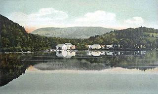
West Sparta is a town in Livingston County, New York, United States. The population was 1,255 at the 2010 census. The name is derived from the neighboring town of Sparta.

Kingston is a census-designated place (CDP) in the town of Kingston in Plymouth County, Massachusetts, United States. The population was 5,591 at the 2010 census.

Cruz Bay, U.S. Virgin Islands is the main town on the island of Saint John in the United States Virgin Islands. According to the 2000 census, Cruz Bay had a population of 2,743.

Bird Island is a tiny island in Buzzards Bay at the mouth of Sippican Harbor, less than a mile off the mainland coast of the town of Marion, Massachusetts, United States.
Waterford Flat is a historic village in the town of Waterford in Oxford County, Maine, United States. The village has been called by other names in its history, including Sweats Island, Sweet Island, Swetts Island, and Waterford. It is located north of Keoka Lake.

Italia is an unincorporated community in Nassau County, Florida, United States, located near the center of the county. It is a Florida Heritage Site.

Alton is a small village of about 250 residents within the town of Richmond, Rhode Island. It is located about one hour south of Providence, the state's capital. The village is primarily residential, with no retail stores. Alton is located at a crossing of the Wood River and is 5 miles from the Pawcatuck River.

Fort Recovery is a fort on the West End of Tortola in the British Virgin Islands. In historical records, the fort is often referred to as Tower Fort, and the area around the fort is still referred to as "Towers" today. A hotel is now built around the Tower.

The Whelk Point Fort was a colonial fort erected on the southeast part of Tortola in the British Virgin Islands. The fort fell into disrepair and ruin, and relatively little of the original structure remains. In 1992 a house was built over the original foundations of the fort, but the remains of the barracks can still be seen on the land behind the house. The ruins are on private property and are not generally accessible to the public.

U.S. Virgin Islands Highway 66 is a major east–west arterial on St. Croix in the United States Virgin Islands and is named the Melvin H. Evans Highway in honor of the territory's first elected governor. It is one of the few divided highways in a territory with the distinction of being the only US jurisdiction to drive on the left. It is also the fastest road on the island—and in the territory—with a 55 mph speed limit for passenger vehicles and a 40 mph (64 km/h) limit for heavy trucks and buses. All junctions are at-grade, there are stoplights with connecting roads, and driveway access is limited by default in the territory but the highway is not explicitly classified as an expressway. It is an important intermediate link between locations on the southern coast, including an oil refinery of the Hess Corporation and the Henry E. Rohlsen International Airport, and the island's principal towns Christiansted and Frederiksted. The highway travels through areas of mostly lighter development and has multiple spurs and other intersections connecting to parallel roads and smaller communities. St. Croix has no single encircling route so the highway is one of the most heavily used.

The Dutch Virgin Islands is the collective name for the enclaves that the Dutch West India Company had in the Virgin Islands. The area was ruled by a director, whose seat was not permanent. The main reason for starting a colony here was that it lay strategically between the Dutch colonies in the south and New Netherland. The Dutch West India Company was mainly affected by the competition from Denmark, England and Spain. In 1680 the remaining islands became a British colony.
Nugent is a settlement on the island of Saint Croix in the United States Virgin Islands.
Profit is a settlement on the island of Saint Croix in the United States Virgin Islands.

General Zaragoza is a municipality and town of the northeastern Mexican state of Nuevo León. It is located in the south-eastern part of the state. The town is at 23°58′25″N99°46′23″W. The municipality has a total area of 508 square miles (1,315 km2) and had a population of 5,942 in 2010. Most of the population lives in the town of Zaragoza. The elevation of Zaragoza is 4,520 feet (1,379 m). Zaragoza is bordered by Aramberri, on the south and east by Hidalgo, Tamaulipas, and on the west by Doctor Arroyo.

East Honolulu is a census-designated place (CDP) located in Honolulu County, Hawaii, United States. As of the 2020 Census, the CDP had a population of 50,922, making it the 2nd most populated CDP in Hawaii, behind Honolulu.

U.S. Virgin Islands Governor's Mansion may refer to any one of the three official residences owned by the government of the U.S. Virgin Islands and provided to the Governor of the United States Virgin Islands. One residence is located on each of the three largest inhabited islands of this U.S. territory in the Caribbean. The U.S. Virgin Islands maintains more official gubernatorial residences than any other state or territory of the United States.
Slob Historic District, near Christiansted, Virgin Islands, is a historic district which was listed on the National Register of Historic Places in 1987. The listing included nine contributing buildings, three contributing structures, and a contributing site on 9 acres (3.6 ha).
