
Konica Minolta, Inc. is a Japanese multinational technology company headquartered in Marunouchi, Chiyoda, Tokyo, with offices in 49 countries worldwide. The company manufactures business and industrial imaging products, including copiers, laser printers, multi-functional peripherals (MFPs) and digital print systems for the production printing market. Konica Minolta's Managed Print Service (MPS) is called Optimised Print Services. The company also makes optical devices, including lenses and LCD film; medical and graphic imaging products, such as X-ray image processing systems, colour proofing systems, and X-ray film; photometers, 3-D digitizers, and other sensing products; and textile printers. It once had camera and photo operations inherited from Konica and Minolta but they were sold in 2006 to Sony, with Sony's Alpha series being the successor SLR division brand.
Thermal infrared spectroscopy is the subset of infrared spectroscopy that deals with radiation emitted in the infrared part of the electromagnetic spectrum. The emitted infrared radiation, though similar to blackbody radiation, is different in that the radiation is banded at characteristic vibrations in the material. The method measures the thermal infrared radiation emitted from a volume or surface. This method is commonly used to identify the composition of surface by analyzing its spectrum and comparing it to previously measured materials. It is particularly suited to airborne and spaceborne applications.

Spectral signature is the variation of reflectance or emittance of a material with respect to wavelengths. The spectral signature of stars indicates the composition of the stellar atmosphere. The spectral signature of an object is a function of the incidental EM wavelength and material interaction with that section of the electromagnetic spectrum.

Multispectral imaging captures image data within specific wavelength ranges across the electromagnetic spectrum. The wavelengths may be separated by filters or detected with the use of instruments that are sensitive to particular wavelengths, including light from frequencies beyond the visible light range. It can allow extraction of additional information the human eye fails to capture with its visible receptors for red, green and blue. It was originally developed for military target identification and reconnaissance. Early space-based imaging platforms incorporated multispectral imaging technology to map details of the Earth related to coastal boundaries, vegetation, and landforms. Multispectral imaging has also found use in document and painting analysis.

The Minolta Vectis S-series comprises two APS system models of film SLR cameras made by Minolta, the flagship model Vectis S-1 and the Vectis S-100. The cameras feature a compact design, owing to the use of mirrors instead of prisms in the viewfinder.
Spectral imaging is imaging that uses multiple bands across the electromagnetic spectrum. While an ordinary camera captures light across three wavelength bands in the visible spectrum, red, green, and blue (RGB), spectral imaging encompasses a wide variety of techniques that go beyond RGB. Spectral imaging may use the infrared, the visible spectrum, the ultraviolet, x-rays, or some combination of the above. It may include the acquisition of image data in visible and non-visible bands simultaneously, illumination from outside the visible range, or the use of optical filters to capture a specific spectral range. It is also possible to capture hundreds of wavelength bands for each pixel in an image.
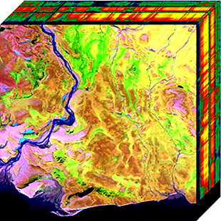
Hyperspectral imaging collects and processes information from across the electromagnetic spectrum. The goal of hyperspectral imaging is to obtain the spectrum for each pixel in the image of a scene, with the purpose of finding objects, identifying materials, or detecting processes. There are three general types of spectral imagers. There are push broom scanners and the related whisk broom scanners, which read images over time, band sequential scanners, which acquire images of an area at different wavelengths, and snapshot hyperspectral imagers, which uses a staring array to generate an image in an instant.

Image stabilization (IS) is a family of techniques that reduce blurring associated with the motion of a camera or other imaging device during exposure.

An imaging spectrometer is an instrument used in hyperspectral imaging and imaging spectroscopy to acquire a spectrally-resolved image of an object or scene, usually to support analysis of the composition the object being imaged. The spectral data produced for a pixel is often referred to as a datacube due to the three-dimensional representation of the data. Two axes of the image correspond to vertical and horizontal distance and the third to wavelength. The principle of operation is the same as that of the simple spectrometer, but special care is taken to avoid optical aberrations for better image quality.
Chemical imaging is the analytical capability to create a visual image of components distribution from simultaneous measurement of spectra and spatial, time information. Hyperspectral imaging measures contiguous spectral bands, as opposed to multispectral imaging which measures spaced spectral bands.

Oxford Instruments Andor Ltd is a global developer and manufacturer of scientific cameras, microscopy systems and spectrographs for academic, government, and industrial applications. Founded in 1989, the company's products play a central role in the advancement of research in the fields of life sciences, physical sciences, and industrial applications. Andor was purchased for £176 million in December 2013 by Oxford Instruments. The company is based in Belfast, Northern Ireland and now employs over 400 staff across the group at its offices in Belfast, Japan, China, Switzerland and the US.
Ophir Optronics Solutions is a multinational company that sells optronics solutions. The company develops, manufactures and markets infrared (IR) optics and laser measurement equipment. Founded in 1976, the company was traded on the Tel Aviv Stock Exchange from 1991 until it was acquired, and was a constituent of its Tel-tech index. Headquartered in the Har Hotzvim industrial park in Jerusalem, Israel Ophir owns a 100,000-square-foot (9,300 m2) complex that includes the group's main production plant. Ophir has additional production plants in North Andover, Massachusetts and Logan, Utah in the US and sales offices in the US, Japan and Europe. In 2006, Ophir acquired Spiricon Group, a US-based company in the beam-profiling market. Ophir's sales increased sharply from $45 million in 2005 to $74 million in 2007. During 2007, Ophir established a Swiss-based subsidiary to market lenses and components for surveillance and imaging systems in Europe. In May 2010, Ophir acquired Photon Inc., another US-based beam-profiling company. Newport Corporation, a global supplier in photonics solutions, completed its acquisition of the Ophir company in October 2011. In 2016, metrology firm MKS Instruments bought Newport Corporation, including the Ophir brand, for $980 million.

Airborne Real-time Cueing Hyperspectral Enhanced Reconnaissance, also known by the acronym ARCHER, is an aerial imaging system that produces ground images far more detailed than plain sight or ordinary aerial photography can. It is the most sophisticated unclassified hyperspectral imaging system available, according to U.S. Government officials. ARCHER can automatically scan detailed imaging for a given signature of the object being sought, for abnormalities in the surrounding area, or for changes from previous recorded spectral signatures.
Electro-optical MASINT is a subdiscipline of Measurement and Signature Intelligence, (MASINT) and refers to intelligence gathering activities which bring together disparate elements that do not fit within the definitions of Signals Intelligence (SIGINT), Imagery Intelligence (IMINT), or Human Intelligence (HUMINT).

A liquid crystal tunable filter (LCTF) is an optical filter that uses electronically controlled liquid crystal (LC) elements to transmit a selectable wavelength of light and exclude others. Often, the basic working principle is based on the Lyot filter but many other designs can be used. The main difference with the original Lyot filter is that the fixed wave plates are replaced by switchable liquid crystal wave plates.
CytoViva, Inc. is a scientific imaging and instrumentation company that develops and markets optical microscopy and hyperspectral imaging technology for nanomaterials, pathogen and general biology applications.
Photon etc. is a Canadian manufacturer of infrared cameras, widely tunable optical filters, hyperspectral imaging and spectroscopic scientific instruments for academic and industrial applications. Its main technology is based on volume Bragg gratings, which are used as filters either for swept lasers or for global imaging.
PRISMA is an Italian Space Agency pre-operational and technology demonstrator mission focused on the development and delivery of hyperspectral products and the qualification of the hyperspectral payload in space.
PCO Imaging is a developer and manufacturer of camera systems for scientific and industrial applications.

Applied Spectral Imaging or ASI is a multinational biomedical company that develops and manufactures microscopy imaging and digital analysis tools for hospitals, service laboratories and research centers. The company provides cytogenetic, pathology, and research laboratories with bright-field, fluorescence and spectral imaging in clinical applications. Test slides can be scanned, captured, archived, reviewed on the screen, analyzed with computer-assisted algorithms, and reported. ASI system platforms automate the workflow process to reduce human error in the identification and classification of chromosomal disorders, genome instability, various oncological malignancies, among other diseases.
