Britain most often refers to:

The Maluku Islands or the Moluccas are an archipelago in the eastern part of Indonesia. Tectonically they are located on the Halmahera Plate within the Molucca Sea Collision Zone. Geographically they are located east of Sulawesi, west of New Guinea, and north and east of Timor. Lying within Wallacea, the Moluccas have been considered a geographical and cultural intersection of Asia and Oceania.
Chesterfield may refer to:
Indonesian is anything of, from, or related to Indonesia, an archipelagic country in Southeast Asia. It may refer to:
Captain Morgan is a brand of flavored rums produced by British alcohol conglomerate Diageo. It is named after the 17th-century Welsh privateer of the Caribbean, Sir Henry Morgan.

Malibu is a coconut flavored liqueur, made with white rum, and having an alcohol content by volume of 21.0%. Since 2005 the Malibu brand has been owned by Pernod Ricard, which calls it a "flavored rum", where this designation is allowed by local laws.
A hermit is a person who lives in seclusion from society.
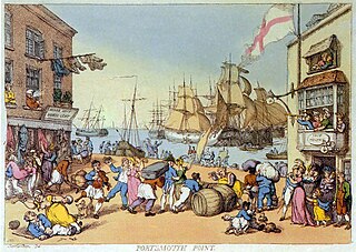
Portsmouth Point, or "Spice Island", is part of Old Portsmouth in Portsmouth, Hampshire, on the southern coast of England. The name Spice Island comes from the area's seedy reputation, as it was known as the "Spice of Life". Men were easily found and press-ganged into Nelson's navy from Portsmouth Point due to its hostelries and for being where prostitutes plied their trade. The area forms the eastern side of the narrow entrance to Portsmouth Harbour, facing Gosport on the western side.
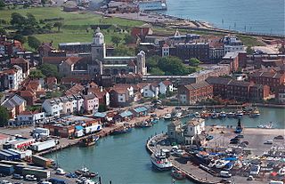
Old Portsmouth is a district of the city of Portsmouth. It is the area covered by the original medieval town of Portsmouth as planned by Jean de Gisors. It is situated in the south west corner of Portsea Island. The roads still largely follow their original layout.

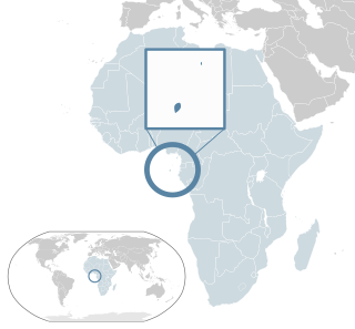
The Zanzibar Archipelago is a group of islands off the coast of mainland Tanzania in the sea of Zanj. The archipelago is also known as the Spice Islands. There are four main islands, three primary islands with permanent human populations, a fourth coral island that serves as an essential breeding ground for seabirds, plus a number of smaller islets that surround them and an isolated tiny islet.
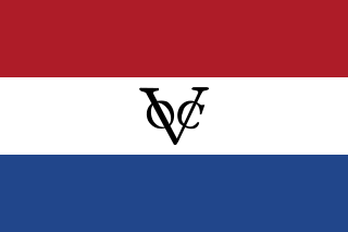
Company rule in the Dutch East Indies began when the Dutch East India Company appointed the first governor-general of the Dutch East Indies in 1610, and ended in 1800 when the bankrupt company was dissolved and its possessions were nationalized as the Dutch East Indies. By then it exerted territorial control over much of the archipelago, most notably on Java.
Richard Spicer may refer to:
Santomean cuisine comprises the cuisine, dishes and foods of São Tomé and Príncipe, a Portuguese-speaking island nation in the Gulf of Guinea, off the western equatorial coast of Central Africa. The country consists of two archipelagos around the two main islands: São Tomé and Príncipe, located about 140 kilometres (87 mi) apart and about 250 and 225 kilometres, respectively, off the northwestern coast of Gabon.

Ayam kecap or ayam masak kicap is an Indonesian Javanese chicken dish poached or simmered in sweet soy sauce commonly found in Indonesia, and Malaysia
This page is based on this
Wikipedia article Text is available under the
CC BY-SA 4.0 license; additional terms may apply.
Images, videos and audio are available under their respective licenses.