Lillooet is a town in the Fraser Canyon in British Columbia.
A Tribal Council is either: (1) a First Nations government in Canada or, an association of Native American bands in the United States; or, (2) the governing body for certain tribes within the United States or elsewhere. In both countries they are generally formed along regional, ethnic or linguistic lines.
The Declaration of the Lillooet Tribe is an important document in the history of relations between First Nations and the governments of the Dominion of Canada and the Province of British Columbia. Signed in Spences Bridge on May 10, 1911 by a committee of the chiefs of the St'at'imc peoples, taken down by anthropologist James Teit, a resident of Spences Bridge who lived among the Nlaka'pamux, it is an assertion of sovereignty over traditional territories as well as a protest against recent alienations of land by settlers at Seton Portage, British Columbia.
The In-SHUCK-ch Nation, also known as Lower Lillooet people, are a small First Nations Tribal Council on the lower Lillooet River south of Pemberton-Mount Currie in the Canadian province of British Columbia. The communities of the In-SHUCK-ch are of the St'at'imcets-speaking St'at'imc people, but in recent years seceded from the Lillooet Tribal Council to form their own organization.
Mount Currie is a small, mostly First Nations, community in British Columbia, 164 kilometres north of Vancouver and 40 kilometres north-east of Whistler along Highway 99. "The Mount Currie settlement and mountain were named after Scottish settler John Currie, who located to Quebec in 1851. After failure as a gold seeker in California and the Cariboo, Currie turned to ranching and finally settled near Pemberton with his Lillooet Indian wife in 1885." The area is traditional territory of the Lil'wat, a subgroup of the St'at'imc people who with the communities of Skatin, Samahquam and Xa'xtsa to the south comprise the Lower St'at'imc or Lower Lillooet. The Mount Currie Indian Reserve hosts most of the population of Mount Currie, who are known as the Lil'wat, their name for the spot, but west of the reserve there are non-native farms, industrial sites and tourist resorts, and on the mountain shoulder immediately north of the reserve is Owl Creek, the site of the original Catholic mission school which drew the Lil'wat from their former homebase at Pemberton Meadows so as to be close to their children. Owl Creek today is the name of a modern subdivision of mostly non-natives, though Owl Creek remains on the rail crossing on the CNR just outside the reserve.
Chief Hunter Jack was a 19th-century chief of the Lakes Lillooet. His name in St'at'imcets, the Lillooet language, was In-Kick-Tee. Irene Edwards, long-time storekeeper at D'arcy and later at Seton Portage, gives another Indian name for him, Tash Poli.
Xaxli'p, also known as the Fountain First Nation or the Fountain Indian Band, is a First Nations government located in the Central Interior-Fraser Canyon region of the Canadian province of British Columbia. It is a member of the Lillooet Tribal Council, which is the largest grouping of band governments of the St'at'imc people.

The Lil'wat First Nation, a.k.a. the Lil'wat Nation or the Mount Currie Indian Band, is a First Nation band government located in the southern Coast Mountains region of the Interior of the Canadian province of British Columbia. It is a member of the Lillooet Tribal Council, which is the largest grouping of band governments of the St'at'imc or Stl'atl'imx people. Other St'at'imc governments include the smaller In-SHUCK-ch Nation on the lower Lillooet River to the southwest, and the independent N'quatqua First Nation at the near end of Anderson Lake from Mount Currie, which is the main reserve of the Lil'wat First Nation, and also one of the largest Indian reserves by population in Canada.
The T'it'q'et First Nation also known as the T'it'k't First Nation, the Tl'itl'ikt First Nation and as the Lillooet Indian Band, is a First Nations government located in the Central Interior-Fraser Canyon region of the Canadian province of British Columbia. It is a member of the Lillooet Tribal Council, which is the largest grouping of band governments of the St'at'imc people. Other St'at'imc governments include the smaller In-SHUCK-ch Nation on the lower Lillooet River to the southwest, and the independent N'quatqua First Nation at the farther end of Anderson Lake from Seton Portage, which is the location of three of the reserve communities of the Seton Lake First Nation, another member of the Lillooet Tribal Council.
The N'Quatqua First Nation, also known as the N'quatqua Nation, the N'Quatqua Nation, the Nequatque First Nation, the Anderson Lake Indian Band, the Anderson Lake First Nation and the Anderson Lake Band, is a First Nations government of the St'at'imc people, located in the southern Coast Mountains region of the Canadian province of British Columbia at the community of D'Arcy, where the British Columbia Railway meets the head of Anderson Lake, about midway between the towns of Pemberton and Lillooet.
The Tsk'weylecw'mc or Tsk'waylaxw'mx are a First Nations people in the Central Fraser Canyon area of the Canadian province of British Columbia. They are a subgroup of both the St'at'imc and Secwepemc peoples and reside at and around the community of Pavilion, an unincorporated settlement comprising the Pavilion Indian Reserve and adjacent ranches on Highway 99 about 30 kilometres north of Lillooet, near Marble Canyon. There is another reserves of which is immediately on the other side of Marble Canyon near Upper Hat Creek. Another non-residential reserve on the opposite side of the Fraser River from Pavilion is Pavilion Indian Reserve 1A, used for hunting in that area. They historically have close ties and a shared cultural identity with their Secwepemc neighbours, particularly the Bonaparte group, but also with the St'at'imc of Fountain and Lillooet. The Tsk'weylecw'mc are both St'at'imc Secwepemc ethnically, and have close family ties and shared cultural traditions with the Canyon Shuswap at nearby High Bar, the Llenlleney'ten, who although Secwepemc are partly Tsilhqot'in in identity. Their particular dialect is a hybrid of St'at'imcets and Secwepemctsin. Most placenames in the Pavilion area are Secwepemctsin, a legacy times in the recent past, just prior to the Fraser Canyon Gold Rush, when the east bank of the Fraser, including Fountain and opposite Lillooet itself, were part of Secwepemc territory.
The Lower Stl'atl'imx Tribal Council is a First Nations tribal council in British Columbia, Canada, comprising four band governments of the St'at'imc people:
The Bridge River Rapids, also known as the Six Mile Rapids, the Lower Fountain, the Bridge River Fishing Grounds, and in the St'at'imcets language as Sat' or Setl, is a set of rapids on the Fraser River, located in the central Fraser Canyon at the mouth of the Bridge River six miles north of the confluence of Cayoosh Creek with the Fraser and on the northern outskirts of the District of Lillooet, British Columbia, Canada.
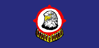
The Stl'atl'imx Tribal Police Service (STPS) is the police force for St'at'imc aboriginal peoples of British Columbia. The STPS is the only aboriginal police service in British Columbia. Their officers are appointed as designated provincial constables, and have full police powers on and off-duty throughout the province. They are based in Lillooet and Mount Currie.