St Andrew's United Church

Last updated

St Andrew's United Church
Kostel St. Andrews United Church - Hokitika - panoramio.jpg
St Andrew's United Church, Hokitika
St Andrew's United Church
42°42′55.6″S170°58′7.3″E / 42.715444°S 170.968694°E / -42.715444; 170.968694
Location66 Hampden Street and Fitzherbert Street, Hokitika
CountryNew Zealand
Denomination Presbyterian/Methodist
History
Status Parish church
Architecture
Functional statusActive
Heritage designationCategory I
Designated28 June 1990
Architect(s) Roy Lovell-Smith
Architectural typeGothic
Groundbreaking 19 July 1919
Completed24 November 1935
Construction cost£2,540
Specifications
Materials Reinforced concrete, roughcast plaster

St Andrew's United Church, previously the Scot's Memorial Church, in Hokitika, New Zealand, is a Presbyterian/Methodist United church. It is a Category I registered building on the West Coast of New Zealand.

Contents

Background

The first St Andrew's Church in Hokitika was built in February 1867, following the arrival of the first minister of the Hokitika parish, Reverend John Gow. [1] It was a wooden building with a prominent spire, sited on Stafford Street. [2]

In 1919, the congregation of St Andrew's elected to build a new church, to be known as the Scot's Memorial Church, to honour the contribution of Westland Scots who died in the First World War and as an offering to God for the Allied victory. A ground-breaking ceremony was held on Peace Day in 1919, although the church was eventually built on a different site. [3] [4]

An architect was not commissioned until 1931, when Roy Lovell-Smith completed his design. Construction was then delayed by both the choice of site and financial problems. Tenders were finally called In January 1935, and a month later the tender for £2,450 from J.O. Grant of Christchurch was accepted. [5] The church was officially opened on 24 November 1935, at a final cost of just over £2,540. [1] [6]

The original church building of 1867 was used as a Sunday School, until it was demolished in 1946. In 1941, a booklet describing the history of the church was published to celebrate the 75th anniversary. [1] [7]

In 1970, the Presbyterian St Andrew's Church united with the Methodist church to form St Andrew's United Parish. [1]

Construction

The church is built in the Gothic style with a minimum of interior ornamentation. The tower is notable for having wide Gothic arch windows on four sides. [1]

The Westland Scots Memorial inside St Andrew's Church St Andrews Scots Memorial MRD.jpg
The Westland Scots Memorial inside St Andrew's Church

The church is built of reinforced concrete, with double walls and exterior roughcast cement plaster. The roof is slate with wooden bargeboards. The interior walls are plastered, and the ceiling and interior fittings, all designed by the architect, are of oiled rimu. [1]

The church contains the Westland Scots Memorial, a marble roll of honour listing forty locals fallen in the First World War. [1]

Current status

The church is registered by Heritage New Zealand as a Category I structure, with registration number 5013. The listing recognises the importance of St Andrew's as the first Presbyterian congregation to be established on the West Coast, and the church as a visible symbol of that, as well as a memorial. Further, the listing describes the building as a fine example of a small Gothic style parish church, and acknowledges its importance as a local landmark. The Roll of Honour in the church is 'very fine'. [1]

Related Research Articles

Waipukurau is the largest town in the Central Hawke's Bay District on the east coast of the North Island of New Zealand. It is located on the banks of the Tukituki River, 7 kilometres south of Waipawa and 50 kilometres southwest of Hastings.

<span class="mw-page-title-main">Hokitika</span> Town in West Coast, New Zealand

Hokitika is a town in the West Coast region of New Zealand's South Island, 40 kilometres (25 mi) south of Greymouth, and close to the mouth of the Hokitika River. It is the seat and largest town in the Westland District. The town's estimated population is 3,120 as of June 2023.

<span class="mw-page-title-main">Milton, New Zealand</span> Town in New Zealand

Milton, formerly known as Tokomairiro or Tokomairaro, is a town of over 2,000 people, located on State Highway 1, 50 kilometres to the south of Dunedin in Otago, New Zealand. It lies on the floodplain of the Tokomairaro River, one branch of which loops past the north and south ends of the town. This river gives its name to many local features, notably the town's only secondary school, Tokomairiro High School.

<span class="mw-page-title-main">Hamilton East, New Zealand</span> Suburb of Hamilton, New Zealand

Hamilton East is a suburb in central Hamilton in New Zealand. The suburb's primary commercial and retail precinct is located along Grey Street. Hamilton East is characterised by villas and bungalows built early in the 20th century.

<span class="mw-page-title-main">Stillwater–Ngākawau Line</span> Railway line in New Zealand

The Stillwater Ngākawau Line (SNL), formerly the Stillwater–Westport Line (SWL) and the Ngakawau Branch, is a secondary main line, part of New Zealand's national rail network. It runs between Stillwater and Ngakawau via Westport on the West Coast of the South Island. It was one of the longest construction projects in New Zealand's history, with its first section, at the south end, opened in 1889, and the beginnings of the Ngākawau Branch, at its Westport end, in 1875. The full line was completed in 1942. The only slower railway projects were Palmerston North to Gisborne, 1872 to 1942, and the Main North Line to Picton, 1872 to 1945.
<span class="mw-page-title-main">Tokanui, Southland</span> Village in Southland, New Zealand

Tokanui is a community in the eastern portion of Southland District Council, located on the Southern Scenic Route about 56 km (35 mi) east of Invercargill and 107 km (66 mi) southwest of Balclutha, New Zealand. The Tokanui River runs just to the north of the village and occasionally floods the lower parts, as it did when the railway yard flooded in 1935.

<span class="mw-page-title-main">Edmund Allen (politician)</span> New Zealand politician

Edmund Giblett Allen (1844–1909) was a Liberal Party Member of Parliament in New Zealand.

Andrew Graham was a 19th-century Member of Parliament from the Gisborne Region of New Zealand.
<span class="mw-page-title-main">George Fraser (New Zealand engineer)</span> New Zealand engineer, foundry proprietor, and ship owner

George Fraser was a New Zealand engineer, foundry proprietor and ship owner. He was born in Aberdeen, Aberdeenshire, Scotland on 28 June 1832.

<span class="mw-page-title-main">Charles Cook (academic)</span>

Charles Henry Herbert Cook was an English-born, Australian-raised, New Zealand-based mathematician. He was born in Kentish Town, Middlesex, England on 30 September 1843, but educated in Melbourne, Australia, where he got a BA and an LLB from University of Melbourne. He then went to St John's College, Cambridge, initially to train for the English Bar but became interested in mathematics.

<span class="mw-page-title-main">Hamilton City Council (New Zealand)</span>

Hamilton City Council is the territorial authority for the New Zealand city of Hamilton.

<span class="mw-page-title-main">Northern Steamship Company</span> New Zealand local shipping and transport company

The Northern Steam Ship Company Ltd (NSS) served the northern half of the North Island of New Zealand from 1881 to 1974. Its headquarters, the Northern Steam Ship Company Building, remains in use on Quay St, Auckland as a bar.

<span class="mw-page-title-main">Rangiaowhia</span> Former Village in Waikato region, New Zealand

Rangiaowhia was, for over 20 years, a thriving village on a ridge between two streams in the Waikato region, about 4 km (2.5 mi) east of Te Awamutu. From 1841 it was the site of a very productive Māori mission station until the Invasion of the Waikato in 1864. The station served Ngāti Hinetu and Ngāti Apakura. Only a church remains from those days, the second oldest Waikato building.
<span class="mw-page-title-main">Ormondville</span> Settlement in Manawatū-Whanganui Region, New Zealand

Ormondville is a locality in the Manawatū-Whanganui region of New Zealand's North Island. It is located inland, south of Waipukurau and west of Flemington, Hawke's Bay.

<span class="mw-page-title-main">All Saints' Church, Hokitika</span> Church in South Island, New Zealand

All Saints' Church, also known as Hokitika Anglican Church, is an heritage-listed Anglican church located in Hokitika, on the West Coast of the South Island of New Zealand. The church forms part of the Ross and South Westland parish of the Diocese of Christchurch within the Anglican Church in Aotearoa, New Zealand and Polynesia. The church building is a Category I building on the Heritage New Zealand register.

<span class="mw-page-title-main">Roy Lovell-Smith</span> New Zealand architect (1884–1972)

Leonard Roy Lovell-Smith was a New Zealand architect.
<span class="mw-page-title-main">Oio railway station</span> Railway station in New Zealand

Oio was a station on the North Island Main Trunk line, in the Ruapehu District of New Zealand. It served the hamlet of Oio, which lay to the north of the station. It was 8.29 km (5.15 mi) north of Raurimu and 5.64 km (3.50 mi) south of Ōwhango. It was one of the many temporary railheads along the route, with work going on from 1904 to 1908.

<span class="mw-page-title-main">Rangiwahia</span> Settlement in New Zealand

Rangiwahia is a small, elevated, farming settlement in the North Island, New Zealand, 26 km (16 mi) northeast of Kimbolton in the Manawatū-Whanganui region. It is in the Kiwitea valley, near the Whanahuia Range of the Ruahines. Due to its height and the nearby ranges, Rangiwahia has a mean annual rainfall of 1267mm; 309mm more than Feilding's.
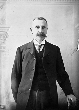
<span class="mw-page-title-main">Robert William Dyer</span> New Zealand solicitor, judge, and mayor (1859–1939)

Robert William Dyer (1859-1939) was a solicitor, judge and the mayor of Hamilton, New Zealand from 1901 to 1903.
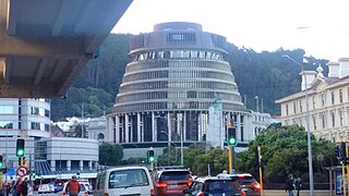
<span class="mw-page-title-main">Whitmore Street</span> Street in Wellington, New Zealand

Whitmore Street is at the boundary of the central business district and the government buildings area of Wellington, New Zealand's capital. The street runs almost north-south and is one of those linking Lambton Quay, Wellington's main shopping street, with Stout Street, Featherston Street and the harbourside at Customhouse/ Waterloo Quay. It is in the suburb of Pipitea.

References

  1. 1 2 3 4 5 6 7 8 "Search the List | St Andrew's United Church (Presbyterian/Methodist) | Heritage New Zealand". www.heritage.org.nz. Archived from the original on 21 December 2019. Retrieved 21 September 2020.
  2. "Ecclesiastical | NZETC". nzetc.victoria.ac.nz. Archived from the original on 1 October 2020. Retrieved 21 September 2020.
  3. "Scot's Memorial Church". paperspast.natlib.govt.nz. Retrieved 21 September 2020.
  4. "Hokitika Excels Itself: Scots Memorial Church". paperspast.natlib.govt.nz. Retrieved 1 October 2020.
  5. "New Church for Hokitika". paperspast.natlib.govt.nz. Archived from the original on 18 October 2021. Retrieved 21 September 2020.
  6. "The new Scots' Memorial Presbyterian Church, Hokitika, which was opened recently". paperspast.natlib.govt.nz. Retrieved 21 September 2020.
  7. "Early Presbyterian History". paperspast.natlib.govt.nz. Archived from the original on 18 October 2021. Retrieved 21 September 2020.