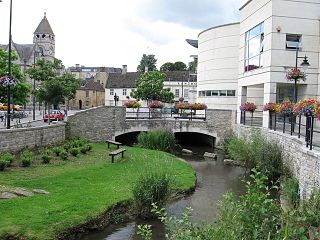
Great Dunmow is a historic market town and civil parish in the Uttlesford district of Essex, England. It lies to the north of the A120 road, approximately midway between Bishop's Stortford and Braintree, 5 mi (8 km) east of London Stansted Airport.

St Mary the Great is a Church of England parish and university church at the north end of King's Parade in central Cambridge, England. It is known locally as Great St Mary's or simply GSM to distinguish it from "Little St Mary's". It is one of the Greater Churches. It is designated by Historic England as a Grade I listed building.

Calne is a town and civil parish in Wiltshire, southwestern England, at the northwestern extremity of the North Wessex Downs hill range, a designated Area of Outstanding Natural Beauty.

Bowes & Bowes was a bookselling and publishing company based in Cambridge, England.

The A215 is an A road in south London, starting at Elephant and Castle and finishing around Shirley. It runs through the London Boroughs of Lambeth, Southwark and Croydon.

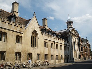
King's Parade is a street in central Cambridge, England. The street continues north as Trinity Street and then St John's Street, and south as Trumpington Street. It is a major tourist area in Cambridge, commanding a central position in the University of Cambridge area of the city. It is also a place frequented by many cyclists and by students travelling between lectures during term-time.

Trumpington Street is a major historic street in central Cambridge, England. At the north end it continues as King's Parade where King's College is located. To the south it continues as Trumpington Road, an arterial route out of Cambridge, at the junction with Lensfield Road.

Trinity Street is a street in central Cambridge, England. The street continues north as St John's Street, and south as King's Parade and then Trumpington Street.

Trinity Lane is a street in the centre of Cambridge, England that passes through portions of the University of Cambridge, one of the world's most prestigious universities. The lane leads off Trinity Street.

Sidney Street is a major street in central Cambridge, England. It runs between Bridge Street at the junction with Jesus Lane to the northwest and St Andrew's Street at the junction with Hobson Street to the southeast.

Regent Street is an arterial street in southeast central Cambridge, England. It runs between St Andrew's Street, at the junction with Park Terrace, to the northwest and Hills Road at the junction with the A603 to the southeast. Regent Terrace runs in parallel immediately to the northeast. Beyond that is Parker's Piece, a large grassed area with footpaths.

The Old Schools are part of the University of Cambridge, in the centre of Cambridge, England. The Old Schools house the Cambridge University Offices, which form the main administration for the University.

Peas Hill is a street in central Cambridge, England. It runs between Wheeler Street to the south and Market Hill to the north. King's Parade runs parallel with the street to the west. Guildhall Street runs parallel to the east.

Market Hill is the location of the marketplace in central Cambridge, England. Operating as a marketplace since Saxon times, a daily outdoor market with stalls continues to run there.

Market Street is a shopping street in central Cambridge, England. It runs between Market Hill, location of the city's central Market Square to the west and Sidney Street to the east. On the other side of the market square, the street continues west as St Mary's Street, north of Great St Mary's, the University church. On the other side of Sidney Street is Hobson's Passage leading east to Hobson Street. To the north is Market Passage and to the south is Petty Cury, a pedestrianised shopping street.

Holy Trinity Church is a church in Market Street, in the city of Cambridge, in Cambridgeshire,England, on the corner with Sidney Street. Its current vicar is Stuart Browning. Theologically, it stands within the charismatic evangelical tradition of the Church of England.

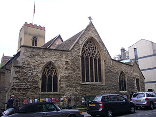
St Edward's Passage, known in the 18th century as Chain Lane, is a Y-shaped alleyway in Cambridge, England, between King's Parade—opposite the main gate of King's College—and Peas Hill. It houses the entrance and churchyard of the Church of St Edward King and Martyr; the Cambridge Arts Theatre; several cottages; G. David, an independent bookshop run from the same building since 1896; a few businesses; and student accommodation. It is a narrow, dark lane, with riven-stone paving, which opens out onto the much wider and sunnier King's Parade.
This is a list of the etymology of street names in the City of London.


