Unst is one of the North Isles of the Shetland Islands, Scotland. It is the northernmost of the inhabited British Isles and is the third-largest island in Shetland after Mainland and Yell. It has an area of 46 sq mi (120 km2).
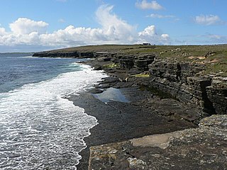
Papa Westray, also known as Papay, is one of the Orkney Islands in Scotland, United Kingdom. The fertile soil has long been a draw to the island.
Uyea is an uninhabited island, lying south of Unst in Shetland, Scotland.

Eileach an Naoimh is an uninhabited island in the Inner Hebrides of the west coast of Scotland. It is the second largest and southernmost of the Garvellachs archipelago and lies in the Firth of Lorn between Mull and Argyll. The name of the island is Gaelic for "rocky place of the saint" or from na-h-Eileacha Naomha meaning "the holy rocks".

Muness Castle is located on Unst, which is one of the Shetland Islands of Scotland. The castle is 3 kilometres (1.9 mi) east of the village of Uyeasound. Unst is Scotland's most northerly inhabited island, and Muness is the most northerly fortalice in the British Isles. It was designated as a Scheduled monument in 1953 and is run as a museum by Historic Environment Scotland.
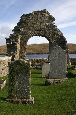
Sandsting is a parish in the West Mainland of Shetland, Scotland, forming a southern arm of the Walls Peninsula. After the parish of Aithsting was annexed into Sandsting in the sixteenth century, it became known as Sandsting and Aithsting parish.
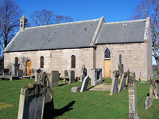
Birnie Kirk is a 12th century parish church located near Elgin, in Moray, Scotland. It was the first cathedral of the Bishop of Moray and is one of the oldest in Scotland to have been in continuous use. The graveyard, symbol stone and archaeological remains under the church have been designated a scheduled monument by Historic Environment Scotland.

Eynhallow Church is a ruined medieval church located on the uninhabited island of Eynhallow in Orkney, Scotland. The church dates back to the 12th-century and is thought to have originally been a monastery. Near the church are the building remains from a post-medieval village. Historic Environment Scotland first listed the site as a scheduled monument in 1921.

The Lady Kirk at Pierowall is a ruined 17th-century church on the island of Westray, in Orkney, Scotland. The church was built in 1674, on the foundations of the 13th-century church. Two 17th-century grave-slabs, in excellent condition, are set into the interior wall of the chancel and are now protected by glass screens. The graves display fine lettering and 17th-century images of mortality, engraved in high relief. Historic Environment Scotland established the site as a scheduled monument in 2014.

Westside Church,, is a ruined 12th century church located on the island of Westray in Orkney, Scotland. Archaeological excavations at the site suggest that the church is related to a nearby late Norse settlement. Historic Environment Scotland established the site, which includes the church and surrounding cemetery, as a scheduled monument in 1921.
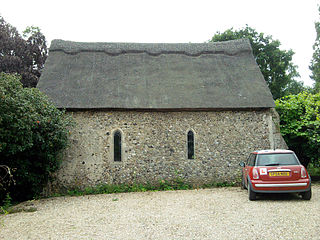
St James' Chapel is a 13th-century chapel located near the village of Lindsey, Suffolk, England. Built in 1250 of flint, brick and stone, the small church served as the chantry chapel for nearby Lindsey castle. The chapel was in use until 1545 when it was dissolved as a "free chapel". After dissolution, the King granted the property to Thomas Turner, who converted the building into a barn. St James' chapel is recorded in the National Heritage List for England as a designated Grade I listed building and scheduled monument.
The Society of Our Lady of the Isles (SOLI) is a small Anglican religious order for women, founded in the late 20th century. It is located in Shetland, and is part of the Scottish Episcopal Church. It is arguably the most remote community within the Anglican Communion. The Rule of the community is a mixture of Franciscan and Cistercian, but with heavy Celtic influences.

St Magnus Church, Birsay is a 17th-century church located in the parish of Birsay on Mainland, Orkney in Scotland. Built in 1664 on the site of an earlier, 11th-century church, St Magnus was later expanded in 1760 and 1867. The graveyard surrounding the church dates to the 18th century. The church is now maintained by the St Magnus Church Birsay Trust.

St Boniface's Church, Papa Westray is a historic church and graveyard located on the island of Papa Westray in Orkney, Scotland. The site of the church dates back to the Iron Age and was possibly used later as a Christian monastery. The present church was built in the 12th century and was remodeled in 1710. A 12th-century Norse hogback gravestone lies to the east of the church. Two Pictish cross-slabs were uncovered in the graveyard in the 20th century, and were later moved to museums. Historic Environment Scotland established the site as a scheduled monument in 1959.

St. Mary's Chapel is a ruined 12th century chapel found on the island of Wyre, in Orkney, Scotland. It is thought to have been built by a Norse chieftain, Kolbeinn hrúga or his son, Bjarni Kolbeinsson, Bishop of Orkney. The now roofless Romanesque style building was originally constructed of local rubble and lime mortar. During the late 19th century, the building was restored. Historic Environment Scotland established the site, which includes the church and walled burial ground, as a scheduled monument in 1929.
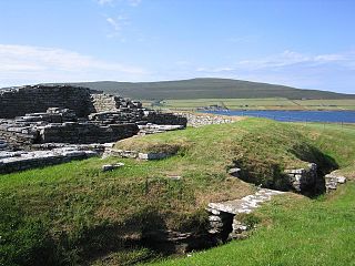
Cobbie Row'sCastle is the oldest medieval castle known to exist in Scotland. The castle ruins are located on the island of Wyre in Orkney. Built in the mid-12 century by Norse landowner, Kolbeinn hrúga, the stone fortification originally consisted of a small, central tower set in an oval enclosure, surrounded by two ditches, a stone wall and an earthen rampart. Historic Environment Scotland established the site as a scheduled monument in 1929.
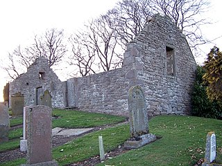
Nevay Church is a ruined 16th century parish church located near the village of Kirkinch in Angus, Scotland. Originally dedicated to St Neveth, a church has been recorded at this site since the 14th century; however, a round-headed cross-slab found in the church, and now displayed in the Meffan Institute, Forfar, suggests an earlier origin. The building and surrounding cemetery are designated a scheduled Ancient Monument. Nevay church was abandoned in 1835 when a newer church was built to serve both the Eassie and Nevay Parishes.

Eassie Old Church is a ruined 13th-century parish church located near the village of Eassie in Angus, Scotland. Erected in the corner of the church is the Eassie Stone, a Class II Pictish stone. The cross slab was discovered in 1850 in the nearby burn. The church was abandoned after 1835 when a new church was built in the area to serve the combined parishes of Eassie and Nevay. Historic Environment Scotland established the site as a scheduled monument in 1921.

Trumpan Church is a ruined medieval church located on the Isle of Skye in Scotland. In 1578, the church was the site of a brutal massacre of the Clan MacLeod by Clan Macdonald, of South Uist. The attack was in retaliation for the massacre of hundreds of members of Clan Macdonald in the village of Eigg the previous year. The church and surrounding graveyard contain late medieval carved gravestones. Historic Environment Scotland designated the church and surrounding burial ground a scheduled monument in 1936.
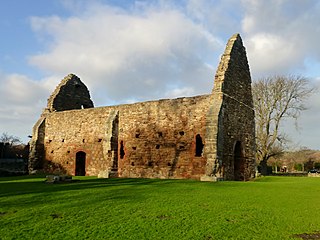
St Martin's Church, Haddington is a ruined church in the town of Haddington, East Lothian, Scotland. A rare example of a 12th-century parish church, it was originally attached to the nunnery of St Mary's at Nungate. The nunnery was later destroyed by the English. St Martin's continued to function as a Protestant place of worship after the Reformation. It later fell into decay and was abandoned. Historic Environment Scotland established the site as a scheduled monument in 1921.


