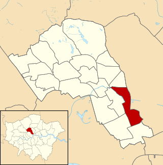
St Pancras was a civil parish and metropolitan borough in London, England. It was an ancient parish in the county of Middlesex, governed by an administrative vestry. The parish was included in the area of responsibility of the Metropolitan Board of Works in 1855 and became part of the County of London in 1889. The parish of St Pancras became a metropolitan borough in 1900, following the London Government Act 1899, with the parish vestry replaced by a borough council. In 1965 the borough was abolished and its former area became part of the London Borough of Camden in Greater London.

The Metropolitan Borough of Holborn was a metropolitan borough in the County of London between 1900 and 1965. The borough included most of Holborn as well as Bloomsbury and St Giles.

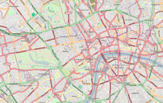
Central London is the innermost part of London, in England, spanning the City of London and several boroughs. Over time, a number of definitions have been used to define the scope of Central London for statistics, urban planning and local government. Its characteristics are understood to include a high-density built environment, high land values, an elevated daytime population and a concentration of regionally, nationally and internationally significant organisations and facilities.

Hampstead & Highgate was a parliamentary constituency covering the northern half of the London Borough of Camden which includes the village of Hampstead and part of that of Highgate.

Holborn and St Pancras is a parliamentary constituency in Greater London that was created in 1983. It has been represented in the House of Commons of the Parliament of the United Kingdom since 2015 by Sir Keir Starmer, the current Leader of the Labour Party and Leader of the Opposition.
The WC postcode area, also known as the London WC postcode area, is a group of postcode districts in central London, England. The area covered is of high density development, and includes parts of the City of Westminster and the London Boroughs of Camden and Islington, plus a very small part of the City of London.

St Mary's Church is a Church of England church on Eversholt Street in Somers Town, in the London Borough of Camden.

Regent's Park Estate is a large housing estate in the London Borough of Camden. The estate consists of nearly 2,000 homes across 49 buildings and lies on either side of Robert Street, between Albany Street and Hampstead Road. It is immediately to the east of the Regent's Park estate owned by the Crown Estate. The estate includes the sites of Cumberland Market, Munster Square and Clarence Gardens.

Charlotte Street is a street in Fitzrovia, historically part of the parish and borough of St Pancras, in central London. It has been described, together with its northern and southern extensions, as the spine of Fitzrovia.

Holborn and Covent Garden is a ward of the London borough of Camden, in the United Kingdom. As the name suggests, it covers the parts of Holborn and Covent Garden that lie in Camden; the eastern part of Holborn lies in the City of London and the southern part of Covent Garden lies in the City of Westminster. For elections to Parliament, Holborn and Covent Garden is part of Holborn and St Pancras.

Bloomsbury is a ward in the London Borough of Camden, in the United Kingdom. It covers much of the historic area of Bloomsbury, and also some of Covent Garden and Fitzrovia.

King's Cross is a ward of the London borough of Camden, in the United Kingdom. The ward has existed since the creation of the borough on 1 April 1965 and was first used in the 1964 elections. The population of the ward at the 2011 Census was 11,843. In 2018, the ward had an electorate of 7,274. The Boundary Commission projects the electorate to rise to 8,459 in 2025.

The London Borough of Camden is a London borough in Inner London, England. Camden Town Hall, on Euston Road, lies 1.4 mi (2.3 km) north of Charing Cross. The borough was established on 1 April 1965 and includes the former Central London borough of Holborn, and St Pancras and Hampstead.

Pancras Square Library is in the London Borough of Camden located just off the Euston Road in the King's Cross area of the borough. It is situated on the ground floor of Camden Council's Town Hall complex. With a separate children's library it provides a wide selection of books, CDs and DVDs available to borrow, and free internet access, making it central to provide a library service and gateway to other Council services to the local community.

Warren Street is a street in the London Borough of Camden that runs from Cleveland Street in the west to Tottenham Court Road in the east. Warren Street tube station is located at the eastern end of the street.
Southwark Coroner's Court is the Coroner's Court for inner south London. It is located at Tennis Street, London. The court covers cases for the London boroughs of Greenwich, Lambeth, Lewisham and Southwark.

Whitfield Street is a street in the London Borough of Camden that runs from Warren Street in the north to Windmill Street in the south. The street is crossed by Grafton Way, Maple Street, Howland Street, Wayland Street, and Goodge Street. Whitfield Place starts and ends in Whitfield Street on its eastern side. Hertford Place, Chitty Street and Scala Street all join Whitfield Street on its western side.

Grafton Way is a street in the London Borough of Camden that runs from Tottenham Court Road in the east to Fitzroy Street in the west. Whitfield Street and Grafton Mews adjoin Grafton Way.

Chitty Street is a street in the London Borough of Camden that runs between Charlotte Street and Whitfield Street. Charlotte Mews adjoins Chitty Street on its south side.

Camley Street is a street in the London Borough of Camden in London, England. It lies in St Pancras and King's Cross: stretching over a kilometre from St Pancras railway station in the south, over the Regent's Canal, and to Agar Grove in the north.


