Camley Street

Last updated

The entrance to the Camley Street Natural Park from Camley Street. The nature reserve occupies the most south-eastern part of Camley Street, between the St Pancras Basin and St Pancras railway station. Camley Street Natural Park.jpg
The entrance to the Camley Street Natural Park from Camley Street. The nature reserve occupies the most south-eastern part of Camley Street, between the St Pancras Basin and St Pancras railway station.

Camley Street is a street in the London Borough of Camden in London, England. It lies in St Pancras and King's Cross: stretching over a kilometre from St Pancras railway station in the south, over the Regent's Canal, and to Agar Grove in the north.

Camley Street is the location of Camley Street Natural Park, a local nature reserve. Adjacent to the natural park is St Pancras Basin, home to the St Pancras Cruising Club. That section of Camley Street is home to three separate grade II-listed buildings: the St Pancras Coroner's Court, [1] the Victorian water tower at St Pancras Basin, [2] and the lock-keeper's cottage by St Pancras Lock. [3] There is also an entrance to St Pancras Gardens (part of St Pancras Old Church).

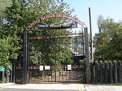
The northern half of the street is home to a number of large developments. [4] [5] [6] Where Camley Street crosses the Regent's Canal, there are three large developments - 101 Camley Street to the bridge's south-west, 102 Camley Street to the bridge's north-east, and 103 Camley Street to the bridge's north-east. [7] Further north, Camley Street proves the eastern access route into the Elm Village estate (formerly the location of Agar Town) and Abacus Belsize Primary School. The north-eastern side of Camley Street is home to one of Camden's largest industrial estates, which is also being redeveloped in a major £136m redevelopment. [8]

Camley Street has its own Neighbourhood Forum and draft Neighbourhood Plan: one of the few streets in the country to have a Forum dedicated to it. The Camley Street Neighbourhood Forum split out of the Kings Cross Neighbourhood Forum. [9]

Developments on Camley Street have been subject to a long dispute in Camden London Borough Council, after the council proposed redevelopment of the street. [10] [11] [12] [13] [14]

Related Research Articles

St Pancras, London Area of central London, England

St Pancras is a large district in north London. St Pancras was originally a medieval ancient parish and subsequently became a metropolitan borough. The metropolitan borough then merged with neighbouring boroughs and the area it covered now forms around half of the modern London Borough of Camden.

Kings Cross, London Area of central London in England

Kings Cross is a district on either side of Euston Road, in Central London, England, 1.5 miles (2.4 km) north of Charing Cross. It is served by two major rail termini, St Pancras and King's Cross. King's Cross station is the terminus of one of the major rail routes between London and the North.

Camden Town Inner city district of London

Camden Town, often shortened to Camden, is a district of northwest London, England, 2.5 miles (4.1 km) north of Charing Cross. Historically in Middlesex, it is the administrative centre of the London Borough of Camden, and identified in the London Plan as one of 34 major centres in Greater London.

River Fleet Subterranean river in London, England

The River Fleet is the largest of London's subterranean rivers, all of which today contain foul water for treatment. Its headwaters are two streams on Hampstead Heath, each of which was dammed into a series of ponds—the Hampstead Ponds and the Highgate Ponds—in the 18th century. At the southern edge of Hampstead Heath these descend underground as sewers and join in Camden Town. The waters flow 4 mi (6 km) from the ponds, having as combined sewers taken on foul water, in the Victorian economic but grandiose scheme designed by Joseph Bazalgette to be conveyed by very large sewers to be treated at Beckton Sewage Treatment Works.

Regents Canal Canal in England

Regent's Canal is a canal across an area just north of central London, England. It provides a link from the Paddington Arm of the Grand Union Canal, 550 yards (500 m) north-west of Paddington Basin in the west, to the Limehouse Basin and the River Thames in east London. The canal is 8.6 miles (13.8 km) long.

Camden Market Retail markets

The Camden markets are a number of adjoining large retail markets, often collectively referred to as Camden Market or Camden Lock, located in the historic former Pickfords stables, in Camden Town, London. It is situated north of the Hampstead Road Lock of the Regent's Canal. Famed for their cosmopolitan image, products sold on the stalls include crafts, clothing, bric-a-brac, and fast food. It is the fourth-most popular visitor attraction in London, attracting approximately 250,000 people each week.

St Pancras Cruising Club

St Pancras Cruising Club (SPCC) is a members' association of boat owners located between Camden Town and Islington on the Regent's Canal in central London. Most boats in the basin are narrowboats, the most common form of craft on the British canals. As the club is near to King's Cross station, it is affected by the ongoing developments at King's Cross Central, formerly known as the Railway Lands.

Agar Town

Agar Town was a short-lived relatively tiny area of St Pancras in central London. It is now the site of St Pancras railway station.

Camley Street Natural Park Urban nature reserve in Kings Cross in central London

Camley Street Natural Park is an urban nature reserve in St Pancras in central London and within the London Borough of Camden. It is a local nature reserve.

Camden Lock

Camden Lock is a small part of Camden Town, London Borough of Camden, England, which was formerly a wharf with stables on the Regent's Canal. It is immediately to the north of Hampstead Road Locks, a twin manually operated lock. The twin locks together are "Hampstead Road Lock 1"; each bears a sign so marked. Hawley Lock and Kentish Town Lock are a short distance away to the east; to the west is a long level pound — it is 27 miles (43 km) to the next lock.

Kings Cross Central Large mixed-use development in central London

King's Cross Central (KXC) is a multi-billion pound mixed-use development in the north-east of central London. The site is owned and controlled by the King's Cross Central Limited Partnership. It consists of approximately 67 acres (27 ha) of former railway lands to the north of King's Cross and St Pancras mainline railway stations. The site is largely determined by three boundaries: the existing East Coast Main Line railway leading out of King's Cross; York Way, a road marking the division between Camden and Islington boroughs; and the new railway line, High Speed 1 (HS1), formerly known as the Channel Tunnel Rail Link, which curves around the site to the north and west.

St Pancras Lock

St Pancras Lock is a lock on the Regent's Canal, in the London Borough of Camden, England. The St Pancras Basin is nearby.

St Pancras Basin

The St Pancras Basin, also known as St Pancras Yacht Basin, is part of the Regent's Canal in the London Borough of Camden, England, slightly to the west of St Pancras Lock. Formerly known as the Midland Railway Basin, the canal basin is owned by Canal & River Trust, and since 1958 has been home to the St Pancras Cruising Club. The basin is affected by the large-scale developments in progress, related to King's Cross Central.

Angel, London Human settlement in England

Angel is an area on the northern fringes of central London within the London Borough of Islington. It is 2 miles (3.2 km) north-northeast of Charing Cross on the Inner Ring Road at a busy transport intersection. The area is identified in the London Plan as one of 35 major centres in London. It is a significant commercial and retail centre, and a business improvement district. It is named after the former Angel Inn which stood on the corner of Islington High Street and Pentonville Road.

St Pancras Coroners Court Coroners Court

St Pancras Coroner's Court is the Coroner's Court for inner north London. It is located at Camley Street, St Pancras, London. The court covers cases for the London boroughs of Camden, Islington, Hackney and Tower Hamlets.

St Marks Regents Park Church in Regents Park, London

St. Mark's Church is located in the Borough of Camden, London, near Regent's Park on Prince Albert Road. Built in 1851-2, it was consecrated in 1853 and belongs to the Diocese of London within the Church of England. Originally designed by Thomas Little, alterations in 1888-90 were made by Arthur Blomfield, it is constructed of Kentish ragstone in the early English style.

Hampstead Road, London

Hampstead Road is a road in London, England, stretching over a kilometre between Bloomsbury and Camden Town. It is signed as the A400. Hampstead Road terminates at Euston Road in the south, where it continues as Tottenham Court Road and Gower Street. In the north, at Mornington Crescent, Hampstead Road becomes Camden High Street.

Chalton Street

Chalton Street is a street in the Somers Town neighbourhood of London, England. Chalton Street is over a kilometre long and stretches from Euston Road to almost Camden Town, before taking a hard right turn and terminating at St Pancras Hospital.

References

  1. "Court Building, St Pancras Coroner's Court, Non Civil Parish - 1439659 | Historic England". historicengland.org.uk.
  2. "STEAM LOCOMOTIVE WATER POINT, Camden - 1113023 | Historic England". historicengland.org.uk.
  3. "LOCK KEEPERS COTTAGE ON THE GRAND UNION CANAL, Camden - 1272512 | Historic England". historicengland.org.uk.
  4. Bourke, Joanna (21 May 2018). "Teddy Sagi-backed Kings Cross property project gets cash injection". www.standard.co.uk.
  5. "Investec arranges £72m loan for major King's Cross development".
  6. Champ2018-06-26T06:00:00+01:00, Hamish. "Ardmore nabs King's Cross job". Building.
  7. "CAMLEY STREET - A NEW SKYLINE FOR ST PANCRAS". 19 May 2016.
  8. Fulcher, Merlin (25 June 2020). "Competition: Camley Street, Camden".
  9. Jessica Ferm; John Tomaney (13 June 2018). Planning Practice: Critical Perspectives from the UK. Taylor & Francis. pp. 152–154. ISBN   978-1-351-20329-6.
  10. "Food supplier: 'Behind the scenes discussions will lead to us being kicked out of Camley Street'". Camden New Journal.
  11. "Camley Street campaigners win 'call in' after legal challenge". Camden New Journal.
  12. "Defending our right to know". Camden New Journal.
  13. "A frosty reception for 'managed democracy'". Camden New Journal.
  14. "Legal steps in Camley Street redevelopment row". Camden New Journal.

Coordinates: 51°32′16″N0°07′49″W / 51.5379°N 0.1304°W / 51.5379; -0.1304