St Vincent Place

Last updated

A view of Montague Street from St Vincent Place south, Melbourne. Montague Street from St Vincent Place south.jpg
A view of Montague Street from St Vincent Place south, Melbourne.

St Vincent Place is a heritage precinct in Albert Park, Victoria, Australia.

Contents

St Vincent Place is bounded by Park Street, Cecil Street, Bridport Street, Cardigan Place and Nelson Road. It is bisected by Montague Street, allowing the passage of trams on route 1. It is an example of nineteenth century residential development around the large landscaped square St Vincent Gardens It is characterised by beautiful original terrace houses of the 1860s and 1870s.

According to the Victorian Heritage Register, "The St Vincent Place precinct was first designed in 1854 or 55, probably by Andrew Clarke, the Surveyor-General of Victoria. Prior to this, St Vincent's Place, as it is known now, was used as a race track for horses for a period of 9 months or so. The current layout is the work of Clement designers, the noted surveyor, engineer and topographer, who adapted the design in 1857 to allow for its intersection by the St Kilda railway. The precinct, which in its original configuration extended from Park Street in the north to Bridport Street in the south, and from Howe Crescent in the east to Nelson Road and Cardigan Street in the west, was designed to emulate similar 'square' developments in London, although on a grander scale. The main streets were named after British naval heroes. The development of the special character of St Vincent Place has been characterised, since the first land sales in the 1860s, by a variety of housing stock which has included quality row and detached houses dominated by Rochester Terrace (Heritage Register Number 813), and by the gardens which, although they have been continuously developed, remain faithful to the initial landscape concept."

Historical significance

It is registered with the National Trust of Australia and on the Victorian Heritage Register for its aesthetic, historical, architectural and social significance to the State of Victoria.

The Victorian Heritage Register states St Vincent Place is "aesthetically important for the outstanding quality of its urban landscape. The major elements that reflect this importance are the gardens with their gardenesque style layout and fine collections of mature specimen trees, and the harmonious relationship of the gardens with the residential buildings facing them around St Vincent Place. The St Vincent Place Precinct is historically important as the premier 'square' development in Victoria based on similar models in London. It is significant as the largest development of its type in Victoria and for its unusual development as gardens rather than the more usual small park as at, for example Macarthur, Murchison, Lincoln and Argyle Squares in Carlton. The precinct is also historically significant for its associations with Surveyor General Andrew Clarke, and more particularly with Clement Hodgkinson, a prolific and influential surveyor engineer in early Melbourne. The St Vincent Place Precinct is architecturally important for the consistent quality of its built form and its high degree of intactness from its earliest phase of development, characterised by a mixture of one and two storey terraces and detached houses. The St Vincent Place Precinct is socially important as a reflection of the aspirations of middle class residents in South Melbourne. Because of the shared outlook on and use of the gardens, the precinct has developed a sense of community cohesion unusual in the Melbourne context. The gardens are also socially important as a focus of community life for the surrounding district with the maintenance of their amenity a priority of municipal government since their inception. The existence of the tennis and bowls club s in the gardens for over a century is a further manifestation of this social importance."

The Australian Demographer Bernard Salt included the precinct as first among his "favourite places that have been designed by planners" : "St Vincent Place, Albert Park: Where would such a list start but in my home city of Melbourne? Surely this residential precinct known only to Melburnians must be one of this nation's town planning treasures. Here are two extended but connecting crescents laid out around gardens which are overlooked by double-storey Victorian terrace houses. Designed in the early 1850s, St Vincent Place was virtually a gated community: the well-to-do would promenade around their public gardens; smaller wooden houses for servants and the working classes were relegated to the lesser enveloping crescents."

People & literature

Marshall Browne's book 'The Gilded Cage' covers an eighteen-month period in 1888–89 and tells the ill-starred love story of William Boyd and Helen O'Neill, and a happier-ending one between Boyd and Katherine Lindsay with a backdrop of "graceful St Vincent Place".

A resident Mary Josephine O'Brien inherited Port Melbourne's Victoria Hotel and O'Brien's Terrace in 1901.

World War I brought grief to several households in St Vincent Place.

In 1928 the first Australian Novitiate of the Catholic Carmelite Order was established in St Vincent Place.

"Albert William Andrews was found in a boarding house in St Vincent's Place, Albert Park in the early 1950s. The place was sold up or his health was deteriorating and the family was contacted."

A 1969 battle to preserve the area from major road construction is described in an interview with Barbara Niven by the Cultural Heritage Centre for Asia and the Pacific The battle was in 1972, not 1969. It was launched with a pamphlet showing a map of the alternative routes for the proposed F14 Freeway. Pamphlet Authorized by Reg Macey 68 McGregor Street, Middle Park In 2006, 2 residents received Australian Honours. Ms Imogen Laurie received an honour "For service to people with disabilities as an advocate for improved disability policies and services through community and public sector organisations." Mr Terrence O'Shannassy received an honour "For service to the community, particularly to youth, and to technical education for people seeking employment opportunities."

Significant buildings and facilities

Rochester Terrace in St Vincent Gardens Rochester terrace south melbourne.jpg
Rochester Terrace in St Vincent Gardens
Detail of the main pavilion, Rochester Terrace Rochester terrace albert park main pavillion.jpg
Detail of the main pavilion, Rochester Terrace

Related Research Articles

<span class="mw-page-title-main">St Kilda, Victoria</span> Suburb of Melbourne, Victoria, Australia

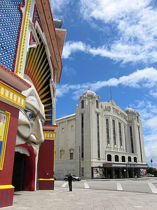
St Kilda is an inner seaside suburb in Melbourne, Victoria, Australia, 6 km south-east of the Melbourne central business district, located within the City of Port Phillip local government area. St Kilda recorded a population of 19,490 at the 2021 census.

<span class="mw-page-title-main">Middle Park, Victoria</span> Suburb of Melbourne, Victoria, Australia

Middle Park is an inner suburb in Melbourne, Victoria, Australia, 5 km south of Melbourne's Central Business District, located within the City of Port Phillip local government area. Middle Park recorded a population of 4,000 at the 2021 census.

<span class="mw-page-title-main">Albert Park, Victoria</span> Suburb of Melbourne, Victoria, Australia

Albert Park is an inner suburb of Melbourne, Victoria, Australia, 4 km (2.5 mi) south of Melbourne's Central Business District. The suburb is named after Albert Park, a large lakeside urban park located within the City of Port Phillip local government area. Albert Park recorded a population of 6,044 at the 2021 census.

<span class="mw-page-title-main">Port Melbourne</span> Suburb of Melbourne, Victoria, Australia

Port Melbourne is an inner-city suburb in Melbourne, Victoria, Australia, 3 km (2 mi) south-west of Melbourne's Central Business District, located within the Cities of Melbourne and Port Phillip local government areas. Port Melbourne recorded a population of 17,633 at the 2021 census.

<span class="mw-page-title-main">South Melbourne, Victoria</span> Suburb of Melbourne, Victoria, Australia

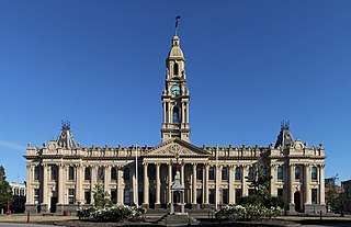
South Melbourne is an inner suburb in Melbourne, Victoria, Australia, 3 km south of Melbourne's Central Business District, located within the City of Port Phillip local government area. South Melbourne recorded a population of 11,548 at the 2021 census.

<span class="mw-page-title-main">Abbotsford, Victoria</span> Suburb of Melbourne, Victoria, Australia

Abbotsford is an inner-city suburb in Melbourne, Victoria, Australia, 2 km (1.2 mi) north-east of Melbourne's Central Business District, located within the City of Yarra local government area. Abbotsford recorded a population of 9,088 at the 2021 census.

<span class="mw-page-title-main">Fitzroy, Victoria</span> Suburb of Melbourne, Victoria, Australia

Fitzroy is an inner-city suburb in Melbourne, Victoria, Australia, 3 km (1.9 mi) north-east of Melbourne's Central Business District, located within the City of Yarra local government area. Fitzroy recorded a population of 10,431 at the 2021 census.

<span class="mw-page-title-main">South Yarra</span> Suburb of Melbourne, Victoria, Australia

South Yarra is an inner-city suburb in Melbourne, Victoria, Australia, 4 km south-east of Melbourne's Central Business District, located within the Cities of Melbourne and Stonnington local government areas. South Yarra recorded a population of 25,028 at the 2021 census.

<span class="mw-page-title-main">Carlton, Victoria</span> Suburb of Melbourne, Victoria, Australia

Carlton is an inner-city suburb in Melbourne, Victoria, Australia, three kilometres north of the Melbourne central business district within the City of Melbourne local government area. Carlton recorded a population of 16,055 at the 2021 census.

<span class="mw-page-title-main">East Melbourne</span> Suburb of Melbourne, Victoria, Australia

East Melbourne is an inner-city suburb in Melbourne, Victoria, Australia, 2 km (1.2 mi) east of Melbourne's Central Business District, located within the City of Melbourne local government area. East Melbourne recorded a population of 4,896 at the 2021 census.

<span class="mw-page-title-main">Flagstaff Gardens</span>

Flagstaff Gardens is the oldest park in Melbourne, Victoria, Australia, first established in 1862. Today it is one of the most visited and widely used parks in the city by residents, nearby office workers and tourists. The gardens are notable for their archaeological, horticultural, historical and social significance to the history of Melbourne.

<span class="mw-page-title-main">St Vincent Gardens</span>

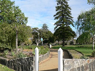
St Vincent Gardens in the Melbourne suburb of Albert Park, is an Australian park of national significance.

<span class="mw-page-title-main">Parks and gardens of Melbourne</span> Parks and gardens in Melbourne, VIC, Australia

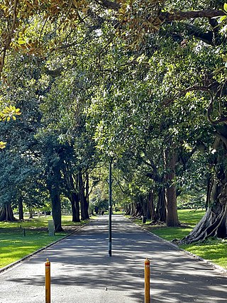
Melbourne is Australia's second largest city and widely considered to be a garden city, with Victoria being nicknamed "the Garden State". Renowned as one of the most livable cities in the world, there is an abundance of parks, gardens and green belts close to the CBD with a variety of common and rare plant species amid landscaped vistas, pedestrian pathways, and tree-lined avenues, all managed by Parks Victoria.

<span class="mw-page-title-main">Edinburgh Gardens</span>

Edinburgh Gardens is a large park located in the inner Melbourne suburb of North Fitzroy. It is bounded by Brunswick Street and St Georges Road to the west, the curve of Alfred Crescent to the north and east, and Freeman Street to the south. It was created from a grant of land in March 1862 by Queen Victoria and laid out by Clement Hodgkinson, who designed many of Melbourne's parks and gardens. At approximately 24 hectares in size, the park is large by inner urban standards.

<span class="mw-page-title-main">Housing Commission of Victoria</span>

The Housing Commission of Victoria was a Government of Victoria body responsible for public housing in Victoria, Australia. It was established in 1938, and was abolished in 1984.

Terrace houses in Australia

Terrace houses in Australia are mostly Victorian and Edwardian era terraced houses or replicas, almost always found in the older, inner city areas of the major cities, mainly Sydney and Melbourne. Terraced housing was introduced to Australia in the 19th century. Their architectural work was based on those in London and Paris, which had the style a century earlier.

<span class="mw-page-title-main">Victoria Street, East Sydney</span> Street in Sydney, Australia

Victoria Street is a suburban street located in the inner eastern suburbs of Sydney, in the City of Sydney local government area of New South Wales, Australia. From south to north, Victoria Street goes through the suburbs of Darlinghurst, Potts Point and the locality of Kings Cross. It is 1.6 kilometres (0.99 mi) in length. In the section in Darlinghurst, the street is one-way, from north to south only.

Albert Purchas was a prominent 19th century architect and surveyor in Melbourne, Australia.

Oakden, Addison and Kemp was an Australian architectural firm in Melbourne, Victoria. While it was short lived, existing from only 1887 to 1892, they designed a number of outstanding projects, and all three members designed many more notable projects in earlier and later partnerships.

<span class="mw-page-title-main">61-65 Harrington Street, The Rocks</span> Historic site in New South Wales, Australia

61-65 Harrington Street, The Rocks is a heritage-listed serviced apartments and former terrace house located at 61-65 Harrington Street, in the inner city Sydney suburb of The Rocks in the City of Sydney local government area of New South Wales, Australia. It was built from 1870 to. It is also known as Stafford Apartments and 75 Harrington Street; Clocktower Development. The property is owned by Property NSW, an agency of the Government of New South Wales. It was added to the New South Wales State Heritage Register on 10 May 2002.

References

Coordinates: 37°50′21″S144°57′18″E / 37.83917°S 144.95500°E / -37.83917; 144.95500