
Charing Cross Road is a street in central London running immediately north of St Martin-in-the-Fields to St Giles Circus, which then merges into Tottenham Court Road. It leads from the north in the direction of Charing Cross at the south side of Trafalgar Square. It connects via St Martin's Place and the motorised east side of the square.

St Giles Circus is a road junction in the St Giles district of the West End of London at the eastern end of Oxford Street, where it connects with New Oxford Street, Charing Cross Road and Tottenham Court Road, which it is more often referred to owing to the location of Tottenham Court Road Underground station directly under the junction. It is near to Soho, Covent Garden, Bloomsbury and Fitzrovia.

Llantwit Major is a town and community in Wales on the Bristol Channel coast. It is one of four towns in the Vale of Glamorgan, with the third largest population after Barry and Penarth, and ahead of Cowbridge. It is 4+1⁄2 miles (7.2 km) from Cowbridge, 9 miles (14 km) from Bridgend, 10 miles (16 km) from Barry, and 15 miles (24 km) from Cardiff. It had a population of 9,530 in 2021.

Coade stone or Lithodipyra or Lithodipra is stoneware that was often described as an artificial stone in the late 18th and early 19th centuries. It was used for moulding neoclassical statues, architectural decorations and garden ornaments of the highest quality that remain virtually weatherproof today.

Queen's Gate is a street in South Kensington, London, England. It runs south from Kensington Gardens' Queen's Gate to Old Brompton Road, intersecting Cromwell Road.

The Phoenix Garden is a local community garden in central London, England, established in 1984. Located in St Giles behind the Phoenix Theatre, within the London Borough of Camden, the Phoenix Garden is nestled between the busy Soho and Covent Garden areas. The Garden is located just off St Giles Passage and Stacey Street, north of Shaftesbury Avenue and east of Charing Cross Road.
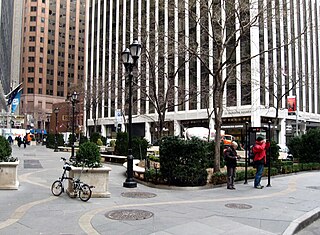
Hanover Square is a square with a public park in the Financial District of Lower Manhattan in New York City. It is triangular in shape, formed by the intersections of Pearl Street and Hanover Street; Pearl Street and a street named "Hanover Square" itself (whose opposite side of Pearl continues as Hanover St.; and William Street and Stone Street. The side between Hanover/Pearl intersection and William/Stone intersection is a pedestrian pathway along the building front facing the square and Pearl Street. Most surrounding buildings are primarily commercial.
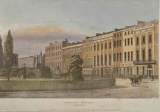
Portman Square is a garden square in Marylebone, central London, surrounded by townhouses. It was specifically for private housing let on long leases having a ground rent by the Portman Estate, which owns the private communal gardens. It marks the western end of Wigmore Street, which connects it to Cavendish Square to the east.

Arbour Square is a late Georgian square in Stepney, in the borough of Tower Hamlets, east London, England.

St John Clerkenwell is a former parish church in Clerkenwell, London, and now the priory church of the British Crown Order of St John.

National Cycle Route 57 is part of the United Kingdom's National Cycle Network. When complete, it will run west to east from Farmington, Gloucestershire near Northleach to Welwyn Garden City in Hertfordshire.

The Church of St John the Baptist, Hoxton, usually known as St John's Hoxton, is an Anglican parish church in the Hoxton area of Hackney, London N1.
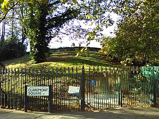
Claremont Square is a square in the Angel (Pentonville) part of Islington, London. Its central green mound, hiding a reservoir, is dotted with mature trees on all four sides (embankments). On its north side is Pentonville Road. It is lined on the south, east and west sides by early-nineteenth-century houses, and on the north side, across the arterial road, by heavily recessed apartment/office buildings. Many of the houses have been internally subdivided.

New Compton Street is a street in the London Borough of Camden that runs from Stacey Street in the south to St Giles High Street in the north. It is crossed only by St Giles Passage. At its southern end, on the western side, is the Phoenix Garden and the rear of the Odeon Covent Garden cinema, formerly the Saville Theatre, on the other side of the street.
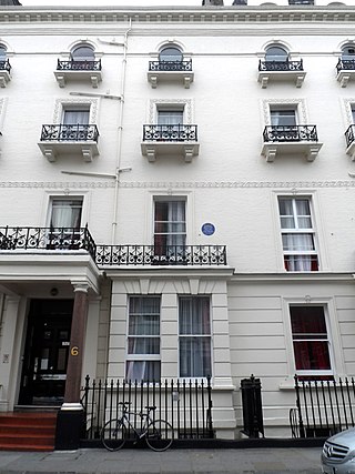
Grenville Place is a street in the Royal Borough of Kensington and Chelsea, London, that connects Cornwall Gardens and Launceston Place in the north with Cromwell Road in the south. It is crossed in its northern part by Cornwall Mews South, and joined on its western side by Emperor's Gate (twice). it is joined on its eastern side by Southwell Gardens.

Walcot Square is an 18th century garden triangle in Central London. The "square" is in the London Borough of Lambeth and has a very rare triangular shape. Since 1968 in planning policy it is a Conservation Area. Three rows of houses front its communal green, granted Grade II listed status under the statutory protective and recognition scheme in 1981.

Regent Square is a public square and street in the London Borough of Camden in London, England. It is located near Kings Cross and Bloomsbury.
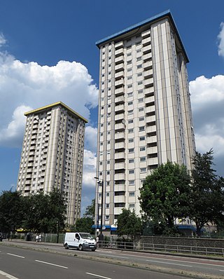
The Ampthill Square Estate, also known as the Ampthill Estate, is a housing estate in the London Borough of Camden in London, England. The estate is located in the Somers Town district, on the south side of Harrington Square, east side of Hampstead Road, and west side of Eversholt Street.

The Grove, Highgate, N6 is a short tree-lined street in north London, running north from Highgate West Hill to Hampstead Lane, known for the notable residents who have lived there over several centuries.
St Mary's Gardens is an 18th-century garden triangle in Central London. The "square" is in the London Borough of Lambeth and has an unusual triangular shape. Since 1968 in planning policy it is a Conservation Area. Three rows of houses front its communal green, granted Grade II listed status under the statutory protective and recognition scheme in 1981.


