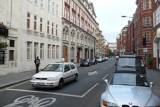
Charing Cross Road is a street in central London running immediately north of St Martin-in-the-Fields to St Giles Circus and then becomes Tottenham Court Road. It is so called because it leads from the north in the direction of Charing Cross at the south side of Trafalgar Square, which it connects via St Martin's Place and the motorised east side of the square.

The West End of London is a district of Central London, west of the City of London and north of the River Thames, in which many of the city's major tourist attractions, shops, businesses, government buildings and entertainment venues, including West End theatres, are concentrated.

Drury Lane is a street on the eastern boundary of the Covent Garden area of London, running between Aldwych and High Holborn. The northern part is in the borough of Camden and the southern part in the City of Westminster.

St Giles Circus is a road junction in the St Giles district of the West End of London at the eastern end of Oxford Street, where it connects with New Oxford Street, Charing Cross Road and Tottenham Court Road, which it is more often referred to owing to the location of Tottenham Court Road Underground station directly under the junction. It is near to Soho, Covent Garden, Bloomsbury and Fitzrovia.

Shaftesbury Avenue is a major road in the West End of London, named after The 7th Earl of Shaftesbury. It runs north-easterly from Piccadilly Circus to New Oxford Street, crossing Charing Cross Road at Cambridge Circus. From Piccadilly Circus to Cambridge Circus, it is in the City of Westminster, and from Cambridge Circus to New Oxford Street, it is in the London Borough of Camden.

Old Compton Street is a road that runs east–west through Soho in the West End of London.

Banbury Road is a major arterial road in Oxford, England, running from St Giles' at the south end, north towards Banbury through the leafy suburb of North Oxford and Summertown, with its local shopping centre. Parallel and to the west is the Woodstock Road, which it meets at the junction with St Giles'. To the north, Banbury Road meets the Oxford Ring Road at a roundabout. The road is designated the A4165. Prior to the building of the M40 motorway extension in 1990, the road formed part of the A423 from Maidenhead to Coventry.

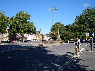
St Giles' is a wide boulevard leading north from the centre of Oxford, England. At its northern end, the road divides into Woodstock Road to the left and Banbury Road to the right, both major roads through North Oxford. At the southern end, the road continues as Magdalen Street at the junction with Beaumont Street to the west. Also to the west halfway along the street is Pusey Street. Like the rest of North Oxford, much of St Giles' is owned by St John's College.

Walton Street is on the eastern edge of the Jericho district of central Oxford, England.

St Sepulchre's Cemetery is located in Jericho, central Oxford, England.

The Phoenix Garden is a local community garden in central London, England, established in 1984. Located in St Giles behind the Phoenix Theatre, within the London Borough of Camden, the Phoenix Garden is nestled between the busy Soho and Covent Garden areas. The Garden is located just off St Giles Passage and Stacey Street, north of Shaftesbury Avenue and east of Charing Cross Road.

St Giles is an area in the West End of London in the London Borough of Camden. It gets its name from the parish church of St Giles in the Fields. The combined parishes of St Giles in the Fields and St George Bloomsbury were administered jointly for many centuries; leading to the conflation of the two, with much or all of St Giles usually taken to be a part of Bloomsbury. Points of interest include the church of St Giles in the Fields, Seven Dials, the Phoenix Garden and St Giles Circus.

Northampton Square, a green town square, is in a corner of Clerkenwell projecting into Finsbury, in Central London. It is between Goswell Road and St John Street, has a very broad pedestrian walkway on the north-west side between university buildings and is fronted chiefly by main buildings of City, University of London.

Holborn and Covent Garden is a ward of the London borough of Camden, in the United Kingdom. As the name suggests, it covers the parts of Holborn and Covent Garden that lie in Camden; the eastern part of Holborn lies in the City of London and the southern part of Covent Garden lies in the City of Westminster. For elections to Parliament, Holborn and Covent Garden is part of Holborn and St Pancras.

Fore Street is a street in the City of London near the Barbican Centre. It runs from Wood Street to Fore Street Avenue and is joined by Moor Lane on its north side. The street was extensively damaged by Nazi bombing during World War II and, following later development, nothing now remains of its original buildings other than St Giles-without-Cripplegate, which is a short distance away from the modern street.

Stacey Street is a street in the London Borough of Camden that runs from Shaftesbury Avenue in the south to Flitcroft Street in the north. It is joined on its east side by New Compton Street and on its west side by Phoenix Street which gave its name to the Phoenix Garden on the east side of Stacey Street.

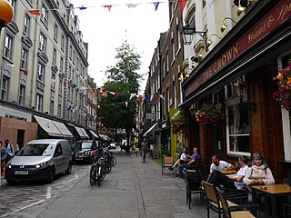
Monmouth Street is a street in the Seven Dials district of Covent Garden, London, England.

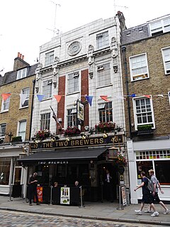
The Two Brewers is a pub in Covent Garden, London, at 40 Monmouth Street.

St George's Church is an Anglican church of modern design in the Parish of Norton in Letchworth Garden City in Hertfordshire. Opening in 1964 and arrow-shaped with a 120-foot concrete spire, the congregation are seated in a semi-circle facing the altar. The church building is in the style of the Liturgical Movement following World War II. It was Grade II listed in 2015 for "its striking architectural form, expressed through a diverse range of materials to provide an innovative building of real quality both in composition and detailing."

Gillygate is a street in York, in England, immediately north of the city centre.


