Related Research Articles

Brownstown is a borough in Cambria County, Pennsylvania, United States. The population was 744 at the 2010 census. It is part of the Johnstown, Pennsylvania Metropolitan Statistical Area and also part of Johnstown's urban area.

Cambria County is a county in the Commonwealth of Pennsylvania. As of the 2020 census, the population was 133,472. Its county seat is Ebensburg. The county was created on March 26, 1804, from parts of Bedford, Huntingdon, and Somerset Counties and later organized in 1807. It was named for the nation of Wales, which in Latin is known as "Cambria".

Cassandra is a borough in Cambria County, Pennsylvania, United States. The population was 147 at the 2010 census. It is part of the Johnstown, Pennsylvania Metropolitan Statistical Area.

Ebensburg is a borough and the county seat of Cambria County in the U.S. state of Pennsylvania. It is located 25 miles (40 km) west of Altoona and surrounded by Cambria Township. It is situated in the Allegheny Mountains at about 2,140 feet (650 m) above sea level. Ebensburg is located in a rich bituminous coal region. In the past, sawmills, tanneries, wool mills, and a foundry operated there. The number of residents in 1900 was 1,574, and in 1910, 1,978. The population was 3,351 at the 2010 census. It is part of the Johnstown, Pennsylvania Metropolitan Statistical Area.

Johnstown is the largest city in Cambria County, Pennsylvania, United States. The population was 18,411 as of the 2020 census. Located 57 miles (92 km) east of Pittsburgh, it is the principal city of the Johnstown metropolitan area, which includes Cambria County and had 133,472 residents in 2020. It is also part of the Johnstown–Somerset combined statistical area, which includes both Cambria and Somerset Counties.

Lower Yoder Township is a township in Cambria County, Pennsylvania, United States. The population was 2,699 at the 2010 census, down from 3,029 at the 2000 census. It is part of the Johnstown, Pennsylvania Metropolitan Statistical Area.

Southmont is a borough in Cambria County, Pennsylvania, United States. It is part of the Johnstown, Pennsylvania Metropolitan Statistical Area. The population was 2,284 at the 2010 census. It was incorporated in 1919 out of Upper Yoder Township.

Upper Yoder Township is a township in Cambria County, Pennsylvania, United States. The population was 5,449 at the 2010 census. It is part of the Johnstown, Pennsylvania Metropolitan Statistical Area.

Vintondale is a borough in Cambria County, Pennsylvania, United States. It is part of the Johnstown, Pennsylvania Metropolitan Statistical Area. The population was 414 as of the 2010 census.

Westmont is a borough in Cambria County, Pennsylvania, United States. It is part of the Johnstown, Pennsylvania Metropolitan Statistical Area. The population was 5,181 at the 2010 census, down from 5,523 at the 2000 census.

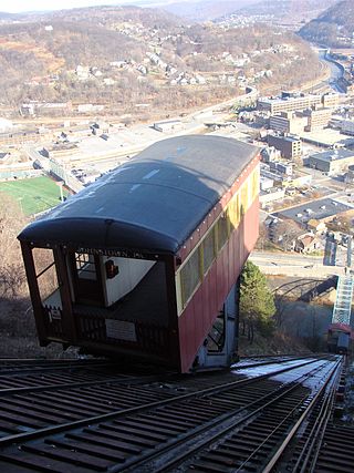
The Johnstown Inclined Plane is a 896.5-foot (273.3 m) funicular in Johnstown, Cambria County, in the U.S. state of Pennsylvania. The incline and its two stations connect the city of Johnstown, situated in a valley at the confluence of the Stonycreek and the Little Conemaugh rivers, to the borough of Westmont on Yoder Hill. The Johnstown Inclined Plane is billed as the "world's steepest vehicular inclined plane". It can carry automobiles and passengers, up or down a slope with a grade of 71.9%. The travel time between stations is 90 seconds.

The South Fork Dam was an earthenwork dam forming Lake Conemaugh, an artificial body of water near South Fork, Pennsylvania, United States. On May 31, 1889, the South Fork Dam failed catastrophically and 20 million tons of water from Lake Conemaugh burst through and raced 14 miles (23 km) downstream, causing the Johnstown Flood.

The Laurel Highlands is a region in southwestern Pennsylvania made up of Fayette County, Somerset County, and Westmoreland County. It has a population of about 600,000 people.
The Rolling Mill Mine was a drift portal coal mine in operation in Johnstown, Cambria County, Pennsylvania, operating from approximately 1856 until 1931. It was originally owned by the Cambria Iron Company and was developed in the Westmont hillside across the Conemaugh River from the company's rolling mill. Its portal was near the confluence of the Stonycreek River and Little Conemaugh River. It supplied the bulk of the coal used in the iron and steel making taking place in the city, producing an average of 3,000 tons a day in 1902, and primarily employed recent immigrants from Central and Eastern Europe.

The Cambria County War Memorial Arena is a 4,001-seat multi-purpose arena in Johnstown, Pennsylvania, United States. It is managed by SMG Entertainment.

Rothrock State Forest is a Pennsylvania state forest in Pennsylvania Bureau of Forestry District #5. The main offices are located in Huntingdon in Huntingdon County, Pennsylvania in the United States.

Ravensburg State Park is a Pennsylvania state park in Crawford Township in Clinton County, Pennsylvania in the United States. It is in a gorge carved by Rauchtown Run through the side of Nippenose Mountain. Ravensburg State Park is 78 acres (32 ha) of wooded land that is almost entirely surrounded by Tiadaghton State Forest. This state park is on Pennsylvania Route 880, 8 miles (13 km) north of Carroll and 8 miles (13 km) south-east of Jersey Shore. The nearest city is Williamsport.

The Cambria Iron Company of Johnstown, Pennsylvania was a major 19th-century industrial producer of iron and steel founded in 1852. The company had the nation's largest steel foundry in the 1870s and was renamed the Cambria Steel Company in 1898. The company used many innovations in the steelmaking process, including those of William Kelly and Henry Bessemer. The company was acquired in 1923 by the Bethlehem Steel Company. The company's historic facilities, extending some 12 miles (19 km) along the Conemaugh and Little Conemaugh Rivers, are a National Historic Landmark District.

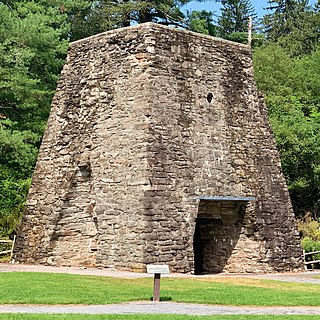
Pine Grove Furnace State Park is a protected Pennsylvania area that includes Laurel and Fuller Lakes in Cooke Township of Cumberland County. The Park accommodates various outdoor recreation activities, protects the remains of the Pine Grove Iron Works (1764), and was the site of Laurel Forge (1830), Pine Grove Park (1880s), and a brick plant (1892). The Park is 8 miles (13 km) from exit 37 of Interstate 81 on Pennsylvania Route 233.

The Inclined Plane Bridge is a 237-foot (72 m), Pennsylvania through truss bridge that spans Stonycreek River in Johnstown, Cambria County, in the U.S. state of Pennsylvania. It connects the city to the lower station of the Johnstown Inclined Plane. The bridge was listed on the National Register of Historic Places in 1988 and was documented by the Historic American Engineering Record (HAER) in 1997.
References
- ↑ "Park History". Powell Stackhouse Park. Stackhouse Park. Retrieved 26 December 2014.
- ↑ Facebook: Morley's Run (2012)
- ↑ Morley's Run: Course Description