Related Research Articles

Orange County is located in southern Indiana in the United States. As of 2020, its population was 19,867. The county seat is Paoli. The county has four incorporated settlements with a total population of about 8,600, as well as several small unincorporated communities. It is divided into 10 townships which provide local services. One U.S. route and five Indiana state roads pass through or into the county.

Perry Township is one of six townships in Martin County, Indiana, United States. As of the 2020 census, its population was 5,060 and it contained 2,269 housing units.

Indian Creek Township is one of nine townships in Lawrence County, Indiana, United States. As of the 2020 census, its population was 2,736 and it contained 1,176 housing units.

Pleasant Run Township is one of nine townships in Lawrence County, Indiana, United States. As of the 2010 census, its population was 1,883 and it contained 862 housing units.

French Lick Township is one of ten townships in Orange County, Indiana, United States. As of the 2020 census, its population was 4,576 and it contained 2,227 housing units.

Greenfield Township is one of ten townships in Orange County, Indiana, United States. As of the 2020 census, its population was 746 and it contained 494 housing units.

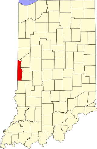
Northwest Township is one of ten townships in Orange County, Indiana, United States. As of the 2020 census, its population was 330 and it contained 183 housing units.

Paoli Township is one of ten townships in Orange County, Indiana, United States. As of the 2020 census, its population was 6,038 and it contained 2,630 housing units.

Southeast Township is one of ten townships in Orange County, Indiana, United States. As of the 2020 census, its population was 1,541 and it contained 725 housing units.

Stampers Creek Township is one of ten townships in Orange County, Indiana, United States. As of the 2020 census, its population was 1,037 and it contained 384 housing units.

Vernon Township is one of thirteen townships in Washington County, Indiana, United States. As of the 2020 census, its population was 667 and it contained 263 housing units.
Aquia is an unincorporated community in Stafford County, in the U.S. state of Virginia. It is named for Aquia Creek, which leads to the Potomac River. Nearby historic locations include Aquia Church and the remains of Aquia quarry. Cliffs of the local Aquia Creek sandstone had been visible from the Potomac River near its confluence with Aquia Creek during colonial times. It was quarried to construct many buildings nearby, as well as in Washington, D.C., including the White House, National Capitol Columns and Washington Monument. It was a stop on the Richmond, Fredericksburg and Potomac Railroad which was replaced by, CSXT.

Rush Creek Valley is an unincorporated community in Jefferson Township, Washington County, in the U.S. state of Indiana.
Mount Carmel is an unincorporated community in Brown Township, Washington County, in the U.S. state of Indiana.
Harristown is an unincorporated community in Washington Township, Washington County, in the U.S. state of Indiana.
Brackentown is an unincorporated community in Sumner County, Tennessee, in the United States.
Youngs Creek is a stream in Orange County, in the U.S. state of Indiana.
Delaney Creek is a stream in Washington County, in the U.S. state of Indiana.
Cane Creek is a stream in the U.S. state of Indiana.
Montezuma Station is an extinct town in Helt Township, Vermillion County, in the U.S. state of Indiana.
References
38°35′00″N86°23′12″W / 38.58333°N 86.38667°W
| | This article related to a river in Indiana is a stub. You can help Wikipedia by expanding it. |