Starkville, Ontario

Last updated
Starkville
Dispersed rural community
Starkville, Ontario.jpg
Concession Road 5 in Starkville
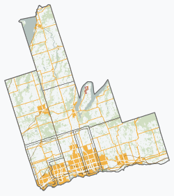
Durham locator map 2021.svg
Red pog.svg
Starkville
Canada Southern Ontario location map 2.png
Red pog.svg
Starkville
Coordinates: 43°59′35″N78°30′52″W / 43.99306°N 78.51444°W / 43.99306; -78.51444
CountryCanada
Province Ontario
Regional municipality Durham Region
Municipality Clarington
Time zone UTC-5 (Eastern (EST))
  Summer (DST) UTC-4 (EDT)
GNBC CodeFCSAG [1]

Starkville is a dispersed rural community in Clarington, Durham Region, Ontario, Canada. [1] [2]
History

William and Mary Stark were early settlers, immigrating from Scotland in 1842. [3]

Starkville Post Office opened in 1882, and remained open until 1928. [4] [5] Starkville School opened in 1902. [3]

The population in 1896 was approximately 45. [6]

A branch of the Federated Women's Institutes of Ontario was located in Starkville from 1906 to 1923. [7]

Starkville Station was located 1 mile (1.6 km) south of Starkville, along a now-abandoned branch of the Canadian Northern Railway. [8]

References

  1. 1 2 "Starkville". Natural Resources Canada. February 16, 2021.
  2. "Clarington". Statistics Canada. November 2, 2016.
  3. 1 2 Higgins, Bev (November 7, 1990). "Starkville Corners". Orono Weekly Times.
  4. "Starkville". Library and Archives Canada. July 10, 2025.
  5. "You Still Have Mail". Orono Weekly Times. Retrieved August 2, 2025.
  6. The Union Publishing Co's Farmers and Business Directory for the Counties of Durham, Haliburton, Northumberland, Peterboro' and Victoria, 1896. Vol. IX. Union Publishing. 1896. p. 337.
  7. "Starkville Women's Institute". ourdigitalworld.org. Retrieved August 2, 2025.
  8. "Graham Creek Background Report: Abiotic, Biotic and Cultural Features" (PDF). Ganaraska Region Conservation Authority. 2009.