
Verran is a municipality in Trøndelag county, Norway. It is part of the Innherred region. The administrative centre of the municipality is the village of Malm. Other villages in Verran include Follafoss, Sela, Verrabotn, and Verrastranda.

Fosnes is a municipality in Trøndelag county, Norway. It is part of the Namdalen region. The administrative centre of the municipality is the village of Dun on the island of Jøa. Other villages include Salsnes and Nufsfjord.

Sverkmoen is a farm area in the municipality of Namdalseid in Trøndelag county, Norway. It is located west of the village of Namdalseid, between the lake Øyungen and the river Sverka which flows through a flat landscape area covered with forests.

Innherred or Innherad is a traditional district in Trøndelag county in the central part of Norway. It consists of the areas around the inner part of the Trondheimsfjord in the central-east part of the county. The district includes the municipalities of Levanger, Frosta, Steinkjer, Verdal, Inderøy, and Verran. Sometimes, the municipalities of Snåsa and Namdalseid are also included in the Innherred district. The area encompasses about 7,913 square kilometres (3,055 sq mi) and about 68,062 residents (2004). There are several larger towns/cities in Innherred including Steinkjer, Levanger, and Verdalsøra.

Roan is a municipality in Trøndelag county, Norway. It is part of the Fosen region in the northern part of the county. The administrative centre of the municipality is the village of Roan. Other villages include Bessaker, Brandsfjord, and Hofstad.
Malm (help·info) is the administrative centre of the municipality of Verran in Trøndelag county, Norway. The village of Malm is located along the Breistadsundet strait which flows into the Trondheimsfjorden. The village of Bartnes lies across the strait from Malm. The village lies about a 32 kilometres (20 mi) drive northwest of the town of Steinkjer, about 12 kilometres (7.5 mi) northwest of the village of Follafoss, and about 20 kilometres (12 mi) south of the village of Namdalseid. The Norwegian County Road 720 runs through the village.

Eidsvatnet is a lake on the border of the municipalities of Høylandet and Overhalla in Trøndelag county, Norway. The 15.87-square-kilometre (6.13 sq mi) lake lies about 5 kilometres (3.1 mi) northeast of the village of Skogmo. The lake empties into the river Bjøra which flows a short distance into the large river Namsen.
Finnvollvatnet is a lake in the municipality of Namdalseid in Trøndelag county, Norway. The 2.97-square-kilometre (1.15 sq mi) lake lies in the western part of the municipality, southwest of the village of Sverkmoen, and only about 3 kilometres (1.9 mi) from the border with the neighboring municipality of Osen. The lake flows out into the Sverka river which eventually ends up in the Namsenfjorden.
Gilten is a lake in the municipality of Steinkjer in Trøndelag county, Norway. The 31.62-square-kilometre (12.21 sq mi) lake lies in the northern part of Steinkjer, about 8 kilometres (5.0 mi) northeast of the village of Kvam, about 1.5 kilometres (0.93 mi) north of the village of Følling, and about 14 kilometres (8.7 mi) east of the village of Namdalseid. The lake is only accessible by road from Namdalseid, even though most of the 31.62-square-kilometre (12.21 sq mi) lake lies in Steinkjer. The lake Bangsjøan lies to the northeast and the lake Snåsavatnet lies to the south.

Otterøy is a former municipality in the old Nord-Trøndelag county, Norway. The 272-square-kilometre (105 sq mi) municipality existed from 1913 until its dissolution in 1964. It was located in the what is now the municipalities of Namsos and Namdalseid in Trøndelag county. The former municipality included most of the island of Otterøya, the island of Hoddøya, the southwestern part of the island of Elvalandet, and some of the mainland southwest of Otterøya and Hoddøya. The area contains good farmland and also good salmon fishing. The main church for the area is Otterøy Church.
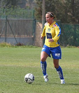
Kristin Lie is a Norwegian former footballer who played as a striker for Egge. She was also capped while playing for Norway.
Sjøåsen is a village in the municipality of Namdalseid in Trøndelag county, Norway. It is located at the mouth of the river Årgårdselva at the end of the Løgnin arm of the Namsenfjorden. It is located along Norwegian County Road 17 at the intersection with Norwegian County Road 766 which goes north to the neighboring municipalities of Flatanger and Osen.
The Namsenfjorden or Namsfjorden is a fjord in Trøndelag county, Norway. The 35-kilometre (22 mi) long fjord flows along the border between the municipalities of Namsos, Namdalseid, and Flatanger. It runs southeast from the Folda firth, between the mainland in the south and the island of Otterøya in the north, past the island of Hoddøya, to the Namsen river estuary in the town of Namsos. The banks of the fjord are mostly wooded and not very high. Near the town of Namsos, the Løgnin fjord arm branches to the south all the way to the village of Sjøåsen in Namdalseid. Other villages along the fjord include Statland, Tøttdalen, Skomsvoll, Bangsund, and Spillum.

Namdalseid Church is a parish church of the Church of Norway in Namdalseid municipality in Trøndelag county, Norway. It is located in the village of Namdalseid, along Norwegian County Road 17. It is the church for the Namdalseid parish which is part of the Nord-Innherad prosti (deanery) in the Diocese of Nidaros. The white, wooden church was built in a long church style in 1858 by the architect Christian Heinrich Grosch. The church seats about 350 people.
Statland Church is a parish church of the Church of Norway in Namdalseid municipality in Trøndelag county, Norway. It is located in the village of Statland. It is the church for the Statland parish which is part of the Nord-Innherad prosti (deanery) in the Diocese of Nidaros. The white, wooden church was built in a long church style in 1992 by the architect Reidar Moholdt. The church seats about 140 people. The church was consecrated on 10 May 1992 by Bishop Finn Wagle.
Skomsvoll is a village on the island of Otterøya in the municipality of Namsos in Trøndelag county, Norway. It is located on the south side of the island, along the Namsenfjorden. The village of Statland lies across the fjord from Skomsvoll, with the island of Hoddøya nearby. The main church for the island, Otterøy Church is located in Skomsvoll.
Beitstad is a former municipality in what was Nord-Trøndelag county, Norway. The 201-square-kilometre (78 sq mi) municipality existed from 1838 until its dissolution in 1964. The municipality encompassed what is now the northeastern part of the municipality of Steinkjer in Trøndelag county. Beitstad was originally quite large, but by 1964, it included the areas east of the Beitstadsundet and Hjellbotn bay and north of the inner-most parts of the Trondheimsfjorden. The administrative centre was the village of Beitstad where Beitstad Church is located.
Namdalseid is the administrative centre of Namdalseid municipality in Trøndelag county, Norway. The village is located along the Norwegian County Road 17, about 30 kilometres (19 mi) north of the town of Steinkjer and about the same distance south of the town of Namsos. The Namdalseid Church sits just southwest of the village. There's a school in the village as well.


