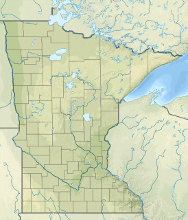
The Sunrise River is a 39.1-mile-long (62.9 km) tributary of the St. Croix River in east–central Minnesota in the United States. It is formed at the city of Forest Lake in Washington County at the outlet of Forest Lake. The river flows north, accepting the South Branch from the west near the city of Wyoming, and continues north into Mud Lake, where the West Branch, which rises in southeast Isanti County and briefly enters Anoka County, joins it near the city of Stacy. From Stacy it flows generally north-northwest through Chisago County to meet the St. Croix River within Wild River State Park near the communities of Sunrise and Almelund. Not far upstream from its mouth, the Sunrise collects its North Branch, which rises in Isanti County and flows through the city of North Branch.

Peary is an unincorporated community in Saint Louis County, Minnesota, United States.

Angora is an unincorporated community in Angora Township, Saint Louis County, Minnesota, United States.

The Caribou River is a 15.0-mile-long (24.1 km) river in northern Minnesota, the United States. It rises in a swamp about .6 miles (1 km) south of Morris Lake and two miles (3.2 km) east of Echo Lake, near the Lake/Cook County line, at an altitude about 1620 feet above sea level. It descends some 1,020 feet in elevation as it flows south to its mouth at Lake Superior, also near the eastern border of Lake County.

The Cross River is a 20.4-mile-long (32.8 km) river in northern Minnesota, the United States. It is a direct tributary of Lake Superior.
Flandreau Creek is a 41.0-mile-long (66.0 km) river in Minnesota and South Dakota.

Jack Creek is a 64-mile-long (103 km) stream in southern Minnesota in the United States. It is a tributary of Heron Lake, the outlet of which flows to the Des Moines River.

The Little Cannon River is a 30.6-mile-long (49.2 km) river of Minnesota in the United States. It flows into the Cannon River at the city of Cannon Falls. A section of the Little Cannon River south of Sogn, Minnesota is a designated trout stream by the Minnesota Department of Natural Resources.
The Little Stewart River is an 8.9-mile-long (14.3 km) river in Lake County, Minnesota, United States. It is a tributary of the Stewart River.

Okabena Creek is a 40-mile-long (64 km) waterway in southern Minnesota. It is a tributary, via the short Diversion Creek, of Heron Lake, the outlet of which flows to the Des Moines River. Okabena Creek begins in Worthington, Minnesota, connecting by a ditch to the outlet of Okabena Lake, then flows northeast past the towns of Brewster and Okabena to the Heron Lake/South Heron Lake system.

The Onion River is a 6.1-mile-long (9.8 km) stream in northeastern Minnesota, the United States, flowing directly into Lake Superior.

Pine Creek is a 23.7-mile-long (38.1 km) tributary of the Mississippi River in Winona and Houston counties, Minnesota, United States. Pine Creek joins the Mississippi southeast of La Crescent, Minnesota, directly across from La Crosse, Wisconsin.

Pipestone Creek is a 53.2-mile-long (85.6 km) river in southwestern Minnesota and northeastern South Dakota.

Wells Creek is a 27.6-mile-long (44.4 km) tributary of the Mississippi River in Wabasha and Goodhue counties in Minnesota, United States. It enters the Mississippi at Old Frontenac.

Swan River is an unincorporated community in southeast Itasca County, Minnesota, United States.

Mildred is an unincorporated community in Pine River Township, Cass County, Minnesota, United States, near Pine River and Backus.

Stewart Lake is a lake in Crow Wing County, in the U.S. state of Minnesota.

Belle Creek is a trout stream in Goodhue County, in the U.S. state of Minnesota. It is a tributary of the Cannon River.

Paupores is an unincorporated community in St. Louis County, in the U.S. state of Minnesota.


