Stikine, meaning "great river" in the Tlingit language, may refer to:
The Tlingit language is spoken by the Tlingit people of Southeast Alaska and Western Canada. It is a branch of the Na-Dene language family. Extensive effort is being put into revitalization programs in Southeast Alaska to revive and preserve the Tlingit language and culture.
- Geography and locations
- the Stikine River, a major river in British Columbia and Alaska
- Stikine Strait, a marine waterway in Alaska offshore from the mouth of the Stikine River, near Wrangell, Alaska
- Fort Stikine, a trading post and fortification of the Hudson's Bay Company at what is now Wrangell, Alaska
- the Stikine Country, aka the Stikine District, a geographic region of the Canadian province of British Columbia, roughly equivalent to the Stikine Mining Division aka Stikine Mining District of the British Columbia Dept. of Mines
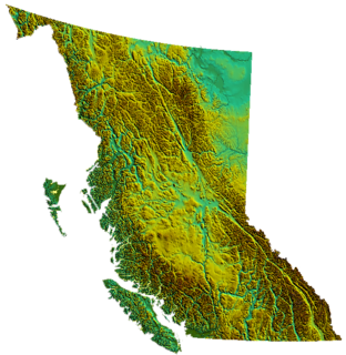
- the Stikine Plateau, a large regional landform in northwestern British Columbia, inclusive of the Stikine and Taku River basins
- the Stikine Ranges, a major subgrouping of the Cassiar Mountains of northern British Columbia
- Stikine, British Columbia, aka Boundary, an unincorporated locality and former customs post on the lower Stikine River
- Stikine River Provincial Park, a provincial park protecting the Grand Canyon of the Stikine River
- Stikine Hot Springs, a hot spring on the lower Stikine River protected by Choquette Hot Springs Provincial Park
- the Stikine Volcanic Belt, a subgrouping of volcanoes within the Northern Cordilleran Volcanic Province in British Columbia
- the Stikine Icecap, a large icefield in the Boundary Ranges of the Coast Mountains, spanning the British Columbia-Alaska border
- Stikine-LeConte Wilderness, a park in the Alaska Panhandle
- Tongass/Stikine National Forest, aka the Tongass National Forest, a US national forest in Alaska

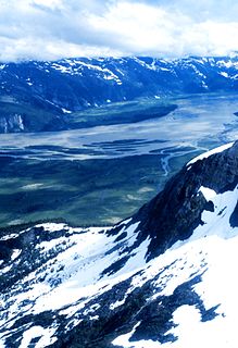
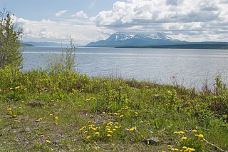
The Stikine River is a river, historically also the Stickeen River, approximately 610 km (379 mi) long, in northwestern British Columbia in Canada and in southeast Alaska in the United States.
The Stikine Strait is a strait in the Alexander Archipelago of Alaska, located between Zarembo Island to the west and Etolin and Woronkofski Islands just southwest of the City of Wrangell. The strait's name derives from that of the Stikine River, the outlet of which is just northeast of Wrangell. The strait is shown on an 1844 Russian chart, but the name was first published on Russian Admiralty charts in 1848 as Proliv Stakhinskiy or Stakhin Strait. Other spelling variants over time have been Frances Strait, Stachin Strait, Stachine Strait, Stackine Strait, Stahkeen Strait, Stahkin Strait, Stakeen Strait, Stakhinski Strait, Stickeen Strait, and Stikeen Strait
Fort Stikine was a fur trade post and fortification in what is now the Alaska Panhandle, at the site of the present-day of Wrangell, Alaska, United States. Originally built as the Redoubt San Dionisio or Redoubt Saint Dionysius in 1834, the site was transferred to the British-owned Hudson's Bay Company as part of a lease signed in the region in 1838, and renamed Fort Stikine when turned into a Hudson's Bay Company post in 1839. The post was closed and decommissioned by 1843 but the name remained for the large village of the Stikine people which had grown around it, becoming known as Shakesville in reference to its ruling Chief Shakes by the 1860s. With the Alaska Purchase of 1867, the fortification became occupied by the US Army and was renamed Fort Wrangel, a reference to Baron von Wrangel, who had been Governor of Russian America when the fort was founded. The site today is now part of the city of Wrangell.
- Political units
- the Stikine Territory, formally the Stickeen Territories, a former British overseas territory established in 1861, absorbed into the Colony of British Columbia in 1863
- the Stikine Region, an administrative region of the Canadian province of British Columbia
- the Regional District of Kitimat-Stikine, a regional district in northwestern British Columbia
- Stikine (provincial electoral district), a provincial electoral district in northwestern British Columbia

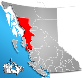
The Stikine Region is an unincorporated area in northwesternmost British Columbia, Canada and is the only area in B.C. not in a regional district. The Stikine Region was left unincorporated following legislation that established the province's regional districts in 1968 and is not classified as a regional district. It contains no municipal governments which normally constitute the majority of seats on the boards of regional districts. There is only one local planning area, the Atlin Community Planning Area, which was combined in 2009 with the Atlin Community Improvement District to provide fire, landfill, water, streetlighting, sidewalks and advisory land use services. All other services not provided privately are administered directly by various provincial government ministries. The area around Dease Lake, formerly in the Stikine Region, is now within the boundaries of the Regional District of Kitimat-Stikine following a boundary amendment in 2008.
The Regional District of Kitimat-Stikine is a type of local government administration in northwestern British Columbia, Canada. As of the Canada 2001 Census it had a population of 40,876 living on a land area of 91,910.63 km². Its administrative offices are in the city of Terrace. The next-largest municipality in the regional district is the District Municipality of Kitimat. The other incorporated municipalities in the regional district are the Village of Hazelton, the District of New Hazelton and the District of Stewart. Unincorporated communities are many, most of them Indian Reserves which are not part of the governmental system of the regional district, which has limited powers relating mostly to municipal-type services. The remote settlement of Dease Lake, formerly in the Stikine Region, was added to the regional district on December 1, 2007.

Stikine is a provincial electoral district in British Columbia, Canada established by the Electoral Districts Act, 2008. It came into effect upon the dissolution of the BC Legislature in April 2009, and was first contested in the 2009 provincial election, and most recently in the 2017 provincial election.
- People
- Stikine people (Shtaxʼhéen Ḵwáan), a ḵwáan or regional group of the Tlingit
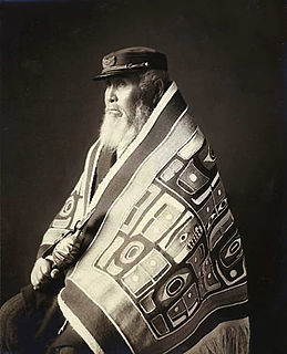
The Stikine people are a ḵwáan or regional group of the Tlingit, today based at Wrangell, Alaska. Their historical territory included Wrangell Island and other islands of the Alexander Archipelago, as well as the basin of the lower Stikine River.
| This disambiguation page lists articles about distinct geographical locations with the same name. If an internal link led you here, you may wish to change the link to point directly to the intended article. |