
The Sierra Nevada is a mountain range in the Western United States, between the Central Valley of California and the Great Basin. The vast majority of the range lies in the state of California, although the Carson Range spur lies primarily in Nevada. The Sierra Nevada is part of the American Cordillera, an almost continuous chain of mountain ranges that forms the western "backbone" of the Americas.

Alta Sierra is a census-designated place (CDP) in Nevada County, California, United States. The population was 6,911 at the 2010 census, up from 6,522 at the 2000 census.

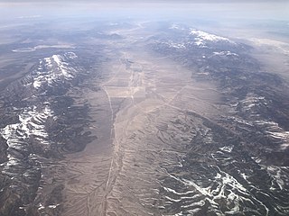
The Wasatch Range or Wasatch Mountains is a mountain range in the western United States that runs about 160 miles (260 km) from the Utah-Idaho border south to central Utah. It is the western edge of the greater Rocky Mountains, and the eastern edge of the Great Basin region. The northern extension of the Wasatch Range, the Bear River Mountains, extends just into Idaho, constituting all of the Wasatch Range in that state.

The Feather River is the principal tributary of the Sacramento River, in the Sacramento Valley of Northern California. The river's main stem is about 73 miles (117 km) long. Its length to its most distant headwater tributary is just over 210 miles (340 km). The main stem Feather River begins in Lake Oroville, where its four long tributary forks join—the South Fork, Middle Fork, North Fork, and West Branch Feather Rivers. These and other tributaries drain part of the northern Sierra Nevada, and the extreme southern Cascades, as well as a small portion of the Sacramento Valley. The total drainage basin is about 6,200 square miles (16,000 km2), with approximately 3,604 square miles (9,330 km2) above Lake Oroville.

Lake Oroville is a reservoir formed by the Oroville Dam impounding the Feather River, located in Butte County, northern California. The lake is situated 5 miles (8 km) northeast of the city of Oroville, within the Lake Oroville State Recreation Area, in the western foothills of the Sierra Nevada. Known as the second-largest reservoir in California, Lake Oroville is treated as a keystone facility within the California State Water Project by storing water, providing flood control, recreation, freshwater releases to assist in controlling the salinity intrusion into the Sacramento-San Joaquin Delta and protecting fish and wildlife.

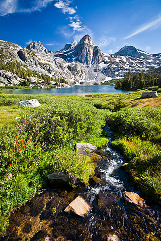
Sequoia National Forest is located in the southern Sierra Nevada mountains of California. The U.S. National Forest is named for the majestic Giant Sequoia trees which populate 38 distinct groves within the boundaries of the forest.

Butte College is a public community college in the Butte-Glenn Community College District in Chico, Orland, and Oroville, California.
Inskip is a ghost town in Butte County, California. It lies at an elevation of 4,777 feet in the northern Sierra Nevada near Lassen National Forest. The main surviving building is the Inskip Hotel, which is listed on the National Register of Historic Places.
The Steptoe Valley is a long basin located in White Pine County, in northeastern Nevada in the western United States. From the historic community of Currie, the valley runs south for approximately 100 miles (160 km). To the west are the high Egan Range and the Cherry Creek Range, while to the east is the even higher Schell Creek Range. U.S. Route 93 passes through much of the northern section of the valley, past the historic mining town of Cherry Creek and the communities of McGill and Ely, before crossing the Schell Creek Range at Connors Pass. Also found in this valley are the Ward Charcoal Ovens State Historic Park, the Steptoe Valley Wildlife Management Area, and Cave Lake State Park. At Egan Canyon and Schellbourne Pass, the Overland Stage Line and the subsequent Pony Express and Transcontinental Telegraph made their way through the mountains of central Nevada in the 1860s.
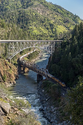
The North Fork Feather River is a watercourse of the northern Sierra Nevada and southern Cascades in the U.S. state of California. It flows generally southwards from its headwaters near Lassen Peak to Lake Oroville, a reservoir formed by Oroville Dam in the foothills of the Sierra, where it runs into the Feather River. The river drains about 2,100 square miles (5,400 km2) of the western slope of the Sierras. By discharge, it is the largest tributary of the Feather.

The Salinian Block or Salinian terrane is a geologic terrane which lies west of the main trace of the San Andreas Fault system in California. It is bounded on the south by the Big Pine Fault in Ventura County and on the west by the Nacimiento Fault. It was named for the Salinas Valley in Monterey County, California.

The Washoe Valley is a geographical region in the United States covering 66 square miles (170 km2) in southern Washoe County in the state of Nevada. Located between Reno and Carson City, it is named for the Washoe people, Native Americans who lived there before the arrival of Europeans. Slide Mountain and Mount Rose overlook the valley from the west.
Floriston is an unincorporated community and census-designated place in Nevada County, California. It is situated at an elevation of 5,400 ft (1,600 m) above sea level. Floriston is located on the Truckee River, 10 miles (16.1 km) east-northeast of Truckee. Formerly an important railroad stop and mill town, Floriston survives to this day as a small residential community. The population was 73 at the 2010 census.

North Table Mountain and South Table Mountain are two prominent basaltic mesas overlooking the city of Oroville, California. They lie a few miles north of Oroville in Butte County, California. In the scientific literature, both mesas are also known as North Oroville Table Mountain and South Oroville Table Mountain in order to differentiate them from the TuolumneTable Mountain, which is also capped by the eroded remnant of a basaltic lava flow, in the central foothills of California. They are named for their flat surface, like a table top; because of this it is often mistakenly called Table Top Mountain.
Blue Canyon–Nyack Airport is an airport in Emigrant Gap, Placer County, California.
Sugarloaf is in the name of two different mountains that are located in Butte County of northern California.

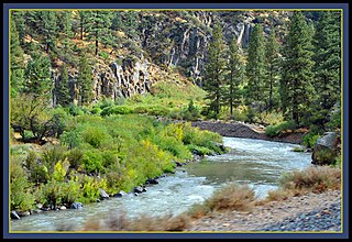
Deer Creek is a stream that flows through the Sierra Nevada Range in Northern California, USA. The 34 miles (55 km) stream begins above Scotts Flat Lake in the alpine region in the Tahoe National Forest, continues through the middle of downtown Nevada City, is a tributary to Lake Wildwood and ends as it enters the Yuba River below Englebright Lake.
The Elsinore Mountains are a ridge of mountains within the larger range of the Santa Ana Mountains, in the Cleveland National Forest, Riverside County, California, United States. the tallest peaks within the range is the unofficially named San Mateo Peak at 3,591 ft (1,095 m). Second is officially named Elsinore Peak at 3,536 ft (1,078 m). The Elsinore Mountanins run in a ridge from just east of El Cariso, southeast to Elsinore Peak. Beyond that peak the ridge begins to descend and curves to the east. From Elsinore Peak, a ridge runs to the west and then northwest to San Mateo Peak, enclosing the Morrell Potrero on the south and west.
The Sequoia and Kings Canyon National Parks is the consolidated management structure for Sequoia National Park and Kings Canyon National Park in California. The two parks have been jointly administered since 1943. They have a combined size of 1,353 square miles (3,500 km2). It was designated the UNESCO Sequoia-Kings Canyon Biosphere Reserve in 1976.
Canyon Creek is a major tributary of the South Yuba River in the Sierra Nevada mountain range.