
Otłoczynek is a village in the administrative district of Gmina Aleksandrów Kujawski, within Aleksandrów County, Kuyavian-Pomeranian Voivodeship, in north-central Poland. It lies 4 kilometres (2 mi) north of Aleksandrów Kujawski and 16 km (10 mi) south of Toruń.
Wielka Komorza is a village in the administrative district of Gmina Tuchola, within Tuchola County, Kuyavian-Pomeranian Voivodeship, in north-central Poland. It lies approximately 6 kilometres (4 mi) north-east of Tuchola and 60 km (37 mi) north of Bydgoszcz.
Błenna B is a village in the administrative district of Gmina Izbica Kujawska, within Włocławek County, Kuyavian-Pomeranian Voivodeship, in north-central Poland. It lies approximately 12 kilometres (7 mi) south-east of Izbica Kujawska, 33 km (21 mi) south of Włocławek, and 77 km (48 mi) south of Toruń.
Nowiny is a village in the administrative district of Gmina Żnin, within Żnin County, Kuyavian-Pomeranian Voivodeship, in north-central Poland. It lies approximately 12 kilometres (7 mi) west of Żnin and 40 km (25 mi) south-west of Bydgoszcz.
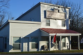
Wintergreen is a census-designated place (CDP) in Augusta and Nelson counties, Virginia, United States, located near Wintergreen Resort. The population as of the 2010 Census was 165.
Czerniczyn is a village in the administrative district of Gmina Hrubieszów, within Hrubieszów County, Lublin Voivodeship, in eastern Poland, close to the border with Ukraine. It lies approximately 7 kilometres (4 mi) south of Hrubieszów and 109 km (68 mi) south-east of the regional capital Lublin.
Złotoria-Kolonia is a village in the administrative district of Gmina Choroszcz, within Białystok County, Podlaskie Voivodeship, in north-eastern Poland.
Gonczary is a village in the administrative district of Gmina Michałowo, within Białystok County, Podlaskie Voivodeship, in north-eastern Poland, close to the border with Belarus.
Siemianówka is a village in the administrative district of Gmina Narewka, within Hajnówka County, Podlaskie Voivodeship, in north-eastern Poland, close to the border with Belarus.
Osiek Dolny is a village in the administrative district of Gmina Gołymin-Ośrodek, within Ciechanów County, Masovian Voivodeship, in east-central Poland.
Mieczysławówka is a village in the administrative district of Gmina Grójec, within Grójec County, Masovian Voivodeship, in east-central Poland.
Kuskowo-Bzury is a village in the administrative district of Gmina Strzegowo, within Mława County, Masovian Voivodeship, in east-central Poland.
Gąsiorowo is a village in the administrative district of Gmina Świercze, within Pułtusk County, Masovian Voivodeship, in east-central Poland.
Górki-Witowice is a village in the administrative district of Gmina Winnica, within Pułtusk County, Masovian Voivodeship, in east-central Poland.
Trzciel-Odbudowa is a village in the administrative district of Gmina Miedzichowo, within Nowy Tomyśl County, Greater Poland Voivodeship, in west-central Poland.
Danabórz is a village in the administrative district of Gmina Wągrowiec, within Wągrowiec County, Greater Poland Voivodeship, in west-central Poland. It lies approximately 10 kilometres (6 mi) north of Wągrowiec and 59 km (37 mi) north of the regional capital Poznań.

Djimla is a town and commune in Jijel Province, Algeria. According to the 1998 census it has a population of 15,513.

Bojišina is a village in the municipality of Leskovac, Serbia. According to the 2002 census, the village has a population of 245 people.
Väike-Lähtru is a village in Lääne-Nigula Parish, Lääne County, in western Estonia.

Miyaly is a town in Atyrau Region, west Kazakhstan. It lies at an altitude of 29 m (95 ft). It has a population of 6,213.


