Related Research Articles
Staffordshire Moorlands is a local government district in Staffordshire, England. Its council is based in Leek, the district's largest town. The district also contains the towns of Biddulph and Cheadle, along with a large rural area containing many villages. North-eastern parts of the district lie within the Peak District National Park.

The Borough of Newcastle-under-Lyme is a local government district with borough status in Staffordshire, England.

Bramhall is a large village in the Metropolitan Borough of Stockport, Greater Manchester, England. In 2011 it had a population of 17,436.
A civil parish is a country subdivision, forming the lowest unit of local government in England. There are 104 civil parishes in the ceremonial county of Berkshire, most of the county being parished; Reading is completely unparished; Bracknell Forest, West Berkshire and Wokingham are entirely parished. At the 2001 census, there were 483,882 people living in the 104 parishes, accounting for 60.5 per cent of the county's population.

A civil parish is a country subdivision, forming the lowest unit of local government in England. There are 14 civil parishes in the ceremonial county of Greater Manchester, most of the county being unparished; Bury, Rochdale, Salford and Stockport are completely unparished. At the 2001 census, there were 129,325 people living in the civil parishes, accounting for 5.2% of the county's population.

A civil parish is a subnational entity, forming the lowest unit of local government in England. There are 101 civil parishes in the ceremonial county of West Yorkshire, most of the county being unparished. At the 2001 census, there were 557,369 people living in the parishes, accounting for 26.8 per cent of the county's population.

A civil parish is a subnational entity, forming the lowest unit of local government in England. There are 21 civil parishes in the ceremonial county of West Midlands, most of the county being unparished; Dudley, Sandwell, Walsall and Wolverhampton are completely unparished. At the 2001 census, there were 89,621 people living in the parishes, accounting for 3.5 per cent of the county's population.

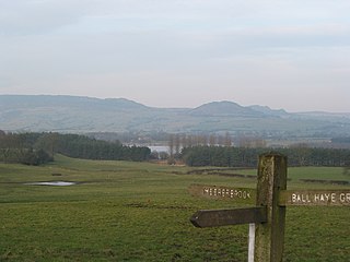
Cheadle is a market town and civil parish in the Staffordshire Moorlands District of Staffordshire, England, with a population of 12,000 at the 2021 census. It is located between Uttoxeter, Leek, Ashbourne and Stoke-on-Trent. Dating back to Anglo-Saxon times, it lies within the historic Staffordshire Hundred of Totmonslow; for administrative purposes, it is now part of the Staffordshire Moorlands area.

Hazel Grove and Bramhall was a civil parish and urban district in north east Cheshire, England from 1900 to 1974.
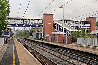
Cheadle Hulme railway station is a station in Cheadle Hulme, Greater Manchester, England. It is operated by Northern Trains.
Wolstanton was a rural district in Staffordshire, England from 1894 to 1904. It was created by the Local Government Act 1894 based on Wolstanton rural sanitary district.

The Municipal Borough of Leigh was, from 1899 to 1974, a local government district of the administrative county of Lancashire, England, consisting of the townships of Pennington, Westleigh, Bedford and part of the township of Atherton and named after the ancient ecclesiastical parish. The area contained the market town of Leigh that served as its administrative centre until its dissolution in 1974. The borough council built Leigh Town Hall which was completed in 1907.
Huyton with Roby Urban District was a local government district in Lancashire, England from 1894 to 1974. It consisted of the civil parish of Huyton with Roby which comprised the settlements of Huyton and Roby. It replaced the Huyton with Roby urban sanitary district.

Fiskerton is a village and former civil parish, now in the parish of Fiskerton cum Morton, in the Newark and Sherwood district, in the county of Nottinghamshire, England. It is on the west bank of the River Trent about 3 miles southeast of Southwell. The waterfront is home to million-pound residential properties, previously residences of merchants and businessmen who commuted in the 1800s to nearby Nottingham by rail from Fiskerton Station. In 1881 the parish had a population of 283.

A civil parish is a country subdivision, forming the lowest unit of local government in England. There are 218 civil parishes in the ceremonial county of Cornwall, which includes the Isles of Scilly. The county is effectively parished in its entirety; only the unpopulated Wolf Rock is unparished. At the 2001 census, there were 501,267 people living in the current parishes, accounting for the whole of the county's population. The final unparished areas of mainland Cornwall, around St Austell, were parished on 1 April 2009 to coincide with the structural changes to local government in England.

Chell is a suburb of the city of Stoke-on-Trent in the ceremonial county of Staffordshire, England, that can be subdivided into Little Chell, Great Chell and Chell Heath. It lies on the northern edge of the city, approximately 1-mile (1.6 km) from Tunstall, 2 miles (3.2 km) from Burslem and 3 miles (4.8 km) from the county border with Cheshire. Chell borders Pitts Hill to the west, Tunstall to the south west, Stanfield and Bradeley to the south, with the outlying villages of Packmoor and Brindley Ford to the north and Ball Green to the east. Since 2011 the area has been divided into the electoral wards of Bradeley & Chell Heath, Great Chell & Packmoor and Little Chell & Stanfield.

Cheadle Rural District was a rural district in the administrative county of Staffordshire, England from 1894 to 1974, covering an area in the north of the county centred on the small town of Cheadle.
References
- ↑ A Vision of Britain – Stoke Rural District Through Time Archived 30 September 2007 at the Wayback Machine
- ↑ A Vision of Britain – Cheadle Rural District Through Time Archived 30 September 2007 at the Wayback Machine
53°01′N2°08′W / 53.02°N 2.14°W
| | This Staffordshire location article is a stub. You can help Wikipedia by expanding it. |