Related Research Articles
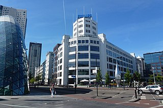
Eindhoven is a city and municipality of the Netherlands, located in the southern province of North Brabant of which it is its largest and is also located in the Dutch part of the natural region the Campine. With a population of 246,443 on a territory of 88.92 km², it is the fifth-largest city of the Netherlands and the largest outside the Randstad conurbation.
Bouches-du-Rhin was a department of the First French Empire in the present-day Netherlands. It was named after the mouth of the river Rhine. It was formed in 1810, when the Kingdom of Holland was annexed by France. Its territory corresponded with the eastern half of the present-day Dutch province of North Brabant and a part of the province of Gelderland. Its capital was 's-Hertogenbosch.

Tongelre is a borough of Eindhoven. It used to be a separate village to the east of Eindhoven. Waterways comprise most of its borders. It is bordered to the south by a canal, the "Eindhovensch Kanaal" to the borough of Stratum and Geldrop municipality. In the northwest the border with Woensel borough is formed by the river "Dommel" and to the east by the river "Kleine Dommel" towards Nuenen municipality.
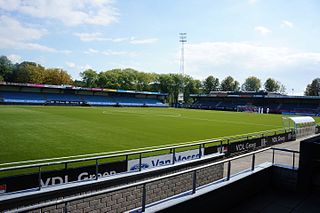
Jan Louwers Stadion is a multi-use stadium in the Eindhoven borough of Stratum, Netherlands.
Woensel is a former town in the Dutch province of North Brabant, but nowadays a borough of Eindhoven.

Gestel en Blaarthem is a former municipality of the Netherlands. The municipality was made up of the villages of Gestel and Blaarthem. On 1 Januari 1920 the municipality merged with the municipality of Eindhoven, together with the former municipalities of Stratum, Strijp, Tongelre and Woensel.
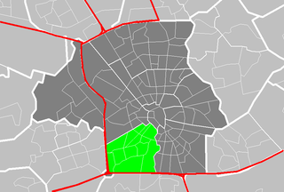
Gestel is a borough in the southwestern part of the city of Eindhoven, Netherlands. Gestel used to be a separate village, and until 1920 was part of the separate municipality of Gestel en Blaarthem.
Strijp is a former town in the Dutch province of North Brabant, now a borough of Eindhoven.

Vessem, Wintelre en Knegsel was a municipality in the Dutch province of North Brabant. It was located west of Eindhoven, and covered the villages of Vessem, Wintelre and Knegsel.

Schiebroek is a former village in the province of South Holland, Netherlands. It is now a neighbourhood of Rotterdam, and part of the borough of Hillegersberg-Schiebroek.

Fresno de Rodilla is a municipality located in the province of Burgos, Castile and León, Spain. According to the 2004 census (INE), the municipality has a population of 46 inhabitants.

Quintanavides is a municipality and town located in the province of Burgos, Castile and León, Spain. According to the 2004 census (INE), the municipality has a population of 118 inhabitants.
Kayon is a village in the Zimtenga Department of Bam Province in northern-central Burkina Faso. It has a population of 479.
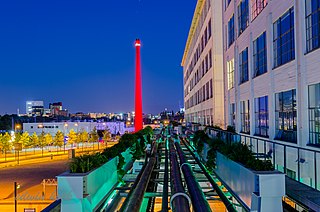
The High Tech Campus Eindhoven is a high tech center and R&D ecosystem on the Southern edge of the Dutch city of Eindhoven. In 2016, the High Tech Campus is home to more than 140 companies and institutions, comprising over 10,000 product developers, researchers and entrepreneurs and an estimated 85 nationalities. The Financial Times, Fortune, Forbes and others have praised the High Tech Campus Eindhoven (HTCE) as one of the best locations in the world for high-tech venture development and startup activity. As such, the HTCE is an innovation district, a targeted area with a huge potential for innovation and entrepreneurship.
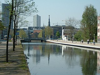
The Eindhovensch Kanaal is a canal in the Dutch province of North Brabant. It connects the center of Eindhoven with the Zuid-Willemsvaart. It was dug in the period 1843-1846, commissioned by the town of Eindhoven. The canal is 13.9 kilometers long and runs by a number of Eindhoven industrial areas and the towns of Geldrop, Mierlo and Helmond. The canal runs over the Kleine Dommel and the Goorloop, which are led under the canal by ducts.
Poljaci is a village in the municipality of Kruševac, Serbia. According to the 2002 census, the village has a population of 393 people.
Het Apollohuis was a space for experimental music and visual arts, "focused in particular on...sound art, new music, performance art and the new media," founded in Eindhoven, Netherlands, by Remko Scha and Paul Panhuysen in a former 19th century cigar factory in 1980. Partly funded by their own publishing house, the space was closed in 2001 after their grant was discontinued.
The following is a timeline of the history of the municipality of Eindhoven, Netherlands.
Pteleum or Pteleon was a fortress town in the territory of Erythrae, in Ionia. Pliny the Elder mentions Pteleon, Helos, and Dorium as near Erythrae, but those places are confused by Pliny with the Triphylian towns in Homer's Catalogue of Ships in the Iliad.
References
- ↑ Ad van der Meer and Onno Boonstra, Repertorium van Nederlandse gemeenten , KNAW, 2011.
51°25′N5°29′E / 51.417°N 5.483°E
| | This North Brabant location article is a stub. You can help Wikipedia by expanding it. |