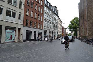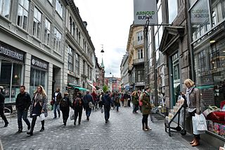
Fiolstræde is a pedestrianised shopping street in central Copenhagen, Denmark. It passes the square Frue Plads on its way from Nørreport station in the north to Skindergade in the south where Jorcks Passage connects it to the shopping street Strøget. Copenhagen Cathedral is located in the street which also passes the rear side of Copenhagen University Library.

Nørre Voldgade is a street in central Copenhagen, Denmark. It runs north-east from Jarmers Plads for approximately 600 metres to Gothersgade where it turns into Øster Voldgade. The succession of Nørre Voldgade, Øster Voldgade and Vester Voldgade together forms a traffic artery which arches around the Zealand side of the central and oldest part of Copenhagen. Nørreport Station, Denmark's busiest railway station, is located in the street.
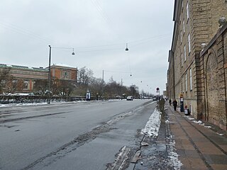
Øster Voldgade, together with Vester Voldgade and Nørre Voldgade, forms a succession of large streets which arches around the central and oldest part of the Zealand side of Copenhagen, Denmark. It runs north-east from Gothersgade at Nørreport Station to Georg Brandes Plads, between the Copenhagen Botanical Gardens and Rosenborg Castle Gardens, and continues straight to a large junction at the southern end of Oslo Plads, near Østerport Station, where it turns into Folke Bernadotte Allé.
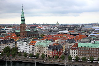
Ved Stranden is a canal side public space and street which runs along a short section of the Zealand side of Slotsholmen Canal in central Copenhagen, Denmark. It begins at Holmens Kanal, opposite Church of Holmen, and runs west along the canal for one and a half blocks before widening into a small, triangular space adjacent to Højbro Bridge and Højbro Plads. The name of the street refers to Gammel Strand, Old Beach, which it formed part of until 1961.
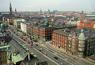
H. C. Andersens Boulevard is the most densely trafficated artery in central Copenhagen, Denmark. The 1.3 km long six-lane street passes City Hall Square on its way from Jarmers Plads, a junction just south of Nørreport station, to Lange Bridge which connects it to Amager Boulevard on Amager. From Jarmers Plads traffic continues along Gyldenløvegade which on the far side of The Lakes splits into Aaboulevard and Rosenørns Allé.

Sølvgade is a street in central Copenhagen, Denmark, extending north-west from Borgergade to The Lakes where Fredens Bro connects it to Fredensgade. The section from Kronprinsessegade to Øster Voldgade follows the walled north-eastern margin of Rosenborg Castle Garden and the next section, from Øster Voldgade to the intersection with Farimagsgade, named Sølvtorvet although it is little more than a busy street junction, separates Copenhagen Botanical Garden from Østre Anlæg.

Dantes Plads is a public square located in front of the Ny Carlsberg Glyptotek where it connects H. C. Andersens Boulevard to Vester Voldgade in central Copenhagen, Denmark.

Ny Kongensgade is a street in central Copenhagen, Denmark, connecting Frederiksholm Canal to H. C. Andersens Boulevard. In the opposite direction, The Prince's Bridge connects the street to Tøjhusgade on Slotsholmen.

The Latin Quarter is a neighbourhood in central Copenhagen, Denmark. It is bounded by Nørregade to the west, Vestergade to the south, Vester Voldgade to the east and Nørre Voldgade to the north. The name refers to the Latin language, which was once widely spoken in and around the University, whose historic home is situated on the other side of Nørregade. Most of the student life has now been relocated to four new campuses but the area is still known for its lively atmosphere with an abundance of boutiques, cafés and night clubs.

Ny Vestergade is a street in central Copenhagen, Denmark. It runs from Frederiksholms Kanal to Vester Voldgade and together with Christiansborg's riding grounds, Marble Bridge and Dantes Plads forms an axis between Christiansborg's tower in the east and Ny Carlsberg Glyptotek's dome in the west. The National Museum's main entrance is located in the street.

Stormgade is a street in central Copenhagen, Denmark. It runs from Frederiksholm Canal to H. C. Andersens Boulevard where it turns into Tietgensgade before continuing along the rear side of Tivoli Gardens and Copenhagen Central Station. In the opposite direction, Storm Bridge connects it to Slotsholmen where traffic may continue across Holmen's Bridge to Holmens Kanal, part of Ring 2, or across Knippel's Bridge to Christianshavn and Amager. The name of the street refers to the Swedish Storm of Copenhagen in 1659.

Hauser Plads is a public square in the Old Town of Copenhagen, Denmark. It is separated from the larger, more well-known square Kultorvet by the former Copenhagen Central Library Building. A landscaped playground and Copenhagen Municipality's underground Cleaning Facilities Centre occupies most of the site since a renovation in 2011..
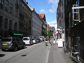
Studiestræde is a street in central Copenhagen, Denmark, running from Bispetorv on Nørregade in the northeast to Axeltorv in the southwest. The oldest section of the street, between Nørregade and Vester Voldgade, is part of Copenhagen's Latin Quarter and is home to many small shops, galleries and cafés. Most of the buildings date from the years after the Copenhagen Fire of 1795. The rest of the street dates from an extension in the second half of the 19th century. It is bisected by H. C. Andersens Boulevard and is home to the music venue Pumpehuset.
Niels Brock Copenhagen Business College, usually referred to simply as Niels Brock, is a school of secondary education and post-secondary education in Copenhagen, Denmark. The school offers programmes within business and management including Vocational Education and Training (VET), Higher Commercial Examination Programme (HHX), Bachelor in Business Administration, Master in International Business Management, Master of Business Administration, and supplementary courses for adults seeking to maintain qualifications. It is an independent self-governing institution under the Danish education system, managed by a board composed of members from the business community in conjunction with a rector that oversees day-to-day operations.

Vestergade is a street in central Copenhagen, Denmark, linking Gammeltorv in the northeast with the City Hall Square in the southwest. The street defines the southern boundary of Copenhagen's Latin Quarter.

Frederiksborggade is a street in central Copenhagen, Denmark. It runs from Kultorvet square in the southeast to Søtorvet where Queen Louise's Bridge connects it to Nørrebrogade in Nørrebro on the other side of The Lakes. The street is effectively divided in two by Nørrebro station on Nørre Voldgade. The short, southern portion, together with Kultorvet and Købmagergade, forms a pedestrian zone between the station and Strøget at Amagertorv. The wider and younger northern portion is open to cvar traffic.

Rigensgade is a street in central Copenhagen, Denmark. It links Sølvgade in the west with Øster Voldgade in the east. An underpass for pedestrians link the beginning of the street with Rosenborg Castle Gardens on the other side of Sølvgade. Notable buildings include the former Garrison Hospital. and the Methodist Jerusalem's Church.

Åbenrå is a street in the Old Town of Copenhagen, Denmark. It runs from Landemærket in the southeast to Rosenborggade in the northwest, linking Vognmagergade with Tornebuskgade. The last part of the street passes the rear side of the grounds of the Reformed Church in Gothersgade. The former rectory associated with the church is located at No. 32-36. It is now houses the Danish Association of Architects.


