Sungai Sarawak Regulation Scheme

Last updated

Kuching Barrage and Shiplock
component of
Sungai Sarawak Regulation Scheme

Ssrs 01.jpg

View of barrage, shiplock and bridge from the Operations Room
Waterway Sarawak River
Country Malaysia
State Sarawak
Maintained by Kuching Barrage Management Sdn. Bhd.
Operation Hydraulic
First built November 1997

The Sungai Sarawak Regulation Scheme (acronym SSRS) is a major civil engineering project in Kuching, Sarawak, Malaysia. This project incorporates a 3-in-1 infrastructure (barrage, shiplock and bridge) which is the first of its kind in Southeast Asia.

Kuching City and State Capital in Sarawak, Malaysia

Kuching, officially the City of Kuching, is the capital and the most populous city in the state of Sarawak in Malaysia. It is also the capital of Kuching Division. The city is situated on the Sarawak River at the southwest tip of the state of Sarawak on the island of Borneo and covers an area of 431 square kilometres (166 sq mi) with a population about 165,642 in the Kuching North administrative region and 159,490 in the Kuching South administrative region—a total of 325,132 people.

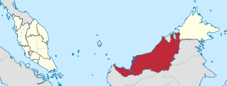
Sarawak State of Malaysia

Sarawak is a state of Malaysia. Being the largest among 13 other states with the size almost equal to West Malaysia, Sarawak is located in northwest Borneo Island, and is bordered by the Malaysian state of Sabah to the northeast, Kalimantan to the south, and Brunei in the north. The capital city, Kuching, is the largest city in Sarawak, the economic centre of the state, and the seat of the Sarawak state government. Other cities and towns in Sarawak include Miri, Sibu, and Bintulu. As of the 2015 census, the population of Sarawak was 2,636,000. Sarawak has an equatorial climate with tropical rainforests and abundant animal and plant species. It has several prominent cave systems at Gunung Mulu National Park. Rajang River is the longest river in Malaysia; Bakun Dam, one of the largest dams in Southeast Asia, is located on one of its tributaries, the Balui River. Mount Murud is the highest point in Sarawak.

Tidal barrage dam-like structure used to capture the energy from masses of water

A tidal barrage is a dam-like structure used to capture the energy from masses of water moving in and out of a bay or river due to tidal forces.

Contents

History

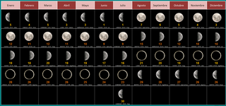
The Sungai Sarawak basin area experience floods as a result of heavy rainfall from upstream, king tides, poor drainage, or a combination of these factors. In low-lying residential areas, floods occur every 1st and 15th day of the lunar calendar. [1]

King tide A colloquial term for an especially high spring tide, such as a perigean spring tide.

"King tide" is a colloquial term for an especially high spring tide, such as a perigean spring tide. "King tide" is not a scientific term, nor is it used in a scientific context. The use of the term "king tide" originated in Australia, New Zealand and other Pacific nations to refer to an especially high tide that occurs only a few times per year. The term has now come to be used in North America as well, particularly in low-lying South Florida, where they cause sunny day tidal flooding.

Lunar calendar type of calendar

A lunar calendar is a calendar based upon the monthly cycles of the Moon's phases, in contrast to solar calendars, whose annual cycles are based only directly upon the solar year. The most commonly used calendar, the Gregorian calendar, is a solar calendar system that originally evolved out of a lunar calendar system. A purely lunar calendar is also distinguished from a lunisolar calendar, whose lunar months are brought into alignment with the solar year through some process of intercalation. The details of when months begin varies from calendar to calendar, with some using new, full, or crescent moons and others employing detailed calculations.

Design

The SSRS consists of:

  1. Bako Causeway
  2. Pending Causeway
  3. Barrage & Shiplock (and a bridge over the barrage)
  4. 24 units of rainfall & water telemetry stations

Construction

The construction of the SSRS is divided into three phases,

Phase I

Phase I of the SSRS project is the construction of the Bako Causeway, the first causeway in Sarawak. [2] The construction involved creating a rock-filled closure across Loba Santubong on Jalan Bako and was completed in August 1993.

Phase II

Phase II of the SSRS project is the construction of the main Barrage Facility (Kuching Barrage and Shiplock), comprising:

  1. a barrage of five radial gates controlling the Sarawak River,
  2. a 125m long by 25m wide shiplock, and
  3. a 435m long four lane road bridge over both barrage and lock, linking the Demak Laut Industrial Park to the Kuching Isthmus.

The groundbreaking ceremony of the Barrage, Shiplock and Bridge was held on 25 July 1995 and graced by Abdul Taib Mahmud, the Chief Minister of Sarawak.

Groundbreaking traditional ceremony in many cultures that celebrates the first day of construction for a building or other project

Groundbreaking, also known as cutting, sod-cutting, turning the first sod or a sod-turning ceremony, is a traditional ceremony in many cultures that celebrates the first day of construction for a building or other project. Such ceremonies are often attended by dignitaries such as politicians and businessmen. The actual shovel used during the groundbreaking is often a special ceremonial shovel, sometimes colored gold, meant to be saved for subsequent display and may be engraved.

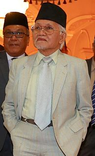
Abdul Taib Mahmud Malaysian politician

Tun Pehin Sri Haji Abdul Taib bin Mahmud is the Yang di-Pertua Negeri of Sarawak, in office since 2014. Previously he was Chief Minister of Sarawak from 1981 to 2014. Taib was also the President of Parti Pesaka Bumiputera Bersatu (PBB), which is part of the Barisan Nasional coalition. He is of ethnic Melanau descent.

Phase III

The components of Phase III of the SSRS project are:

  1. The Construction of the Pending Causeway, a rock fill dam across the Sarawak River at Jalan Keruing in Pending.
  2. The Construction of a four lane road linking Pending with Sejingkat.
  3. The Installation of a Telemetry System comprising 6 units of rainfall and water telemetry stations as an early warning device for the barrage operators.

The rainfall and water telemetry stations were installed at the following locations:

  1. Kampung Sandong
  2. Kampung Bengoh
  3. Kampung Skio
  4. Kampung Blinbim
  5. Kampung Siburuh
  6. Kampung Bogag

Phases II and III were constructed simultaneously and was completed in November 1997 at a cost of RM150 million.

The Kuching Barrage and Shiplock was officiated by Mahathir bin Mohamad, Prime Minister of Malaysia.

Operation of Kuching Barrage and Shiplock

The barrage and shiplock is managed and operated by Kuching Barrage Management Sdn. Bhd., under the supervision of the Sarawak Rivers Board and is governed by The Sarawak Rivers (Sungai Sarawak Barrage) Regulations 1997, which states as follows:

to operate and maintain any barrage or shiplock, and regulate and control the passage of vessels through such barrage or shiplock, and to impose fees or tolls in such vessels passing through the same. [3]

Real-time water and rainfall data is collected by the telemetry system and based on computational model of the Sarawak River. The predicted discharge and water level are the two main factors in deciding when to operate the barrage gates. All data collection and information will be processed by a sophisticated river analysis software known as MIKE-II. [1]

Related Research Articles

Kota Samarahan Town in Sarawak, Malaysia

Kota Samarahan is the administrative seat of the Samarahan District in Samarahan Division, Sarawak, Malaysia. It is located about 30 kilometers from Kuching. The district population was 157,792. Kota Samarahan is the main education hub for Sarawak State and officially known as "Town of Knowledge". The District Officer of this city is Datuk Patinggi Puan Hajah Affidatul. On January 11, 2017, Chief Minister Adenan Satem died in Sarawak Heart Hospital in this city.
Bako National Park national park

Bako National Park is a national park in Kuching Division, Sarawak, Malaysia. Established in 1957, it is the oldest national park in Sarawak. It covers an area of 27.27 square kilometres (10.53 sq mi) at the tip of the Muara Tebas peninsula at the mouth of the Bako and Kuching Rivers. It is approximately 40 kilometres (25 mi) by road from Kuching. Millions of years of erosion of the sandstone have created a coastline of steep cliffs, rocky headlands and stretches of white, sandy bays. Wave erosion at the base of the cliffs has carved many of the rocky headlands into fantastically shaped sea arches and seastacks with colored patterns formed by iron deposition.The most famous of them is shaped like a cobra's head which can be spotted on a boat ride from the headquarters or one of the beaches. Some of these rock formations can be seen on entry to the Teluk Assam Beach, which fronts the park. The park can only be reached by a 20-minute boat ride from the village of Kampung Bako. It is often visited as a day-trip from Kuching, though accommodations are available.

Malaysian Federal Roads System article describing federal roads in Malaysia

Malaysian Federal Roads System, is the main national road network in Malaysia. All Federal Roads in Malaysia are under the purview of the Ministry of Works (MOW). According to the Ministerial Functions Act 1969, the MOW is responsible to plan, build and maintain all Federal Roads gazetted under the Federal Roads Act 1959. However, most of the Federal roads' projects were built and maintained by the Malaysian Public Works Department (JKR), which is also one of the implementing agencies under the MOW.

The Federal Route 1 is the first federal road in Malaysia, and also the oldest federal road in Malaysia, as well as among the nation's earliest public roadways ever constructed. The Federal Route 1 was the backbone of the road system in the western states of Peninsular Malaysia before being supplanted by the North–South Expressway.

East–West Highway or also known as Gerik–Jeli Highway, Kulim–Baling Highway and Titi Karangan–Gerik Highway, Federal Route 4, Asian Highway Route 140 is the 215 kilometres (134 mi) federal highway constructed by the Malaysian Public Works Department (JKR) to shorten the journey from Kota Bharu, Kelantan to northwestern towns and cities of Malaysia such as Alor Star, Kedah and Penang. The highway connects Gerik, Perak in the west to Jeli, Kelantan in the east, before being extended further to Lunas, Kedah.
Klang River river in Malaysia

Klang River is a river which flows through Kuala Lumpur and Selangor in Malaysia and eventually flows into the Straits of Malacca. It is approximately 120 km (75 mi) in length and drains a basin of about 1,288 km2 (497 sq mi). Klang River has 11 major tributaries.

Federal Route 55 or Jalan Kuala Kubu Bharu–Teranum–Raub is a 62-km federal road connecting the states of Selangor and Pahang in Malaysia. It is the first federal road ever being constructed in Pahang. The road connects Kuala Kubu Bharu, Selangor to Teranum near Raub in Pahang. It is the main access route to Fraser's Hill.

Senai–Desaru Expressway, SDE, is an expressway in Johor, Malaysia. It connects Senai in western Johor to Desaru in eastern Johor. Measuring a total length of 77 km (48 mi), it is the third east–west-oriented expressway in the Iskandar Malaysia area after the Pasir Gudang Highway and the Pontian–Johor Bahru Link of the Second Link Expressway. With a new crossing over the Johor River, when opened on June 10, 2011, the expressway shortened travel time from Senai to Desaru from 2.5 hours to one hour.

Petra Jaya

Petra Jaya is a suburb of Kuching, Sarawak, Malaysia. This suburb was named after sixth Yang di-Pertuan Agong, Tuanku Yahya Petra of Kelantan (1975-1979).

Floods in Malaysia

Floods in Malaysia are regular natural disasters in Malaysia which happen nearly every year during the monsoon season.

Bangar, Temburong Mukim in Temburong, Brunei

Bangar is a mukim in the Temburong District of Brunei. It is located in the north-west of the Temburong District bordering Mukim Labu to the north, Mukim Batu Apoi to the east, Mukim Amo to the south-east, Mukim Bokok to the south-west and Limbang, Sarawak (Malaysia) to the west and north. Mukim Bangar has one island within its vicinity which is Pulau Kibi. Bangar has a total area of 113 square kilometres (44 sq mi); as 2016, it had a total population of 2,696.

Tebakang Place in Sarawak, Malaysia

Tebakang is a village in the Serian division of Sarawak, Malaysia, between Serian and Tebedu. It is about 15 minutes drive from Serian Town. Tebakang lies approximately 56.9 kilometres (35 mi) south-south-east of the state capital Kuching.

Tundong Place in Sarawak, Malaysia

Tondong is a settlement on the Sarawak Kanan river in the Bau division of Sarawak, Malaysia. It lies approximately 25.2 kilometres (16 mi) southwest of the state capital Kuching.

Malaysian Expressway System system of expressways in Malaysia

The Malaysian Expressway System is a network of national controlled-access expressways in Malaysia that forms the primary backbone network of Malaysian national highways. The network begins with the North–South Expressway (NSE), and is being substantially developed. Malaysian expressways are built by private companies under the supervision of the government highway authority, Malaysian Highway Authority.

High intensity rainfall since 17 January 2015 caused major flooding across several parts of Sarawak and Sabah. Around 13,878 people had been evacuated with one teenage girl became the only casualty.

Kampung Selamat MRT station

The Kampung Selamat station is a rapid transit station serving the areas of Kampung Selamat and Kampung Baru Sungai Buloh in Sungai Buloh, Selangor, Malaysia. The station is one of the stations on the MRT Sungai Buloh-Kajang Line and was opened on 16 December 2016 under Phase One operations of the line.

Sungai Jernih MRT station

Sungai Jernih MRT station is an elevated rapid transit station on the Sungai Buloh-Kajang Line, located in the northern precincts of downtown Kajang, Selangor, Malaysia. It was opened on 17 July 2017, along with 19 adjoining stations as part of Phase 2 of the system.

The following is an alphabetical list of articles related to Selangor.

References

  1. 1 2 Linda Khoo Hui Li (2006-05-19). "Is S'wak River Barrage To Be Blamed For Massive Floods?". Malaysian National News Agency. Retrieved 2010-10-15.
  2. "Infrastructure Works – Roads, Bridges, Dams, Causeway & Ferry Ramps" . Retrieved 2010-10-15.
  3. "Sarawak Rivers Board: Barrage & Shiplock" . Retrieved 2010-10-15.