Suriyaco | |
|---|---|
Municipality and village | |
| Country | |
| Province | La Rioja Province |
| Time zone | UTC−3 (ART) |
| Climate | BWk |
Suriyaco is a municipality and village in La Rioja Province in northwestern Argentina. [1]
Suriyaco | |
|---|---|
Municipality and village | |
| Country | |
| Province | La Rioja Province |
| Time zone | UTC−3 (ART) |
| Climate | BWk |
Suriyaco is a municipality and village in La Rioja Province in northwestern Argentina. [1]

The Arctic Archipelago, also known as the Canadian Arctic Archipelago, is an archipelago lying to the north of the Canadian continental mainland, excluding Greenland and Iceland.
Lillie Glacier is a large glacier in Antarctica, about 100 nautical miles long and 10 nautical miles wide. It lies between the Bowers Mountains on the west and the Concord Mountains and Anare Mountains on the east, flowing to Ob' Bay on the coast and forming the Lillie Glacier Tongue.

Sur Lípez or Sud Lípez is a province in the Potosí Department in Bolivia. The seat of the province is San Pablo de Lípez.

The Flores Sea covers 240,000 square kilometres (93,000 sq mi) of water in Indonesia. The sea is bounded on the north by the island of Celebes and on the south by the Sunda Islands of Flores and Sumbawa.
Balnamore is a small village in County Antrim, Northern Ireland. It is within the townland of Ballynacree-Skein and lies 3 km west of Ballymoney. It is part Causeway Coast and Glens District Council. Historically it was known as Ballinamore.

Inzá is a town and municipality in the Cauca Department, Colombia. It was part of the San Agustín culture in the Pre-Columbian era, and home to the Tierradentro site. It is mostly inhabited by Paez people.

San Blas de los Sauces is a municipality and village in La Rioja Province, Argentina.
Zaparinqui is a village and municipality in Chaco Province in northern Argentina.

Otter Highlands is a group of peaks and ridges extending northwest-southeast for 17 nautical miles from Mount Lowe to Wyeth Heights, located west of Blaiklock Glacier and forming the west end of the Shackleton Range. Surveyed by the Commonwealth Trans-Antarctic Expedition in 1957. Named by the United Kingdom Antarctic Place-Names Committee (UK-APC) in 1972 after the De Havilland Otter aircraft which supported the CTAE.
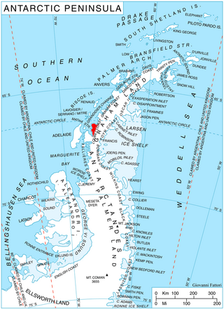
McClary Glacier is a glacier 10 nautical miles (19 km) long and 2 nautical miles (4 km) wide on the west coast of Graham Land, Antarctica. It flows southwest along the north side of Butson Ridge into Marguerite Bay between Cape Calmette and the Debenham Islands. The glacier was first roughly surveyed by the British Graham Land Expedition, 1936–37, and resurveyed by the Falkland Islands Dependencies Survey, 1946–50. It was named by the UK Antarctic Place-Names Committee for George B. McClary, father of Nelson McClary, mate on the Port of Beaumont during the Ronne Antarctic Research Expedition, 1947–48.

Sloman Glacier is a glacier flowing between Mount Liotard and Mount Ditte to the southeast coast of Adelaide Island. Named by the United Kingdom Antarctic Place-Names Committee (UK-APC) in 1963 for William O. Sloman, British Antarctic Survey Personnel Officer for a number of years beginning in 1956.

Sölch Glacier is a glacier on the Pernik Peninsula of the Loubet Coast in Graham Land, flowing west to Salmon Cove just north of Kanchov Peak on the east side of Lallemand Fjord. It was mapped from air photos taken by the Falkland Islands and Dependencies Aerial Survey Expedition, 1956–57, and named by United Kingdom Antarctic Place-Names Committee for Johann Sölch (1883–1951), an Austrian glacial geologist and glaciologist.
League Rock is a distinctive rounded rock lying southwest of Box Reef, off the south end of Adelaide Island, Antarctica. It was surveyed by the Royal Navy Hydrographic Survey Unit, 1962–63, and was so named by the UK Antarctic Place-Names Committee because the rock lies one league distant from what was then Adelaide Station.

The Back Creek, a perennial stream of the Richmond River catchment, is located in Northern Rivers region in the state of New South Wales, Australia.
The Eden Creek, a perennial stream of the Richmond River catchment, is located in Northern Rivers region in the state of New South Wales, Australia.

German submarine U-1017 was a Type VIIC/41 U-boat built for Nazi Germany's Kriegsmarine for service during World War II. She was laid down on 19 April 1943 by Blohm & Voss, Hamburg as yard number 217, launched on 1 March 1944 and commissioned on 13 April 1944 under Kapitänleutnant Victor Graf von Reventlow-Criminil.
German submarine U-720 was a Type VIIC U-boat of Nazi Germany's Kriegsmarine during World War II. The submarine was laid down on 17 August 1942 at the H. C. Stülcken Sohn yard at Hamburg, launched on 5 June 1943, and commissioned on 17 September 1943 under the command of Leutnant zur See Wolf-Harald Schüer.
Huíla (commune) is a town and commune of Angola, located in the province of Huíla.
Bone Bay is a rectangular bay along the northwest coast of Trinity Peninsula, Antarctica. It is nearly 10 nautical miles wide at the entrance between Notter Point and Cape Roquemaurel.