Geodesy is the science of measuring and representing the geometry, gravity, and spatial orientation of the Earth in temporally varying 3D. It is called planetary geodesy when studying other astronomical bodies, such as planets or circumplanetary systems.

Surveying or land surveying is the technique, profession, art, and science of determining the terrestrial two-dimensional or three-dimensional positions of points and the distances and angles between them. These points are usually on the surface of the Earth, and they are often used to establish maps and boundaries for ownership, locations, such as the designed positions of structural components for construction or the surface location of subsurface features, or other purposes required by government or civil law, such as property sales.

The World Geodetic System (WGS) is a standard used in cartography, geodesy, and satellite navigation including GPS. The current version, WGS 84, defines an Earth-centered, Earth-fixed coordinate system and a geodetic datum, and also describes the associated Earth Gravitational Model (EGM) and World Magnetic Model (WMM). The standard is published and maintained by the United States National Geospatial-Intelligence Agency.
A geodetic datum or geodetic system is a global datum reference or reference frame for precisely representing the position of locations on Earth or other planetary bodies by means of geodetic coordinates. Datums are crucial to any technology or technique based on spatial location, including geodesy, navigation, surveying, geographic information systems, remote sensing, and cartography. A horizontal datum is used to measure a location across the Earth's surface, in latitude and longitude or another coordinate system; a vertical datum is used to measure the elevation or depth relative to a standard origin, such as mean sea level (MSL). Since the rise of the global positioning system (GPS), the ellipsoid and datum WGS 84 it uses has supplanted most others in many applications. The WGS 84 is intended for global use, unlike most earlier datums.

The Meades Ranch Triangulation Station is a survey marker in Osborne County in the state of Kansas in the Midwestern United States. The marker was initially placed in 1891. From 1901, it was the reference location for establishing a system of horizontal measurement in the United States, known as geodetic datum. In 1913, the datum was adopted across all of North America, and the system revised and formalized as the North American Datum of 1927 (NAD27). A similar reference for vertical measurement was established in 1929 as the National Geodetic Vertical Datum of 1929. The NAD27 was later supplanted by the North American Datum of 1983 (NAD83), which was formally adopted by the United States in 1989 and Canada in 1990; the new system moved the reference point to a point in the Earth's core, and the Meades Ranch marker lost its special significance to the geodetic datum system.
The Surveyor General of New South Wales is the primary government authority responsible for land and mining surveying in New South Wales.

Haddon Corner is a heritage-listed site in Tanbar, Shire of Barcoo, Queensland, Australia. It is in outback Channel Country at South-West Queensland, on the border corner with South Australia. It was added to the Queensland Heritage Register on 9 November 2012.

The Royal Australian Survey Corps was a Corps of the Australian Army, formed on 1 July 1915 and disbanded on 1 July 1996. As one of the principal military survey units in Australia, the role of the Royal Australian Survey Corps was to provide the maps, aeronautical charts, hydrographical charts and geodetic and control survey data required for land combat operations.

The Earth-centered, Earth-fixed coordinate system, also known as the geocentric coordinate system, is a cartesian spatial reference system that represents locations in the vicinity of the Earth as X, Y, and Z measurements from its center of mass. Its most common use is in tracking the orbits of satellites and in satellite navigation systems for measuring locations on the surface of the Earth, but it is also used in applications such as tracking crustal motion.
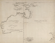
The Gazetteer of Australia is an index or dictionary of the location and spelling of geographical names across Australia. Geographic names include towns, suburbs and roads, plus geographical features such as hills, rivers, and lakes.
The Australian Height Datum was introduced in 1971 as the official vertical datum for Australia, and thereby serves as the benchmark to which all height measurements are referred. The Australian Height Datum is an amalgamation of decades of spirit levelling work conducted by numerous state and territory authorities across the country, and was corrected to align with the mean sea level observations of thirty tide gauges positioned around the entire coastline. While it remains the published vertical datum for all surveying and engineering operations performed throughout Australia, newer technologies have uncovered numerous deficiencies, offsets and distortions within the Australian Height Datum, leading to discussions about defining a new Australian vertical datum.
The State Plane Coordinate System (SPCS) is a set of 125 geographic zones or coordinate systems designed for specific regions of the United States. Each U.S. state contains one or more state plane zones, the boundaries of which usually follow county lines. There are 108 zones in the contiguous United States, with 10 more in Alaska, five in Hawaii, one for Puerto Rico and the United States Virgin Islands, and one for Guam. The system is widely used for geographic data by state and local governments. Its popularity is due to at least two factors. First, it uses a simple Cartesian coordinate system to specify locations rather than a more complex spherical coordinate system. By using the Cartesian coordinate system's simple XY coordinates, "plane surveying" methods can be used, speeding up and simplifying calculations. Second, the system is highly accurate within each zone. Outside a specific state plane zone accuracy rapidly declines, thus the system is not useful for regional or national mapping.
Construction surveying or building surveying is to provide dimensional control for all stages of construction work, including the stake out of reference points and markers that will guide the construction of new structures such as roads, rail, or buildings. These markers are usually staked out according to a suitable coordinate system selected for the project.
The Hellenic Geodetic Reference System 1987 or HGRS87 is a geodetic system commonly used in Greece (SRID=2100). The system specifies a local geodetic datum and a projection system. In some documents it is called Greek Geodetic Reference System 1987 or GGRS87.

Centre points of Australia are those geographical locations that have been considered to be centre of Australia, as distinct from the extreme points of Australia.
The Geocentric Datum of Australia 1994 (GDA94) is a geodetic datum covering the Australian continent. Details of this datum are provided by the GDA94 Technical Manual.

Surveying in North America is heavily influenced by the United States Public lands survey system. It inherits the basis of its land tenure from the United Kingdom, as well as the other countries that established colonies, namely Spain and France.

Cameron Corner Survey Marker is a heritage-listed survey marker in the locality of Cameron Corner, Shire of Bulloo, Queensland, Australia. The survey marker is at the border corner of South-West Queensland with New South Wales and South Australia; it was established in 1880. It was added to the Queensland Heritage Register on 9 November 2012.

The cartography of New Zealand is the history of surveying and creation of maps of New Zealand. Surveying in New Zealand began with the arrival of Abel Tasman in the mid 17th century. Cartography and surveying have developed in incremental steps since that time till the integration of New Zealand into a global system based on GPS and the New Zealand Geodetic Datum 2000.

8 Field Survey Squadron was a unit of the Australian Army and the Royal Australian Survey Corps, being raised in December 1971 at Popondetta, Territory of Papua New Guinea and disbanded twenty-four years later on 1 December 1995 in Port Moresby, Papua New Guinea (PNG). The squadron's initial role was to establish geodetic survey control, establish topographic survey control for mapping, compile and field complete preliminary topographic maps, and conduct other surveys and mapping including acquiring air photography. In 1980 the role changed to provide support and advice to the PNG Defence Force and PNG National Mapping Bureau on all aspects of survey and mapping and to provide liaison support for Australian based survey units on operations in the country.